Hurricane and Storm Surge Watch Issued For Florence But First Fog and Showers Today
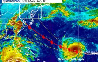
Tuesday September 11 2018 Hurricane Florence is holding at 140 mph winds and now showing up on the edge of our water map. In addition to the States of Emergency
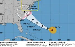
Tuesday September 11 2018 Hurricane Florence is holding at 140 mph winds and now showing up on the edge of our water map. In addition to the States of Emergency
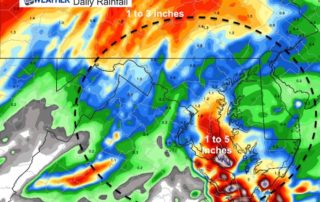
Monday September 10 2018 A State Of Emergency was declared today for Maryland by Governor Hogan for Hurricane Florence. I will address the local possible impacts, but please note this
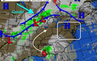
Sunday September 9 2018 Rain is already in place and temperatures may not move much all day. Expect a wet and chilly day and many areas will test the soggy
Wednesday September 5 2018 The Heat Advisory issued today has a focus on Southern Pennsylvania, but I would consider central Maryland under the same conditions as yesterday. It will not
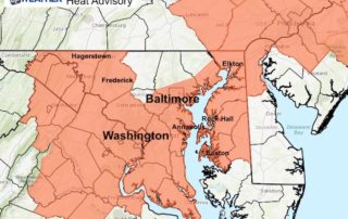
Tuesday September 4 2018 A Heat Advisory today signals how uncomfortable the weather will feel today. Temperatures are already warm and sticky this morning, but by mid day and this
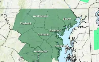
August 31 2018 A Flash Flood Watch is in effect through midnight for central and northern Maryland. The conditions that enhance storms in our area are present today. A stalled
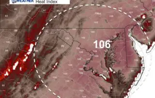
Wednesday August 29 2018 Just looking at temperatures this morning and we can see how dangerous the temperatures will be this afternoon. Most start in the mid to upper 70s
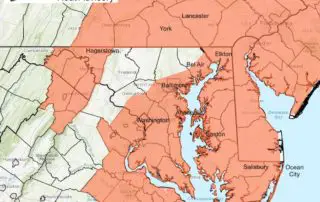
Tuesday July 3 2018 It's hot again and proving that once we have the heat it is tough to shake. The Heat Advisory remains in place in much of Maryland
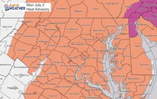
Monday July 2 2018 On Sunday BWI reached 96ºF and it looks like today may be just a little warmer. We are still not going to challenge the record, but
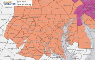
July 1 2018 Welcome to a new month and what appears to be a new weather pattern. We are in the middle of a het wave that may actually peak