July 1 2018
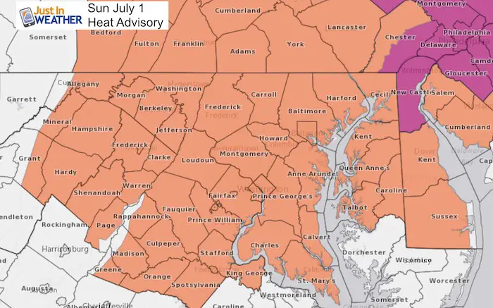
Welcome to a new month and what appears to be a new weather pattern. We are in the middle of a het wave that may actually peak Monday, but last into most of next week. This comes along with some alerts you should be aware of: Code Orange air quality may actually be worse tomorrow when pollution builds at the start of the work week. But the high temperatures and heat index over 100ºF has prompted a Heat Advisory for much of the area.
Record High: 103ºF in 1901
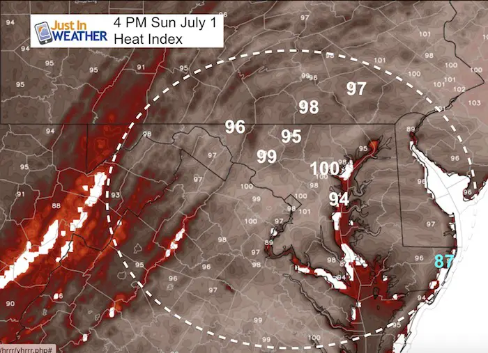
Heat Advisory: The high temperatures will be in the upper 90s, but downtown Baltimore could hit 100ºF. The heat index however, what it feels like will be over 100ºF, making it dangerous to be outside without proper hydration. At 2 PM, Shannon and I will be leading the Let Freedom Ring Parade in Sykesville. We will ride in on a fire truck and then call the parade, hopefully in the shade. I recommend if you join us or whatever your plans… bring plenty of water. I will ask, but I am not sure the fire trucks will hose you down.
Please consider your pets and don’t leave them outside too long without shade or water. Also, check on the kids and elderly frequently for how they feel. Notice that the first sign of heat exhaustion is often slurred speech…
Stats For July 1 in Baltimore
Average High: 87ºF
Record High: 103ºF in 1901
Average Low: 66ºF
Record Low: 50ºF in 1988
Sunrise: 5:43 AM
Sunset 8:36 PM
*Daylight = 0:34 shorter than yesterday
*Bay Water Temperature = 78ºF at Thomas Pt. Light House
Keep In Touch Every Day
Click here to sign up for email alerts…. Just in case you don’t get the post on your social media feed
Please Support Maryland Trek 5
329 miles hiking and biking in 7 days
To provide free integrated wellness programs for kids in and post cancer treatment
If you help my team get to $10,000 this week, you are eligible to win 1 of 10 Shine On Shirts
*If you want to join my team for a day, a few days, or the whole week, please ask me for more info.
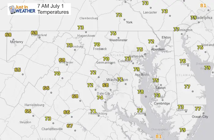
Morning Set Up
Temperatures
Sykesville Parade Begins at 2 PM
Come see us and say hi
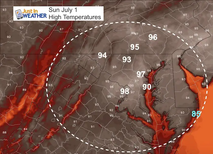
High Temperatures
Heat Index
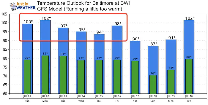
Temperature Outlook
This is from the GFS Model and it has trended too hot. But, it is showing two things I want to pass along
- The peak of the heat wave may be Monday.
- Heat waves tend to last longer than first suggested, and this shows us in the 90s through the end of the week.
I do agree with the heat spiking on Friday ahead of the next cold front. Our next chance of wide spread rain will be Friday into Saturday.
Please share your thoughts, best weather pics/video, or just keep in touch via social media
-
Facebook: Justin Berk, Meteorologist
-
Twitter: @JustinWeather
-
Instagram: justinweather
Keep In Touch Every Day
Click here to sign up for email alerts…. Just in case you don’t get the post on your social media feed
Shine On
Proceeds from all sales go to Just In Power Kids. Click the image to shop and show your support.

![]()
 Get the award winning Kid Weather App I made with my oldest son and support our love for science, weather, and technology. Our 3 year anniversary of the release and our contribution to STEM education is this November. It has been downloaded in 60 countries, and works in both temperature scales. With your support we can expand on the fun introduction to science and real weather.