 Wednesday September 5 2018
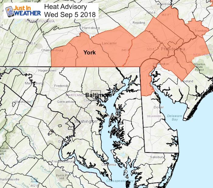
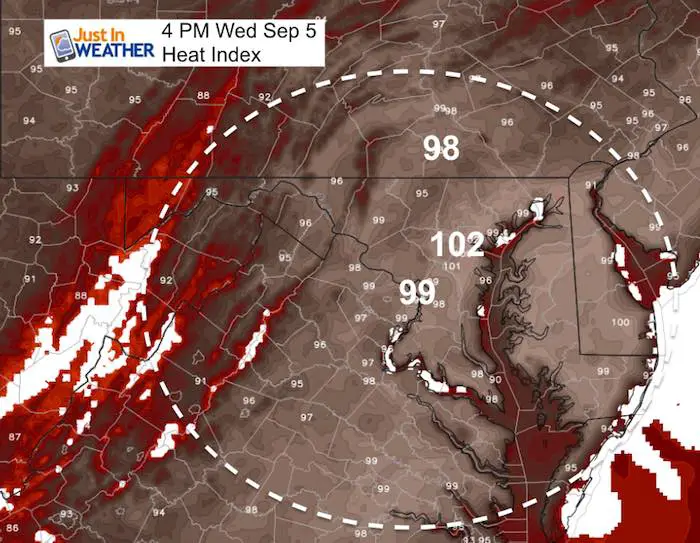
The Heat Advisory issued today has a focus on Southern Pennsylvania, but I would consider central Maryland under the same conditions as yesterday. It will not be comfortable and Baltimore County and City both have schools impacted. But the end is in sight as a cold front will reach us this weekend.
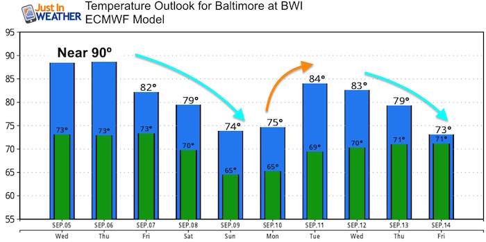
Simply put, it will get cooler this weekend. The complicated thing is trying to determine if the cold front will stall and keep us rainy or keep moving through. At this point, the easy call is to go with the stalling solution, which means the risk of rain will continue all weekend and early next week. Ironically the high temperatures may be lower than some thermometers are reading this morning.
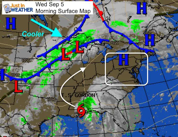
Tropical Storm Gordon made landfall between Mississippi and Alabama overnight. That will curve inland and may eventually bring us rain along the old front. That plus watching Hurricane Florence that could get close off the east coast next week will all help to change the patter and bring in much cooler weather soon.
Now Scheduling School Assemblies
- Storm Smart – Severe Weather (September, October; March through May)
- FITF – Snow and ice (November through March)
Programs for K through Middle School
Choose flat fee or FREE along with a spirit wear shirt fundraiser that earns your school money.
Local Weather Stats For September 5 in Baltimore
Average High: 82ºF
Record High: 96ºF in 1954
Average Low: 62ºF
Record Low: 47ºF in 1997
Sunrise: 6:38 AM
Sunset 7:30 PM
*Daylight = 2:28 shorter than yesterday
*Bay Water Temperature = 83ºF at Thomas Pt. Light House
Also see: Winter Outlook From Two Different Farmers Almanacs
Morning Snapshot
Satellite Loop
Tropical Storm Gordon made landfall with 70 mph wind, down to 50 mph winds this morning and moving to the northwest

Temperatures
6 AM
Afternoon
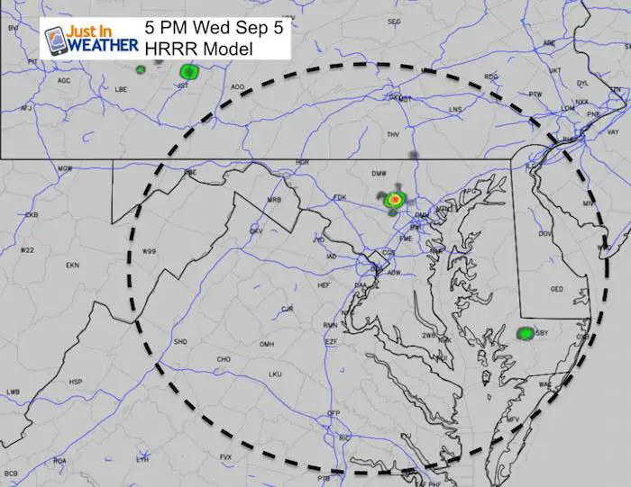
Isolated Storm (Most Won’t See It)
Animations Looking Ahead:
Rain with the cold front will provide the chance of rain Thursday evening through early next week. This is based on the front stalling and some moisture from Gordon being injected in
![]()
Wider View Forecast
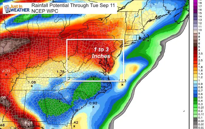
Rainfall Potential
Heavy rain at time from the stalling front and perhaps some moisture from Gordon mixing in. Most of that will stay to our west and north.
Long Range Animation
Watch beyond this weekend and see Hurricane Florence possibly west of Bermuda and close to the east coast. I do not expect landfall from this, but it will be a player in rip currents and could be an adjustment of the east coast pattern for the next season ahead…

 Get the award winning Kid Weather App I made with my oldest son and support our love for science, weather, and technology. Our 3 year anniversary of the release and our contribution to STEM education is this November. It has been downloaded in 60 countries, and works in both temperature scales. With your support we can expand on the fun introduction to science and real weather.
Temperature Outlook
Please share your thoughts, best weather pics/video, or just keep in touch via social media
-
Facebook: Justin Berk, Meteorologist
-
Twitter: @JustinWeather
-
Instagram: justinweather
Keep In Touch Every Day
Click here to sign up for email alerts…. Just in case you don’t get the post on your social media feed
Power Partner Just In Power Kids and Maryland Trek 5:

Still Time To Support Just In Power Kids
We are still taking donations for our best Maryland Trek yet. Every penny goes to Just In Power Kids programs to provide FREE holistic care for kids in cancer treatment and up to 5 years post treatment.
![]()