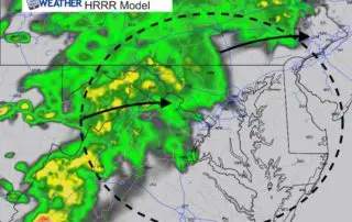
Winter Weather Advisory Radar Simulation And New Winter Storm Watch Monday Night
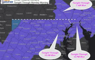
Sunday Evening February 10 2019 The Winter Weather Advisory map has been filled in for most of our area. Snow is showing up on radar, but it may take a
Sunday Evening February 10 2019 The Winter Weather Advisory map has been filled in for most of our area. Snow is showing up on radar, but it may take a
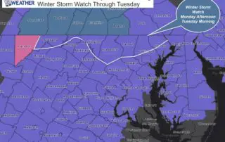
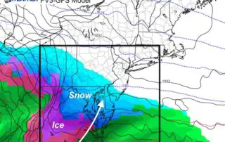
Sunday February 10 2019 A two part winter weather event is about to unfold over our region. The timing spreads from snow arriving tonight to Tuesday when rain finally overtakes
Sunday February 10 2019 Snow will arrive tonight and impact much of our area Monday morning. The cold temperatures have chilled the ground enough to allow for stickage. The first
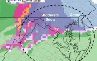
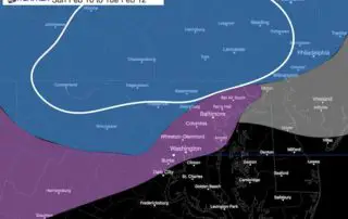
Saturday February 9 2019 This brief update is for the winter weather event we are expecting to arrive late Sunday, but mostly impact our area Monday morning into Tuesday. This

Saturday February 9 2019 The strong winds have brought back winter in a hurry. The warmth from mid week has been erased as the ground is chilling enough to support

Friday February 8 2019 As the sun came out today, that was the leading edge of a cold front. It may not seem like it with the sun that warmed
Thursday February 7 2019 We are still on the cool side of this frontal boundary, but it is trying to move back north. The result will bring some light scattered
Wednesday February 6 2019 It might be hard to imagine after reaching 71ºF in Baltimore yesterday, but winter is still here. A cold front has dropped south and will be
Saturday February 2 2019 The clipper snow on Friday February snow was small but packed a big punch. When this first surfaced, it was apparent we would have arctic air

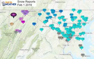
Friday February 1 2019 Light snow will be moving in to our area this morning. Some has already shown up on radar, but the air is so cold and dry,