Flood Stage Update And Radar Simulation With More Record Rain
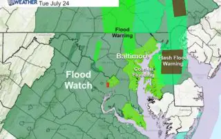
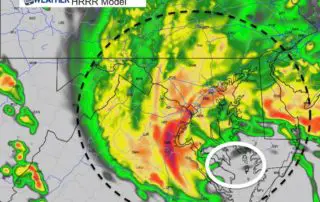
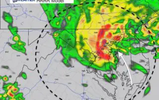
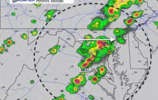
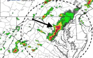
July 24 2018 The record rain continues and the local rivers and Chesapeake Bay shorelines are flooding. The heavy persistent rain has been training over the same areas, making for
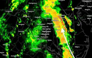
July 24 2018 The record rain continues and the local rivers and Chesapeake Bay shorelines are flooding. The heavy persistent rain has been training over the same areas, making for
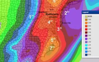
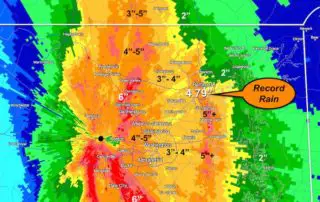
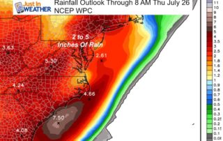
Tuesday July 24 2018 We now have the numbers to prove how epic this month has been for rainfall. There is some irony considering both how dry lawns were last
Monday July 23 2018 We are stuck in the thick of it. What is it? The humidity you may feel this morning as temperatures are in the 70s to near
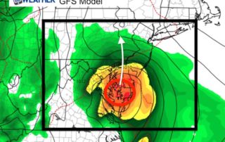
Sunday July 22 2018 The flooding from the storm that hit us yesterday hit a large portion of our area. A rare summer coastal storm thankfully did not get a
Saturday 21 2018 The rain has has ready moved in and there is no avoiding this strong storm. The only debate now will be the track of Low Pressure and
Saturday July 21 2018 A Flash Flood Watch is in place through tonight for a very rare summer coastal storm. This will not have a name and should not turn
Friday July 20 2018 Enjoy today's weather as we flip the switch Saturday with a strong storm rolling up the coast. The only debate now is the timing with a
Thursday July 19 2018 The weather today is nearly ideal for mid summer with sun, low humidity, and warm temperatures in the mid 80s. We will have that again Friday,
Tuesday July 17 2018 Today is world emoji day and I will honor that with a simplified forecast below. But we still need to show the radar simulation as it
Monday July 16 2018 The higher humidity it already an issue this morning and temperatures will climb quickly and very high today. There will be showers and some thunderstorms later