Sunday July 22 2018
The flooding from the storm that hit us yesterday hit a large portion of our area. A rare summer coastal storm thankfully did not get a chance to turn tropical. The results of continuous downpours led to a record for the day at BWI with a total of 4.79 inches of rain. The former record for July 21 was 2.76″ in 1887. Doppler radar estimated showed that the push of the heaviest rain did hit just west of Baltimore and Washington, but local areas were involved. A narrow band of over 5 inches fell in Anne Arundel County. A sharp drop off to the east, but a wide 3 to 6 inch swatch to the west. The heaviest rain fell across northern Virginia to just south of Frederick. 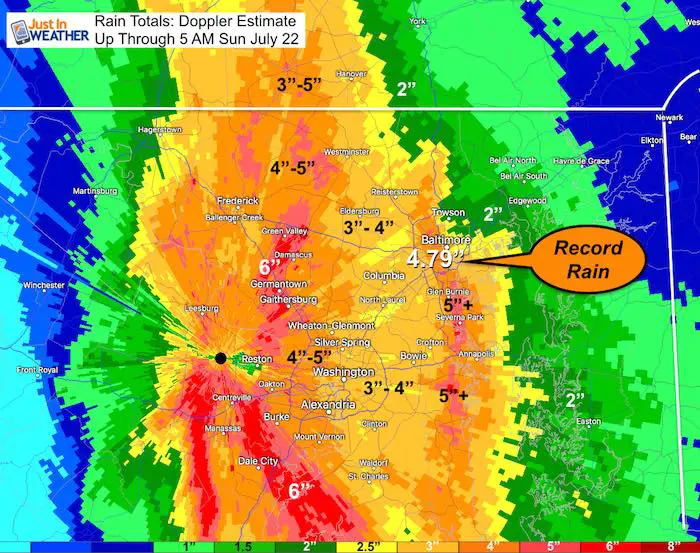
Today we are in for more rain, but a different variety. The upper level pattern will support tropical moisture flowing into the same area, but NOT an organized storm. This will be more intense locally heavy downpours that may contain lightning and local flash flooding. Below is a look at today’s rain timeline and the outlook for the rest of the wet week ahead.
Stats For July 22 in Baltimore
Average High: 87ºF
Record High: 106ºF in 2011
Average Low: 67ºF
Record Low: 53ºF in 1966
Sunrise: 5:57 AM
Sunset 8:27 PM
*Daylight = 1:35 shorter than yesterday
*Bay Water Temperature = 78ºF at Thomas Pt. Light House
Maryland Trek 5 Starts In 2 Weeks
329 miles hiking and biking in 7 days
To provide free integrated wellness programs for kids in and post cancer treatment
Power Sponsor of Maryland Trek 5:

Morning Set Up
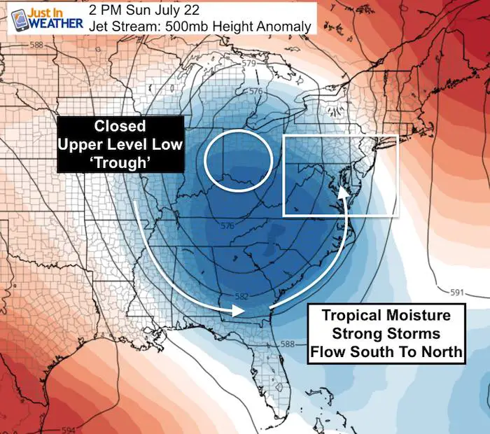
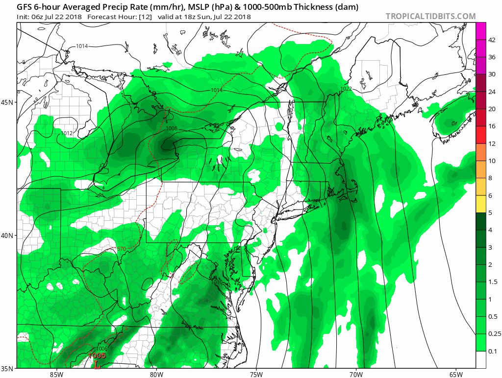
A closed upper level Low is centered in Ohio. This is the block in the atmosphere that will help funnel tropical moisture from the Atlantic and then up the east coast. That is unstable air and will be the direction for the rain bands today
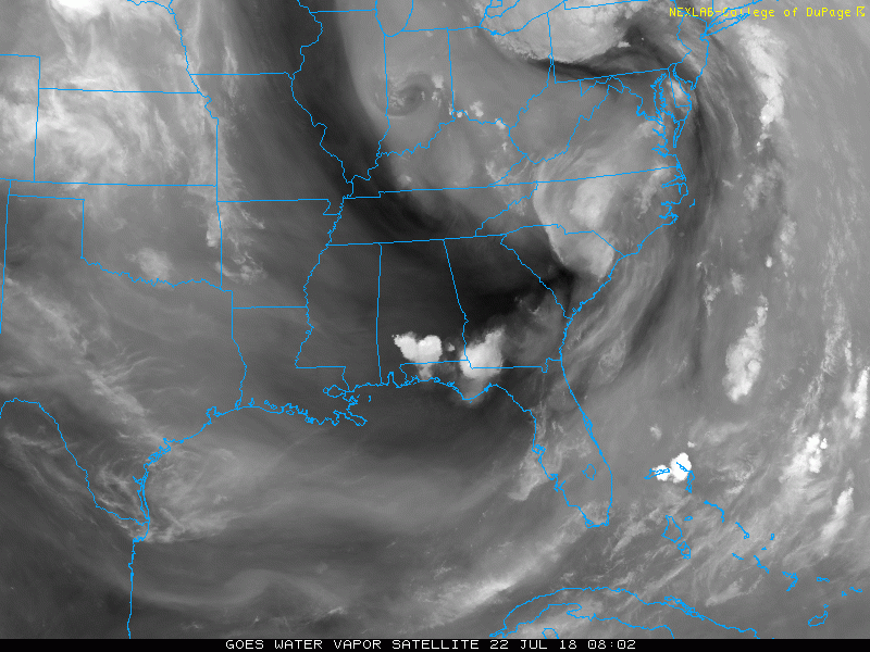
Morning Water Vapor Satellite Loop
Here you can see the flow of moisture.
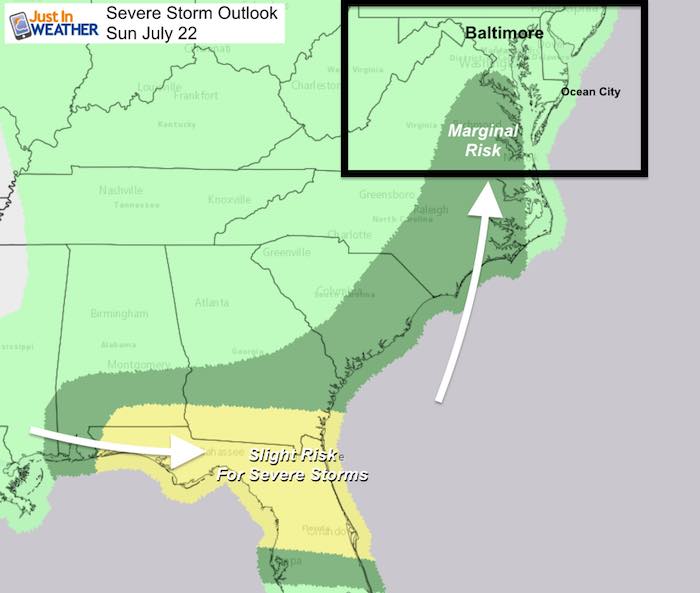
Severe Storm Outlook
Radar Simulation —> slider
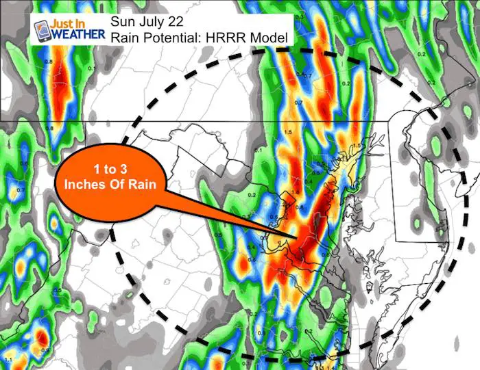
This is the HRRR model that did the best job with the location of the heavy rain bands. Notice the build up of storms with heat of the day. We will start by noon with the heaviest storms after 2 PM through the evening.
[metaslider id=64173]
Rain Total Potential
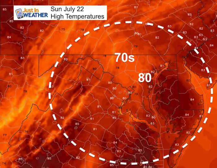
High Temperatures
Rain Animation For The Week Ahead
The pattern is locked in through Friday. Each day the focus of the timing and heaviest rain may wobble and shift, but the overall theme will be soggy, stormy, and possibly bring more flooding.
Please share your thoughts, best weather pics/video, or just keep in touch via social media
-
Facebook: Justin Berk, Meteorologist
-
Twitter: @JustinWeather
-
Instagram: justinweather
Keep In Touch Every Day
Click here to sign up for email alerts…. Just in case you don’t get the post on your social media feed
Shine On
Proceeds from all sales go to Just In Power Kids. Click the image to shop and show your support.

![]()
 Get the award winning Kid Weather App I made with my oldest son and support our love for science, weather, and technology. Our 3 year anniversary of the release and our contribution to STEM education is this November. It has been downloaded in 60 countries, and works in both temperature scales. With your support we can expand on the fun introduction to science and real weather.