 Monday July 23 2018
We are stuck in the thick of it. What is it? The humidity you may feel this morning as temperatures are in the 70s to near 80ºF already. Also this incredibly moist and persistent pattern pushing more ‘stuff’ our way for the near future. Our fate will likely bring more flooding and all I can suggest is NEVER try to drive through high water. One friend of mine lost his car over the weekend.
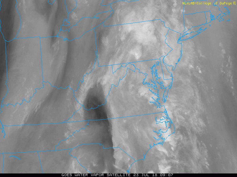
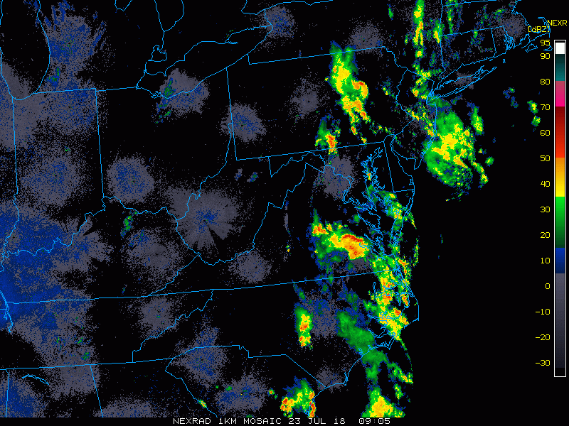
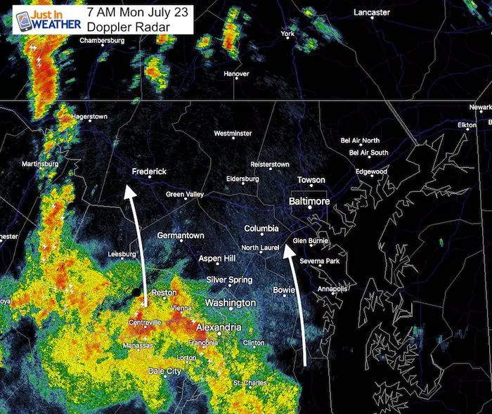
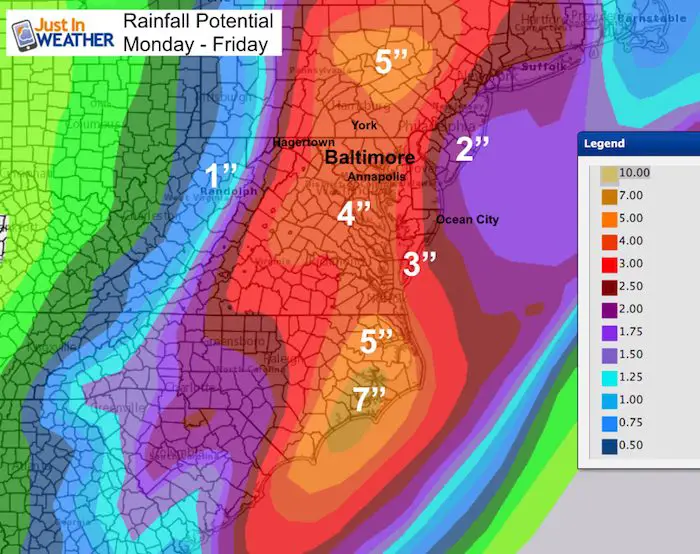
This past weekend produced between 3 to 7 inches of rain across our region. That would be enough, but there will be more and similar to what we have seen. Clusters of heavy rain, some with dangerous lightning and isolated cells that may spin up a weak tornado. Below is a look at this morning’s satellite, radar, and simulation. Plus the animation for the week that remains soggy.
The focus today may shift a little to the west. There is a glimmer of hope for a break in the pattern by the end of the week and part of next weekend. But we are in this set up next week as well.
Note:
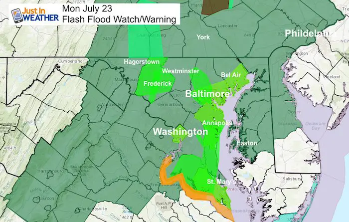
- A Flood Watch means we might have high water develop.
- A Flood Warning means the high water is happening now.
- Flash Flood means it is rising fast vs the coastal flooding which is high water along the Chesapeake Bay and Atlantic beaches.
Stats For July 23 in Baltimore
Average High: 87ºF
Record High: 102ºF in 2011
Average Low: 67ºF
Record Low: 57ºF in 1977
Sunrise: 5:58 AM
Sunset 8:26 PM
*Daylight = 1:37 shorter than yesterday
*Bay Water Temperature = 78ºF at Thomas Pt. Light House
Maryland Trek 5 Starts In 2 Weeks
329 miles hiking and biking in 7 days
To provide free integrated wellness programs for kids in and post cancer treatment
Power Sponsor of Maryland Trek 5:

Morning Set Up
Water Vapor Satellite Loop
Regional Radar Loop
Local Radar Snapshot
Radar Simulation —> slider
[metaslider id=64208]
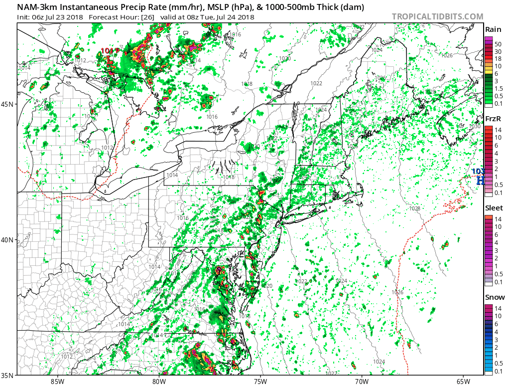
Rain Animation Tuesday (NAM 3 Km Model)- from tropical tidbits
Rain Potential Through Friday
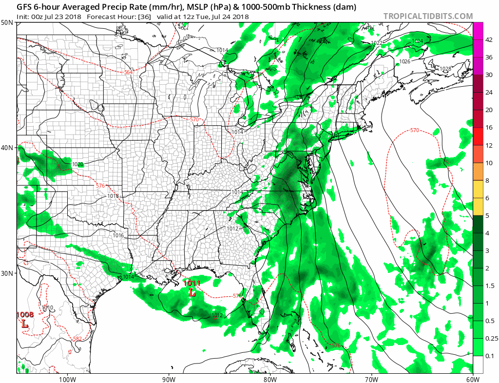
Rain Animation This Week (GFS Model)- from tropical tidbits
Please share your thoughts, best weather pics/video, or just keep in touch via social media
-
Facebook: Justin Berk, Meteorologist
-
Twitter: @JustinWeather
-
Instagram: justinweather
Keep In Touch Every Day
Click here to sign up for email alerts…. Just in case you don’t get the post on your social media feed
Shine On
Proceeds from all sales go to Just In Power Kids. Click the image to shop and show your support.

![]()
 Get the award winning Kid Weather App I made with my oldest son and support our love for science, weather, and technology. Our 3 year anniversary of the release and our contribution to STEM education is this November. It has been downloaded in 60 countries, and works in both temperature scales. With your support we can expand on the fun introduction to science and real weather.