 Friday July 20 2018
Enjoy today’s weather as we flip the switch Saturday with a strong storm rolling up the coast. The only debate now is the timing with a 5 hour range, but we should have rain with us from morning through evening. This system will take the track right along the coast, just inland keeping it from turning tropical. But it might feel like it with the gusty winds and heavy rain. Flooding and lightning are possible through the afternoon. If you have heard about the deadly duck boat in Branson MO or the tornado outbreak in Iowa, that was a completely separate weather event. Ours is purely a coastal system and will set the stage for a wet pattern through next week and possibly beyond.
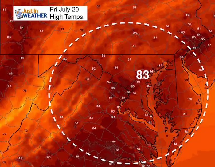
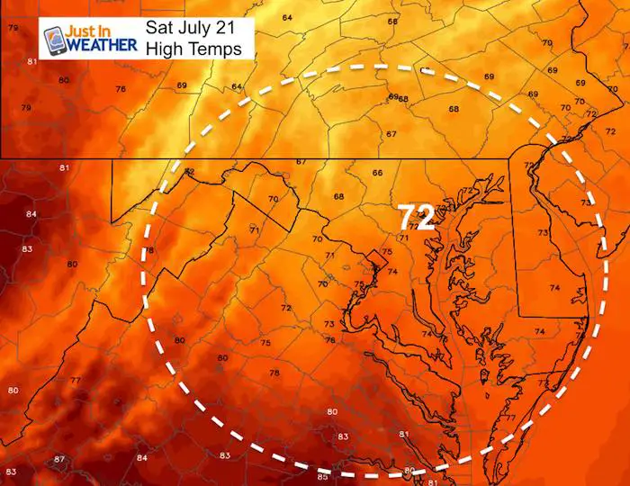
Quick Notes: Today will reach the lower 80s then Saturday will be about 10 degrees cooler thanks to the rain.
At this point I would plan for a washout Saturday, but a brief break Sunday before afternoon storms return. This is not good news for Art Scape in Baltimore or pool parties. Sunday may be a little better, but we will be in for on and off showers and storms each day next week that can’t be timed out for now. Below is a look at the Saturday timeline.
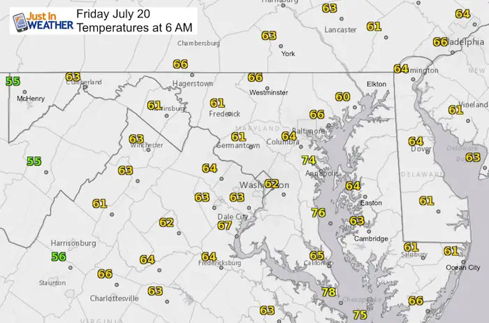
Stats For July 20 in Baltimore
Average High: 87ºF
Record High: 102ºF in 1930
Average Low: 67ºF
Record Low: 57ºF in 2009
Sunrise: 5:56 AM
Sunset 8:28 PM
*Daylight = 1:30 shorter than yesterday
*Bay Water Temperature = 80ºF at Thomas Pt. Light House
Keep In Touch Every Day
Click here to sign up for email alerts…. Just in case you don’t get the post on your social media feed
Support Maryland Trek 5
329 miles hiking and biking in 7 days
To provide free integrated wellness programs for kids in and post cancer treatment
Power Sponsor of Maryland Trek 5:

Morning Set Up
Temperatures
High Temperatures Today
High Temperatures Saturday
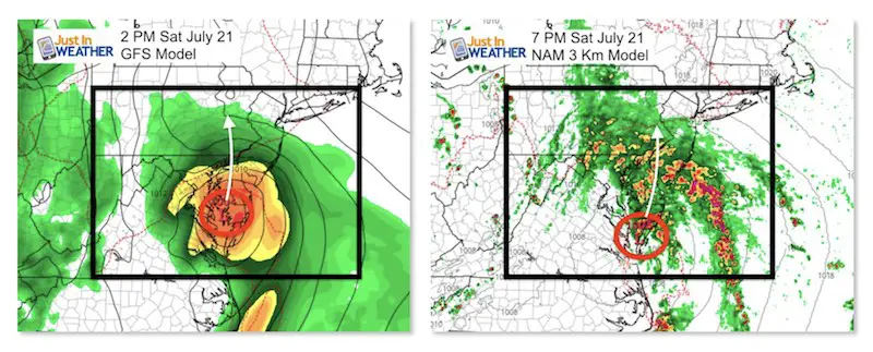
Saturday Storm
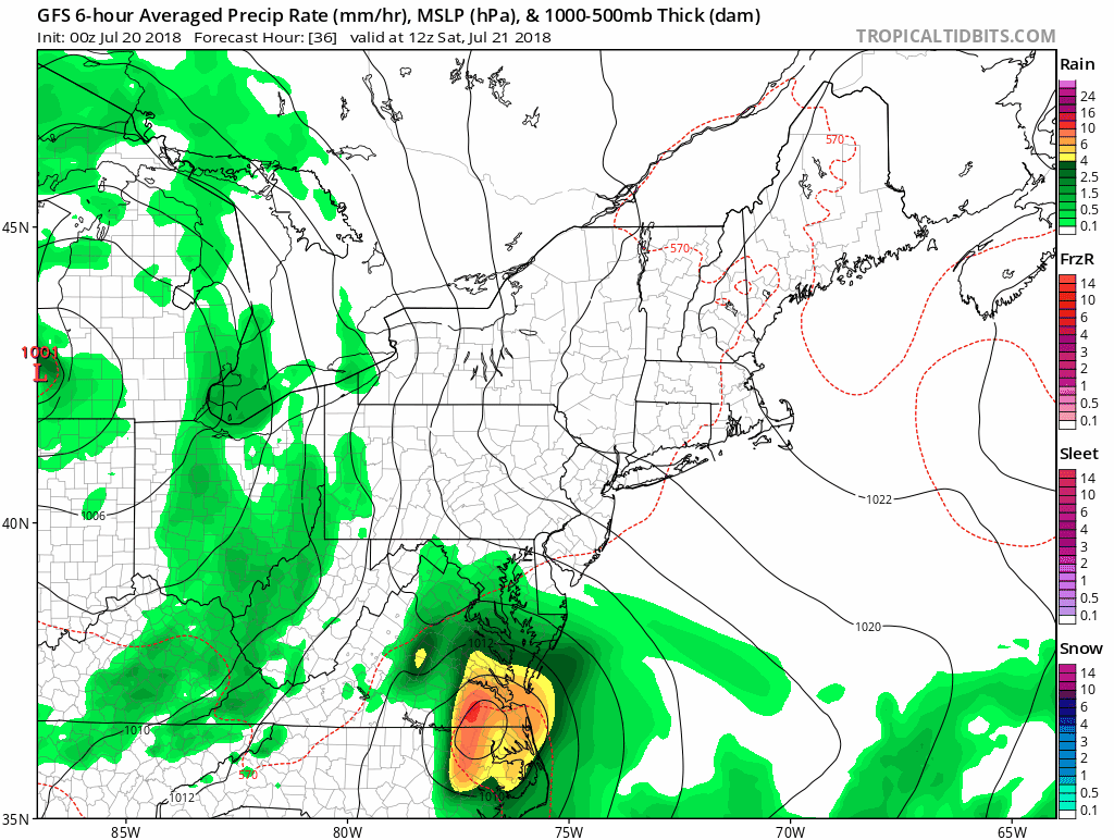
The track of the storm should be across Delmarva to the north. This may prevent this from turning tropical, but will spread the heavy rain farther inland. Most of our region will in the thick of it… The only tricky part is the timing. The NAM Model shown here is a little slower than the GFS (seen below). Both have us with rain starting in the morning.
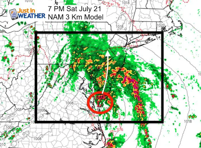
Radar Simulation —> slider
[metaslider id=64021]
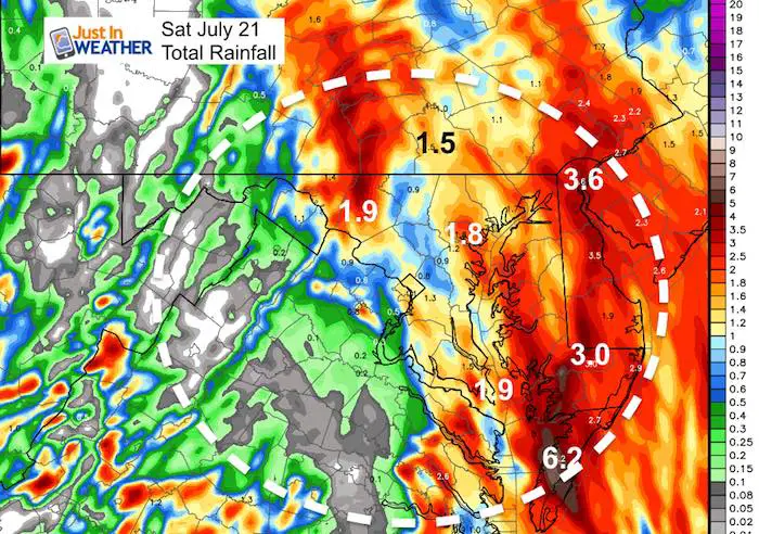
Rain Total (Just for Saturday)
Many spots will be in the 1 to 3 inch rain range, with locally heavier downpours… especially on the Delmarva. This will bring in a flooding chance.
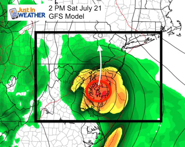
GFS Model
This model is about 5 hours earlier with the Low Pressure in southern Maryland.
Rain Animation
This is a long loop from Saturday through next Friday. It might be tough to track the timing even though I slowed it down. The main point is that the rain chance stays with us each day for the next week.
Temperature Outlook
Each day Sunday through next week will be in the upper 70s to lower 80s. That will depend on the amount of rain expected each day.
Please share your thoughts, best weather pics/video, or just keep in touch via social media
-
Facebook: Justin Berk, Meteorologist
-
Twitter: @JustinWeather
-
Instagram: justinweather
Keep In Touch Every Day
Click here to sign up for email alerts…. Just in case you don’t get the post on your social media feed
Shine On
Proceeds from all sales go to Just In Power Kids. Click the image to shop and show your support.

![]()
 Get the award winning Kid Weather App I made with my oldest son and support our love for science, weather, and technology. Our 3 year anniversary of the release and our contribution to STEM education is this November. It has been downloaded in 60 countries, and works in both temperature scales. With your support we can expand on the fun introduction to science and real weather.