 Saturday July 21 2018
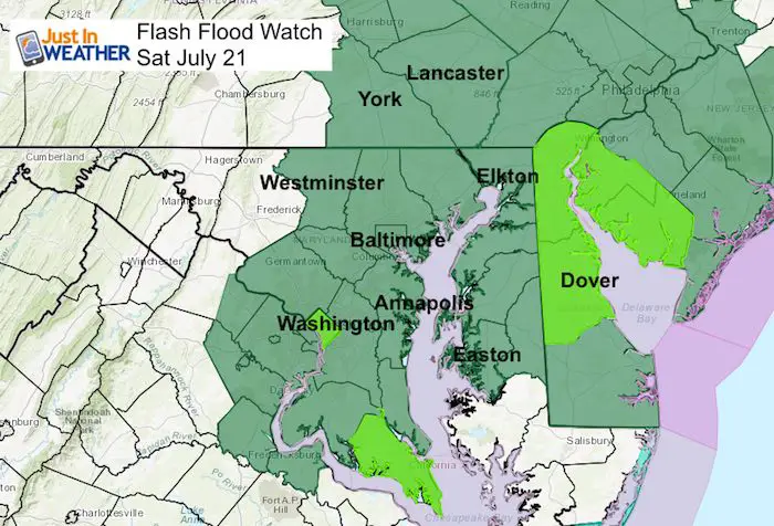
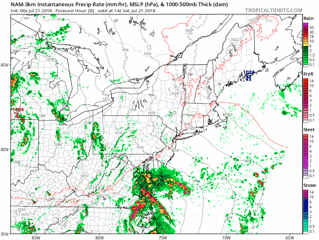
A Flash Flood Watch is in place through tonight for a very rare summer coastal storm. This will not have a name and should not turn tropical as the core Low will remain over land, but it might feel like it. We will have building winds from the east feeding in moisture from the Atlantic wrapping around a deep Low Pressure that will cut right through Maryland. Showers are already arriving this morning but the really heavy rain will arrive tonight along with stronger winds.
Storm Highlights:
Lunch Time most of us have rain
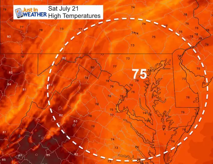
Mid 70s: High Temperatures
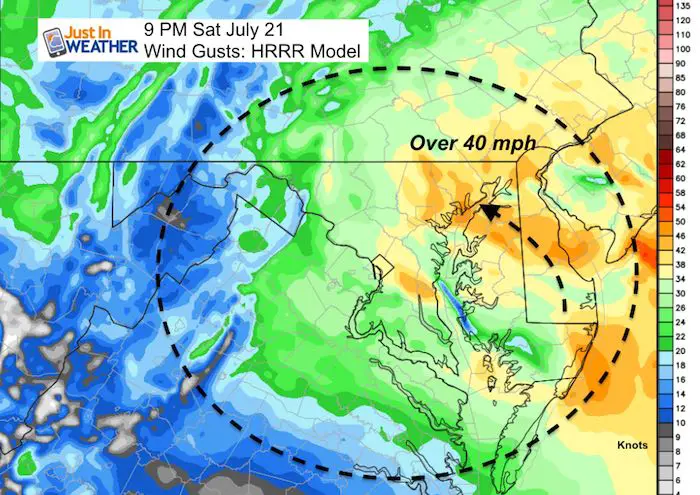
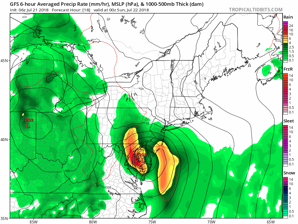
This evening and tonight: Heaviest rain time and strongest winds
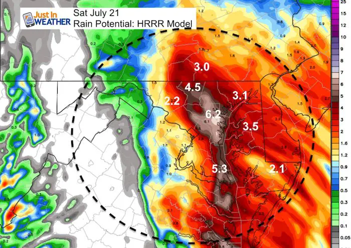
3 to 6 inches: Rain totals in metro Baltimore
30 to 40 mph: Wind speed across Delmarva, central Baltimore, and southern PA.
If you follow my theory of atmospheric memory, mark this date. This pattern set up is likely to repeat itself with a more potent storm this coming fall and winter. Before you get too far ahead about snow, if this was winter, the core low might be too close and push the colder air farther inland. We can talk about that later.
See the radar simulation, rain timeline, and wet stormy week ahead graphics below.
Stats For July 21 in Baltimore
Average High: 87ºF
Record High: 104ºF in 1930
Average Low: 67ºF
Record Low: 53ºF in 1966
Sunrise: 5:56 AM
Sunset 8:28 PM
*Daylight = 1:32 shorter than yesterday
*Bay Water Temperature = 80ºF at Thomas Pt. Light House
Keep In Touch Every Day
Click here to sign up for email alerts…. Just in case you don’t get the post on your social media feed
Support Maryland Trek 5
329 miles hiking and biking in 7 days
To provide free integrated wellness programs for kids in and post cancer treatment
Power Sponsor of Maryland Trek 5:

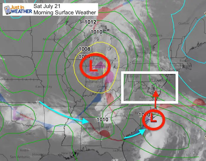
Morning Set Up
Coastal Low Forming With Energy Fed In From The West
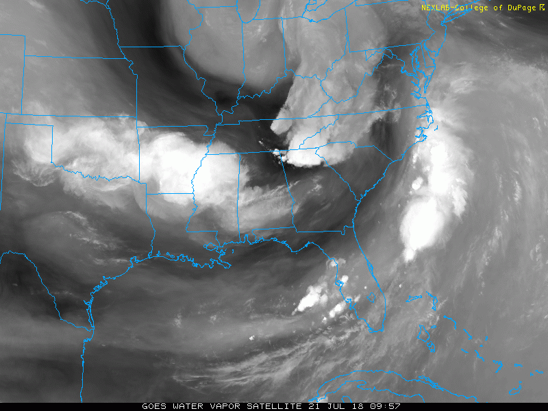
Water Vapor Satellite Loop
Radar Simulation —> slider
HRRR Model – Worst will arrive tonight
[metaslider id=64067]
Rain Total Potential
This is the flooding potential through tonight.
Yes, that is 3 to 6 inches of rain today in central to southern Maryland!
NAM Model Animation
High Temperatures
Outlook
Rain pattern next week:
We have a chance of rain every day. This may contain some severe storms.
Please share your thoughts, best weather pics/video, or just keep in touch via social media
-
Facebook: Justin Berk, Meteorologist
-
Twitter: @JustinWeather
-
Instagram: justinweather
Keep In Touch Every Day
Click here to sign up for email alerts…. Just in case you don’t get the post on your social media feed
Shine On
Proceeds from all sales go to Just In Power Kids. Click the image to shop and show your support.

![]()
 Get the award winning Kid Weather App I made with my oldest son and support our love for science, weather, and technology. Our 3 year anniversary of the release and our contribution to STEM education is this November. It has been downloaded in 60 countries, and works in both temperature scales. With your support we can expand on the fun introduction to science and real weather.