 Thursday July 19 2018
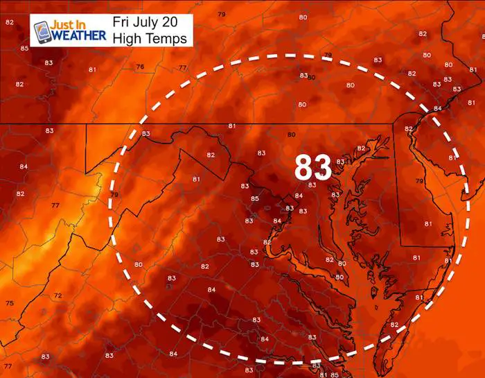
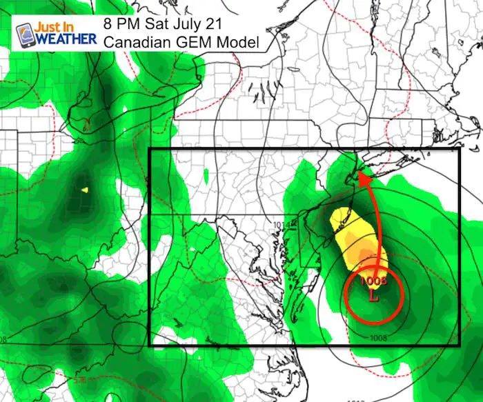
The weather today is nearly ideal for mid summer with sun, low humidity, and warm temperatures in the mid 80s. We will have that again Friday, then a abrupt change. A storm will form off the coast and roll by Ocean City on Saturday. There will be heavy rain at the beaches and possibly across Delmarva. This depends on the storm track, but it has been trending closer. Following this will be a stuck pattern with multiple waves of storm and almost daily rain through all of next week.
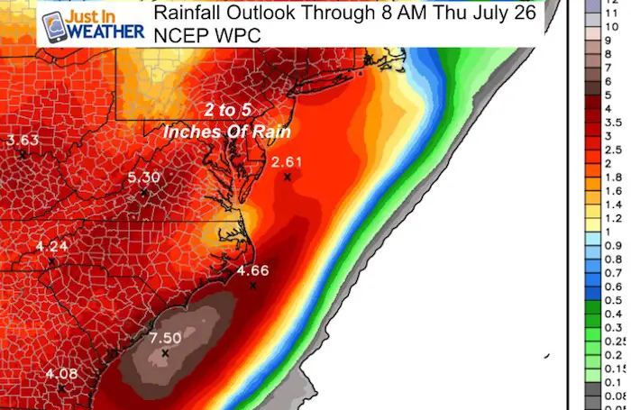
At this time the rain fall outlook is very wet! Local areas may exceed what is suggest in this first map as there will be pockets of heavy downpours that may hit some spots more than others spanning the week. This will raise our risk for flooding once again.
Here is a look at today’s stats and the outlook through next week. Beyond Sunday the timing is subject to change. The general theme however has us with a chance of rain each day with no specific time. Just a very active weather pattern.
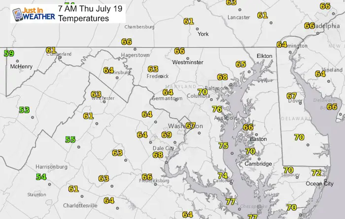
Stats For July 19 in Baltimore
Average High: 87ºF
Record High: 103ºF in 1930
Average Low: 67ºF
Record Low: 57ºF in 2009
Sunrise: 5:55 AM
Sunset 8:29 PM
*Daylight = 1:28 shorter than yesterday
*Bay Water Temperature = 80ºF at Thomas Pt. Light House
Keep In Touch Every Day
Click here to sign up for email alerts…. Just in case you don’t get the post on your social media feed
Please Support Maryland Trek 5
329 miles hiking and biking in 7 days
To provide free integrated wellness programs for kids in and post cancer treatment
Power Sponsor of Maryland Trek 5:

Morning Set Up
High Temperatures Today

High Temperatures Friday
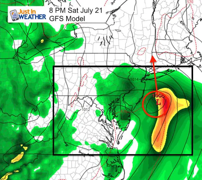
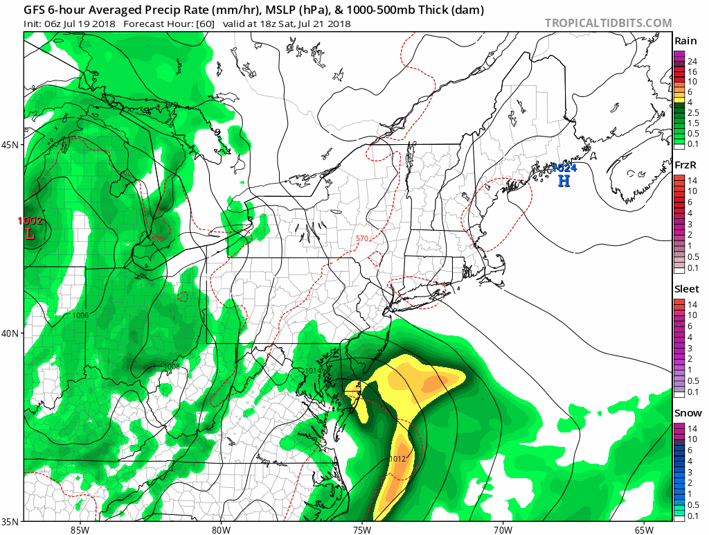
Weekend Rain: Starts Saturday
The NAM 3 Km Model shows the showers arriving in the morning, with heavy rain building at the beaches mid day through the afternoon
—> slider
[metaslider id=63996]
Storm Outlook
The timing and proximity to the coast is still up for debate, but here we see the Canadian GEM (similar to the Euro) and GFS both close enough
Storm Animation
This outlook on the GFS Model is the consensus of rain chances each day through next week.
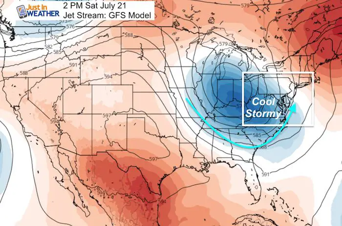
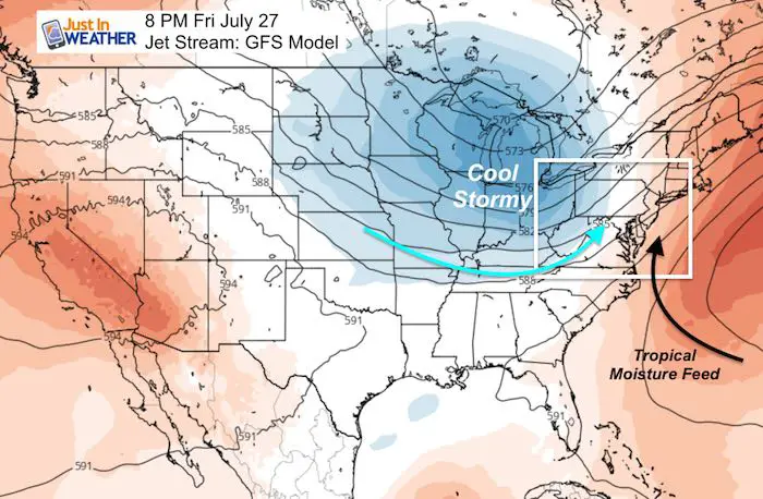
Active Jet Stream
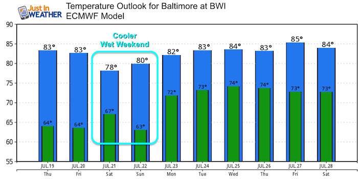
Temperature Outlook
Please share your thoughts, best weather pics/video, or just keep in touch via social media
-
Facebook: Justin Berk, Meteorologist
-
Twitter: @JustinWeather
-
Instagram: justinweather
Keep In Touch Every Day
Click here to sign up for email alerts…. Just in case you don’t get the post on your social media feed
Shine On
Proceeds from all sales go to Just In Power Kids. Click the image to shop and show your support.

![]()
 Get the award winning Kid Weather App I made with my oldest son and support our love for science, weather, and technology. Our 3 year anniversary of the release and our contribution to STEM education is this November. It has been downloaded in 60 countries, and works in both temperature scales. With your support we can expand on the fun introduction to science and real weather.