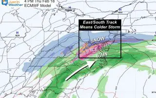
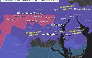
Winter Storm On Thursday Trending Colder
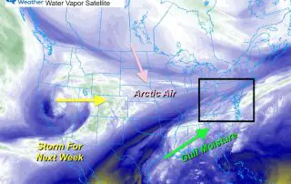
Monday February 15 2021 Evening Update The active winter pattern is currently producing historic snow and cold from south Texas to the Ohio Valley. The arctic air went due south
Monday February 15 2021 Evening Update The active winter pattern is currently producing historic snow and cold from south Texas to the Ohio Valley. The arctic air went due south
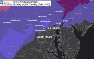
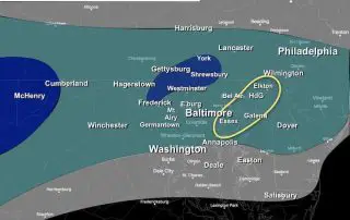
February 15 2021 Monday Evening Updating Report Light rain, falling temperatures, and going into the dark hours of the evening are a recipe for icing. A Winter Weather Advisory is
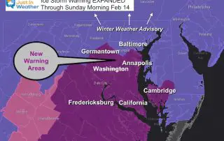
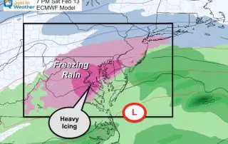
Saturday February 13 Afternoon Update Moderate icing has already spread through southern and parts of central Maryland. This storm appears to be following the trend to speed up and enhance
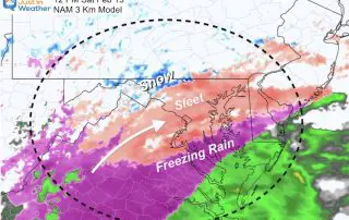
Saturday February 13 2021 Freezing rain already began moving in to the region. The air and especially the ground are both cold enough for whatever falls to be able to
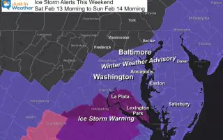
Friday February 12 2021 Freezing rain this weekend. An Ice Storm Warning and Winter Weather Advisory was posted by the National Weather Service for a broad area. This was suggested
Friday February 12 2021 The third winter ‘event’ in four days is all teed up and ready to move in. This time ice is the concern from sleet and freezing
Friday February 12 2021 There is so much to cover the morning, and I realize you may have plans for the weekend, Valentine’s Day or beyond. So I want to
Wednesday February 10 2021 In my last report in showed a new Snow Map where I increased my forecast in parts of north central Maryland to push the 6 inch
Wednesday February 10 Afternoon Update Tonight will be the start of our very active weather pattern. Now that the first system is on our doorstep, it is coming into focus.
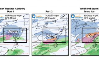
February 10 2021 We have a very busy stretch of weather starting tonight and going to the weekend. It does look like we are in a pattern for quick movers,