October 26 Weather Showers Later Today Storm Line Sunday
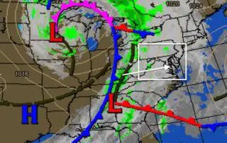
Saturday October 26 2019 A strong storm in the southern US got a boost yesterday when Tropical Storm Olga was named in the Gulf of Mexico. But much like last
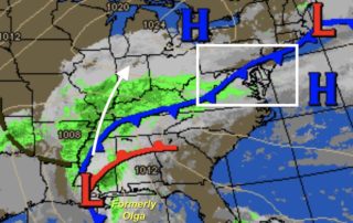
Saturday October 26 2019 A strong storm in the southern US got a boost yesterday when Tropical Storm Olga was named in the Gulf of Mexico. But much like last
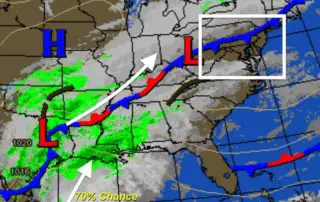
Friday October 25 2019 The weather pattern is getting more active and starting to repeat itself. You will notice more clouds today as a frontal boundary crosses our region, but
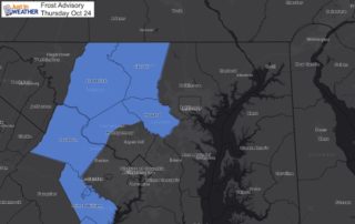
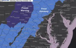
Thursday October 24 2019 A Frost Advisory was issued for some of the counties west of Baltimore. This includes Carroll, Howard, Frederick, and western Montgomery Counties. This is for areas
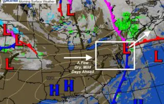
Wednesday October 23 2019 It is rather ironic that we talk about a few days to dry out, but we have had more rain in the last week than the
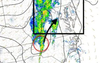
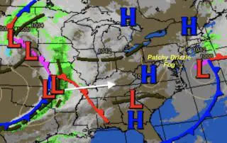
Tuesday October 22 2019 You may have noticed the wind increase as the fog and drizzle dispersed mid day. This is just a lull before the showers and bands of
Tuesday October 22 2019 Some drizzle has developed across the region this morning, but is not showing up on radar. So the roads may be damp, but later today a
Monday October 21 2019 The rain on Sunday did soak the region and make a dent in our drought. The report from Baltimore's BWI was 1.35" of rain, which was
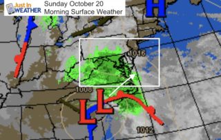
Sunday October 20 2019 Nestor was a tropical storm for about a day, but it left a trail of destruction with numerous tornadoes in Florida. The core Low is no
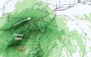
Saturday October 19 2019 This morning brought some frost to parts of our region and tomorrow morning should bring rain for most of us. Tropical Storm Nestor formed in the
Friday October 18 2019 The weather pattern is getting very active and there is no rest for the weary. The strong Nor'easter will be departing but still bringing us a