Friday October 25 2019
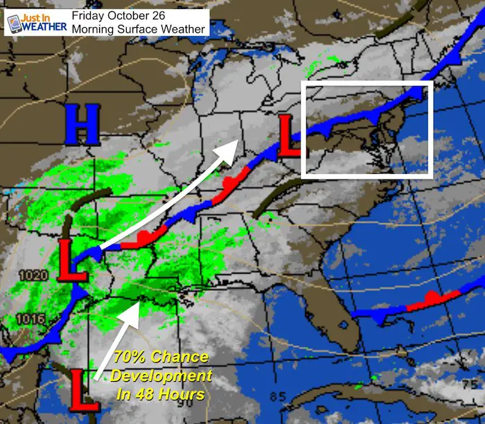
The weather pattern is getting more active and starting to repeat itself. You will notice more clouds today as a frontal boundary crosses our region, but we should remain dry. The developing storm in Texas is our weekend event, and is being fed by tropical moisture from the Gulf of Mexico. The National Hurricane Center has a 70% chance of development in the next 48 hours. It may run out of room to do that, but a signal of a stronger system to move our way Sunday.
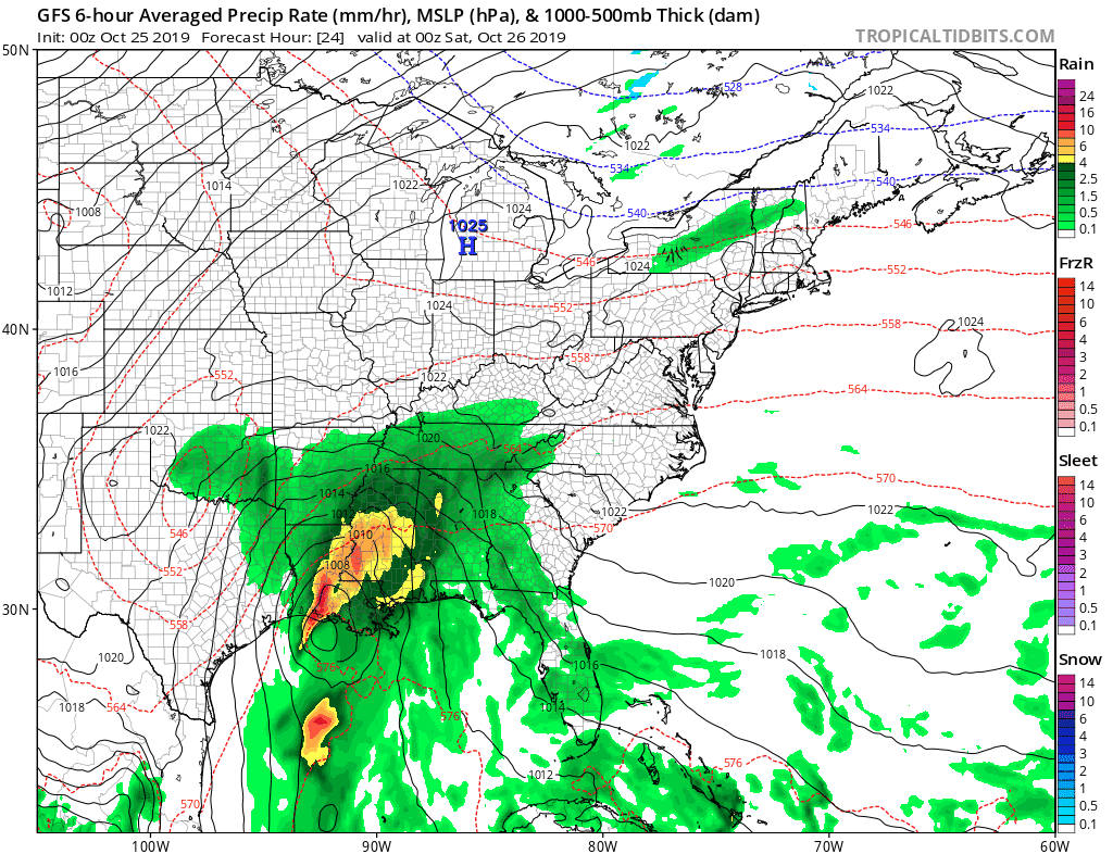
Friday Morning Surface Weather
Headlines
- More Clouds Today
- Saturday: Mostly Dry, But Showers West Late Afternoon And Evening
- Sunday: Periods Of Rain May Be Heavy
- Next Week: More Rain And Colder Before Halloween
Local Weather Stats:
Friday October 25, 2019 in Baltimore
Average High: 64ºF
Record High: 77ºF in 1931
Average Low: 42ºF
Record Low: 28ºF in 1962
Sunrise: 7:26 AM
Sunset 6:14 PM
*Daylight = 2:22 shorter than yesterday
*Bay Water Temperature = 63ºF at Thomas Pt. Light House
Get Forecasts By Email
Just in case you don’t get all posts on your social media feed, stay up to date with the latest info…
Click here to sign up for email alerts…. Be the first to hear any new weather
Thank you to our Title Sponsor for Maryland Trek 6
Shining on with Smyth and their contribution, our team has raised over $95,000 for Just In Power Kids to provide free programs for kids in and post cancer treatment.

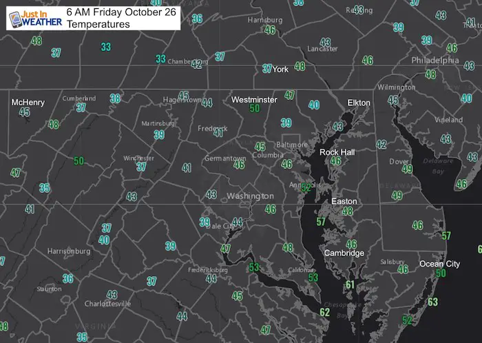
Morning Temperatures
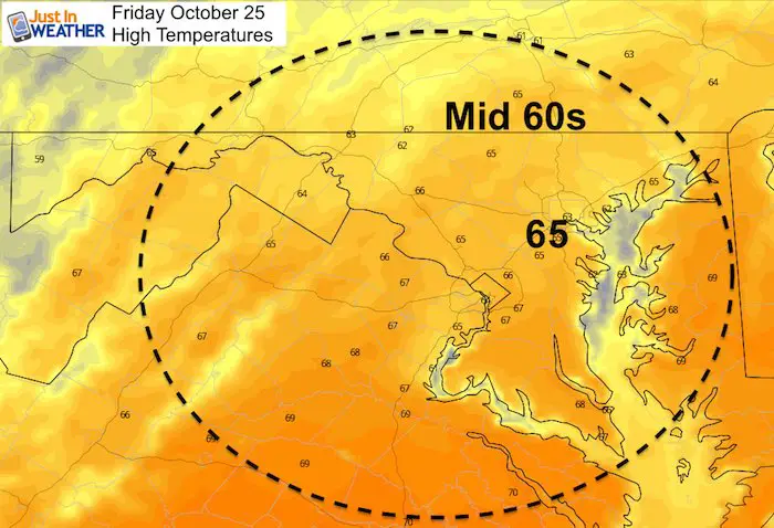
Friday Afternoon Highs
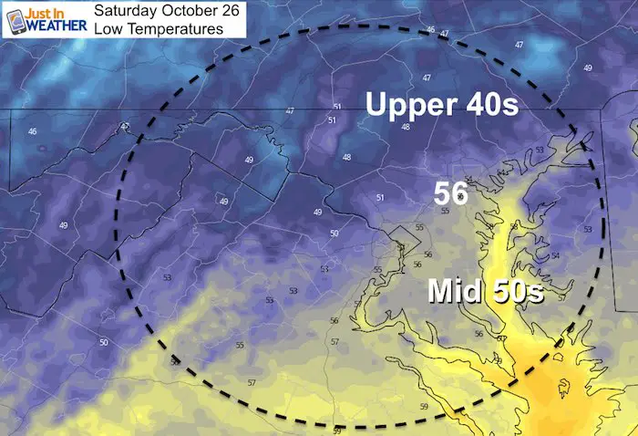
Saturday Morning Lows
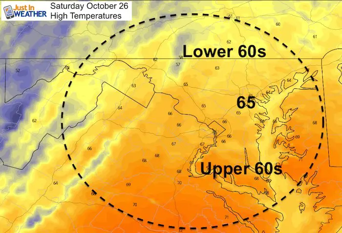
Saturday Afternoon Highs
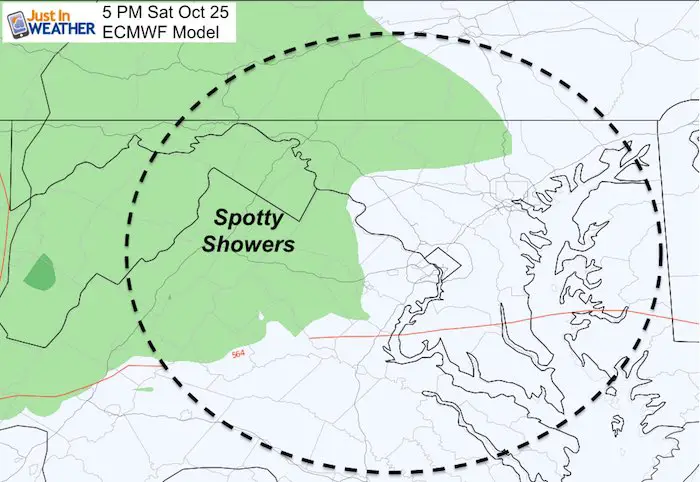
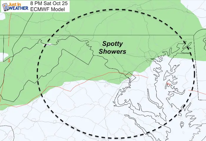
Saturday Afternoon/Evening Showers
Keeping with the trend I’ve identified with the past few systems, rain will likely try to arrive earlier. At this point, that appears to be spotty showers and more likely in western Maryland and perhaps the hilly suburbs west and north of the cities Saturday evening.
Sunday Rain Timeline
European Model —> Slider
[metaslider id=80785]
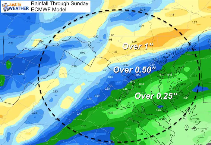
Rainfall Potential
Will this be on par or an overachiever for you? Either way, most of the region should be over 0.50″ of rain. More north of the cites, and less in southern Maryland/Delmarva.
Rainfall Animation
The GFS Model is more aggressive with the rain this weekend, then brings in the next rain event on Wednesday, ending with snow in western Maryland Thursday morning.
Please share your thoughts, best weather pics/video, or just keep in touch via social media
-
Facebook: Justin Berk, Meteorologist
-
Twitter: @JustinWeather
-
Instagram: justinweather
ALL FITF Apparel Available


New Colors
We are giving 10% of each sale to Just In Power Kids: Providing FREE holistic care to pediatric oncology patients and FREE healthy meals to local hospitals.

October is Breast Cancer Awareness Month
Love Maryland Shirts and Hoodies
This shirt was designed by my ‘bonus’ daughter Jaiden. The hoodie has been the biggest hit, so our promotion is back this year. Join us to support the cause and show off your Love of Maryland
|
||
|
Show your love for Maryland and make this 15 year old artist and her mom extra proud
|


Also See:
NOAA Winter Outlook Leaves Room For More Snow With Mild ‘Seasonal Average’ Temperatures

Many areas inland from the cities should drop into the 30s by tomorrow morning. This could do it.
See the maps for when we normally expect the first frost in this link.

Snowy Winters Following A Hot and Dry September

Baltimore Weather At BWI May Not Be As Hot As Reported
Construction at the airport close to the weather station may be added artificial heat. Click here or the image for the details.

Other Links:
Atmospheric Memory Shaped The US East Coast
Atmospheric Memory Of Hurricanes Over Thousands Of Years Shaped The Coast

Was Your County Not Included?
Click this map for more on the regional forecast zones

Maryland Trek Cycle Jerseys From Hill Killer
All proceeds will go to the Maryland Trek 6 total and Just In Power Kids programs

Just In Power Kids:
Proceeds go to our programs Providing FREE holistic care for kids in cancer treatment and up to 5 years post treatment and caregivers.
![]()
Shine On
Proceeds from all sales go to Just In Power Kids. Click the image to shop and show your support.
