More Fog This Morning And More Flooding This Weekend
June 1 2018 Today is the start of meteorological summer and hurricane season. But, once again we have low visibility across our area that is the focus. That is just
June 1 2018 Today is the start of meteorological summer and hurricane season. But, once again we have low visibility across our area that is the focus. That is just
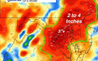
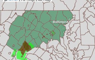
Thursday May 31 2018 We have a Flash Flood Watch in place this afternoon and this evening, and I will show the latest radar simulation update below. Many afternoon sports
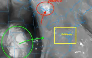
May 31 2018 We start the morning with more widespread fog which is just a sign of the moisture in the air. The remains of Subtropical Depression Alberto have pushed
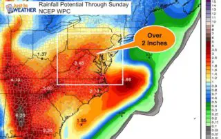
Tuesday May 29 2018 More rain is on the way this week. This morning the visibility is the main issue. Fog and some mist will be a dominant part of
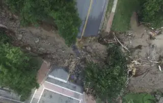
The flood in Ellicott City Maryland on May 27 2018 was the result of nearly 8 inches of rainfall in a few hours and up to 10 inches in surrounding

May 27 2018 State of Emergency in Maryland Strong thunderstorms and flooding was expected today, but not like this. This was worse than the once in a lifetime flood just
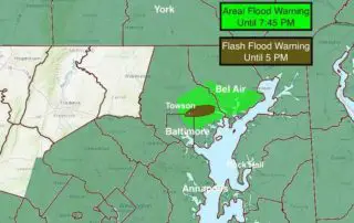
May 27 2018 Heavy rain has already erupted early this afternoon and prompted Flash Flooding in Baltimore and Hartford Counties. Doppler Radar is showing heavy rain moving over the same
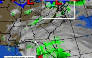
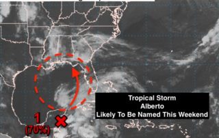
Sunday May 27 2018 We start today with a tropical feel to the air. This is the part of Memorial Day Weekend we talked about all week as having the
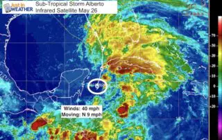
Saturday May 26 2018 As you may have noticed, there are some more clouds this morning along with a little more heat and humidity. This will seem like a typical
Friday May 25 2018 H is good, L is bad. That is the simple approach to weather a friend of mine had years ago. Well, the big H is on