 Saturday May 26 2018
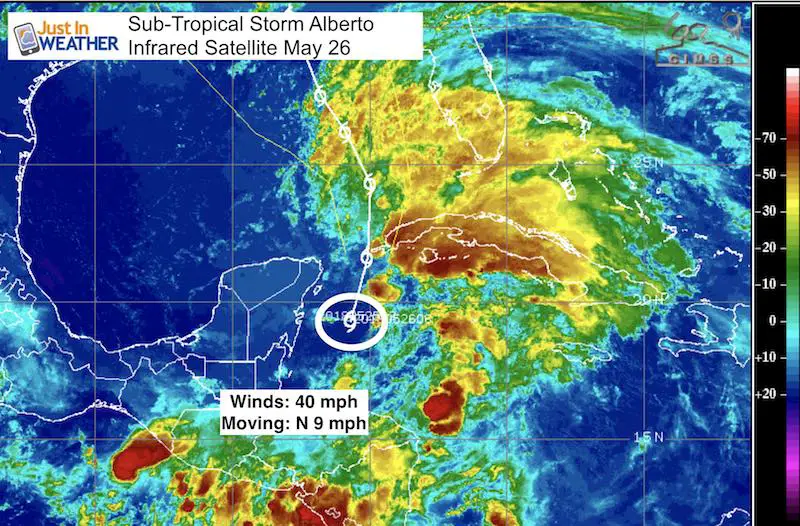
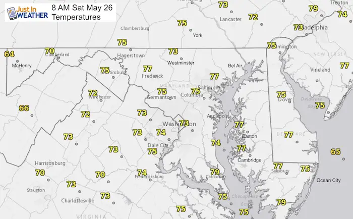
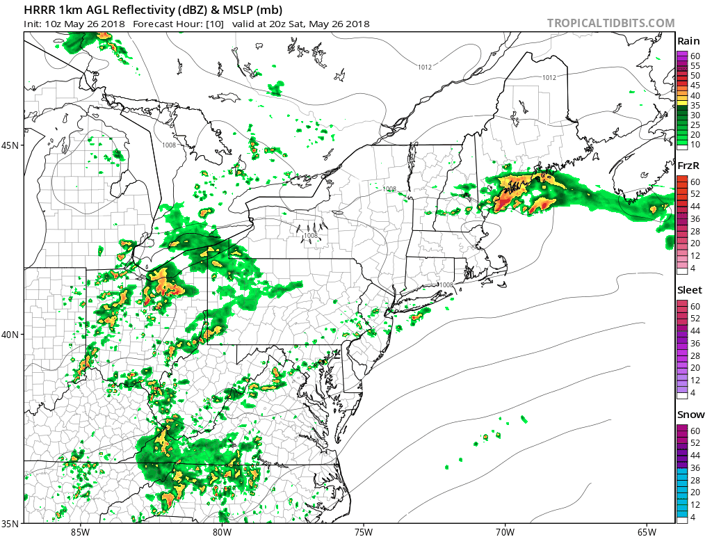
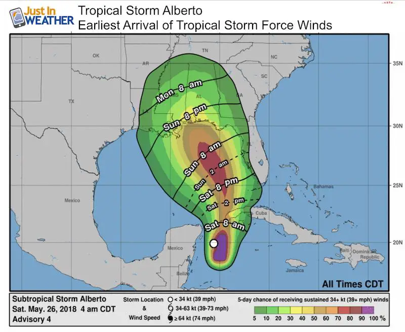
As you may have noticed, there are some more clouds this morning along with a little more heat and humidity. This will seem like a typical summer like day, with highs in the mid 80s to near 90ºF. We do have the chance of showers and thunderstorms developing after 4 PM. The same will be the case Sunday, so our Memorial Day Weekend weather is not perfect. The one difference in this outlook is Sun-Tropical Storm Alberto. This is the newly named storm in the Gulf of Mexico. As of early this morning, winds were 40 mph and it is moving to the N at 9 mph. The formation of this storm has adjusted the larger moisture flow into our area. We will still have rain to deal with, but primarily in the afternoon and evenings.
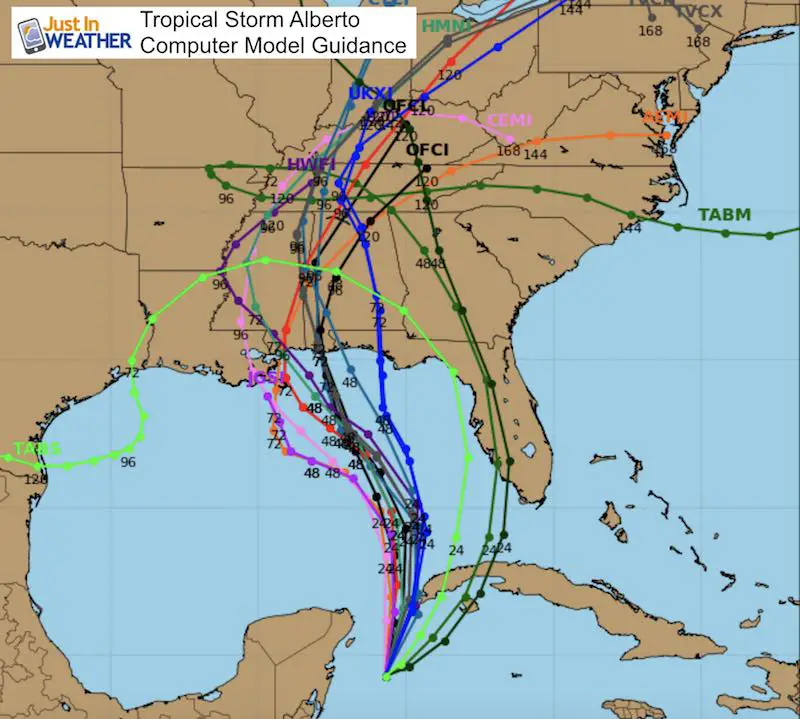
At this point it looks like Alberto will make more of a direct impact on our region by Thursday and Friday next week.
Here is a quick look at the maps and animations. I hope to be able to spend a little more time later for a more detailed breakdown.
Stats For May 26 in Baltimore
Average High: 77ºF
Record High: 97ºF in 1914
Average Low: 55ºF
Record Low: 41ºF in 1967
Sunrise: 5:44 AM
Sunset 8:212PM
*Daylight = 1:24 longer than yesterday
*Bay Water Temperature = 69ºF at Thomas Pt. Light House
This Morning
Rain Animation (HRRR) 4 PM to Midnight
Developing storms mid afternoon expanded to broader rain tonight.
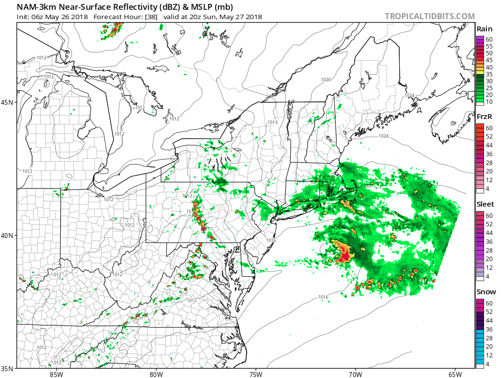
Rain Animation Sunday (NAM 3 Km) 4 PM to Midnight)
Stronger to severe storms possible between 6 and 10 PM
Sub Tropical Storm Alberto
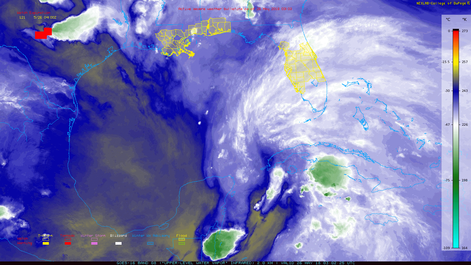
This is not a full fledged typical system based on the structure, but it is expected to moved over warmer water AND have a favorable upper level environment to develop this weekend. This Water Vapor Satellite Animation has the Flood Watches overlaid to show the most prone heavy rain areas… This is much of central Florida, the western panhandle, and into Louisiana, including New Orleans.
Computer Model Forecast Tracks
At this point it looks like Alberto will make more of a direct impact on our region by Thursday and Friday next week.
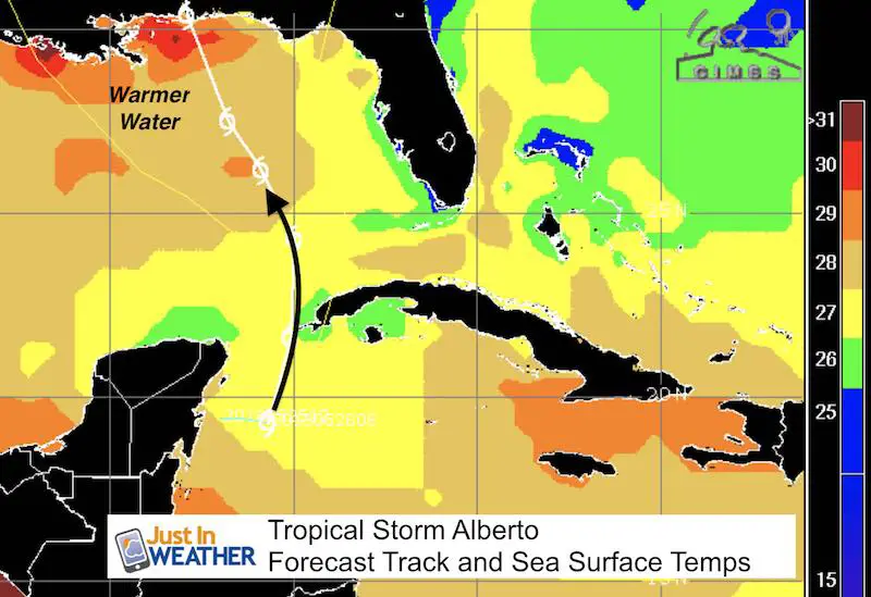
Sea Surface Temperatures
Warmer water will bring more energy into development before reaching the coast.
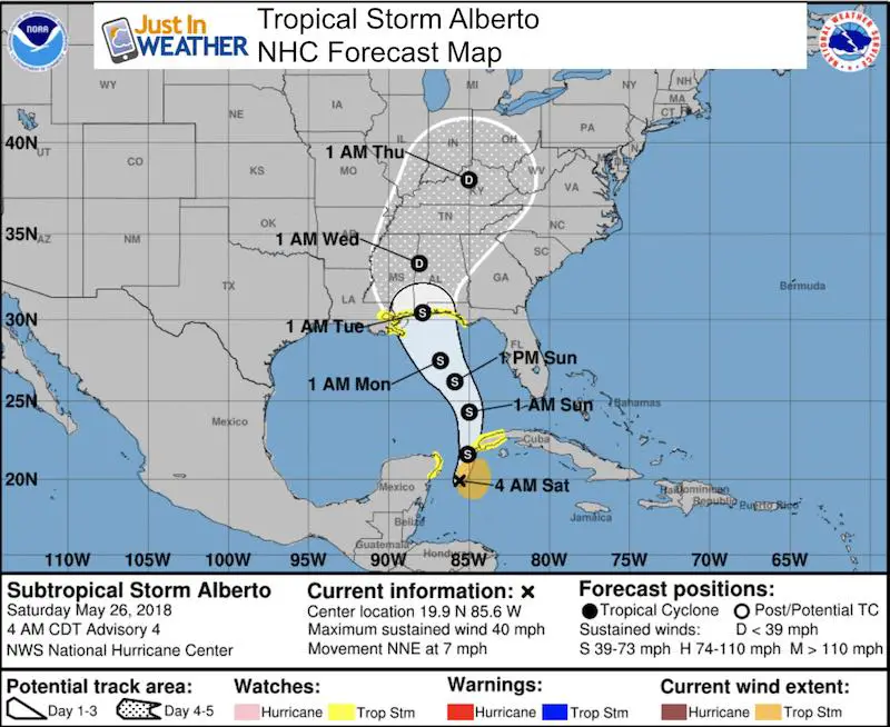
Forecast Map- National Hurricane Center
Forecast Winds – National Hurricane Center
Keep In Touch Every Day
Click here to sign up for email alerts…. Just in case you don’t get the post on your social media feed
![]()
Shine On
Proceeds from all sales go to Just In Power Kids. Click the image to shop and show your support.

Please share your thoughts, best weather pics/video, or just keep in touch via social media
-
Facebook: Justin Berk, Meteorologist
-
Twitter: @JustinWeather
-
Instagram: justinweather
 Get the award winning Kid Weather App I made with my oldest son and support our love for science, weather, and technology. Our 3 year anniversary of the release and our contribution to STEM education is this November. It has been downloaded in 60 countries, and works in both temperature scales. With your support we can expand on the fun introduction to science and real weather.