 Sunday May 27 2018
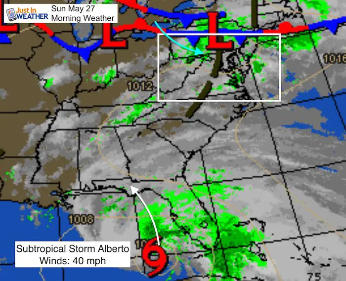
We start today with a tropical feel to the air. This is the part of Memorial Day Weekend we talked about all week as having the best chance of rain. It will be an afternoon and evening thing. It is warm and humid with a sense that something will give. We will have strong storms develop this afternoon the may be most intense this evening and tonight. This is not connected to Subtropical Storm Alberto that is located in the Gulf of Mexico. That storm has 40 mph winds this morning as Florida, Alabama, and Mississippi are under a State of Emergency for heavy rain. Some moisture is feeding into our weather system, but we may have a more direct impact from later at the end of the week ahead.
Today, our focus will be a stationary front drifting south. See two radar simulations with some difference in timing, plus the update on Alberto below.
Stats For May 27 in Baltimore
Average High: 77ºF
Record High: 95ºF in 1965
Average Low: 56ºF
Record Low: 43ºF in 1961
Sunrise: 5:44 AM
Sunset 8:23vPM
*Daylight = 1:23 longer than yesterday
*Bay Water Temperature = 70ºF at Thomas Pt. Light House
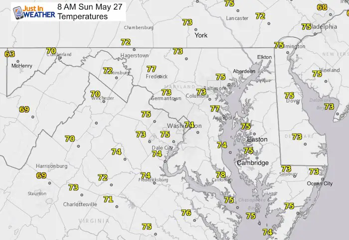
This Morning
Rain Timeline(s) Today
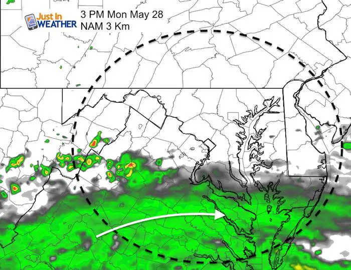
The two sliders here are meant to compare and contrast the short range storm development today. Both show storm development in PA that will drift into metro Baltimore, plus secondary storm development from the south. This is surrounding the stationary front in our region.
- Both show the strongest storms between 7 and 10 PM
- HRRR– Has the storms beginning early afternoon after 1 PM
- NAM – Has the main cluster worth watching after 5 PM
—> sliders
HRRR Model
[metaslider id=62609]
NAM Model
[metaslider id=62630]
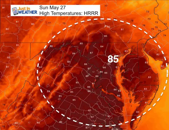
Afternoon Highs
Sunday Rain
The front should settle in southern Virginia. That will focus the rain to our south, but may linger around Ocean City. The morning is likely to start of cloudy, cool and damp in central Maryland and PA, but may clear in the afternoon. Temps will be much cooler in the 70s.
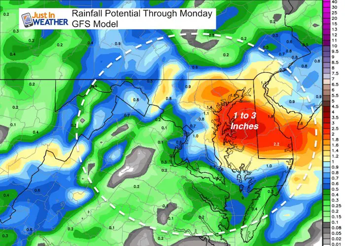
Rainfall Total Through Memorial Monday
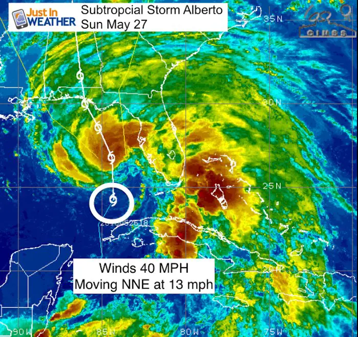
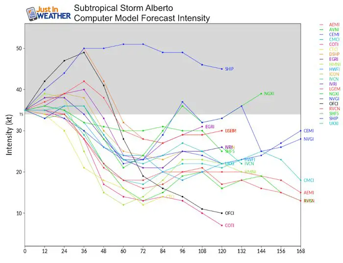
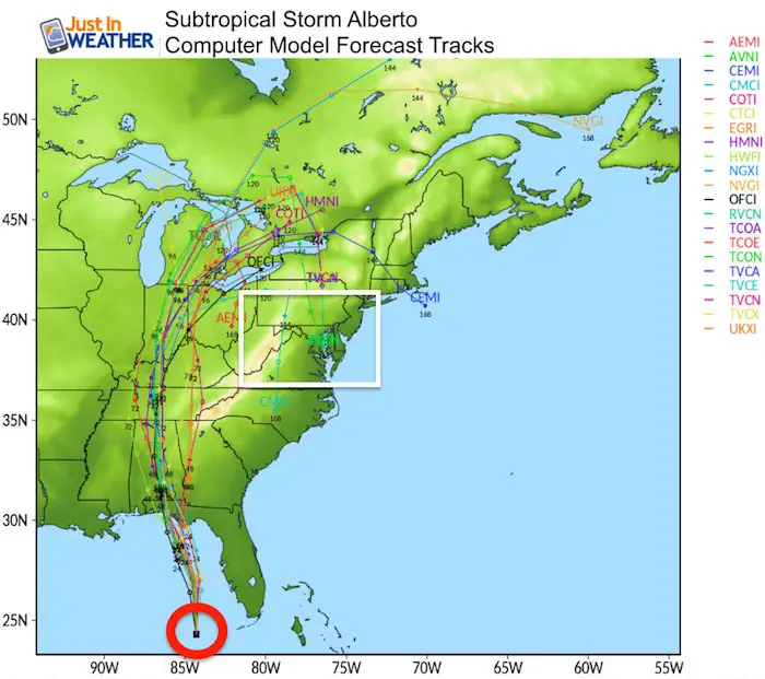
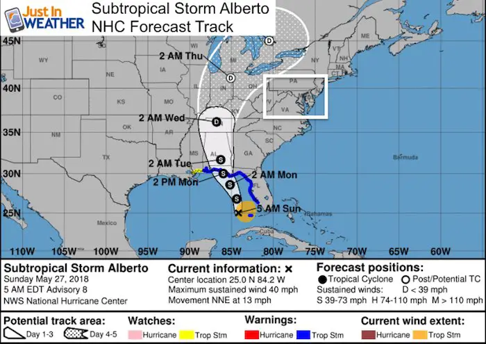
Subtropical Storm Alberto
8 AM Update
LOCATION...26.3N 84.4W
ABOUT 165 MI...265 KM SW OF TAMPA FLORIDA
ABOUT 240 MI...385 KM S OF APALACHICOLA FLORIDA
MAXIMUM SUSTAINED WINDS...45 MPH...75 KM/H
PRESENT MOVEMENT...N OR 010 DEGREES AT 15 MPH...24 KM/H
MINIMUM CENTRAL PRESSURE...997 MB...29.44 INCHES
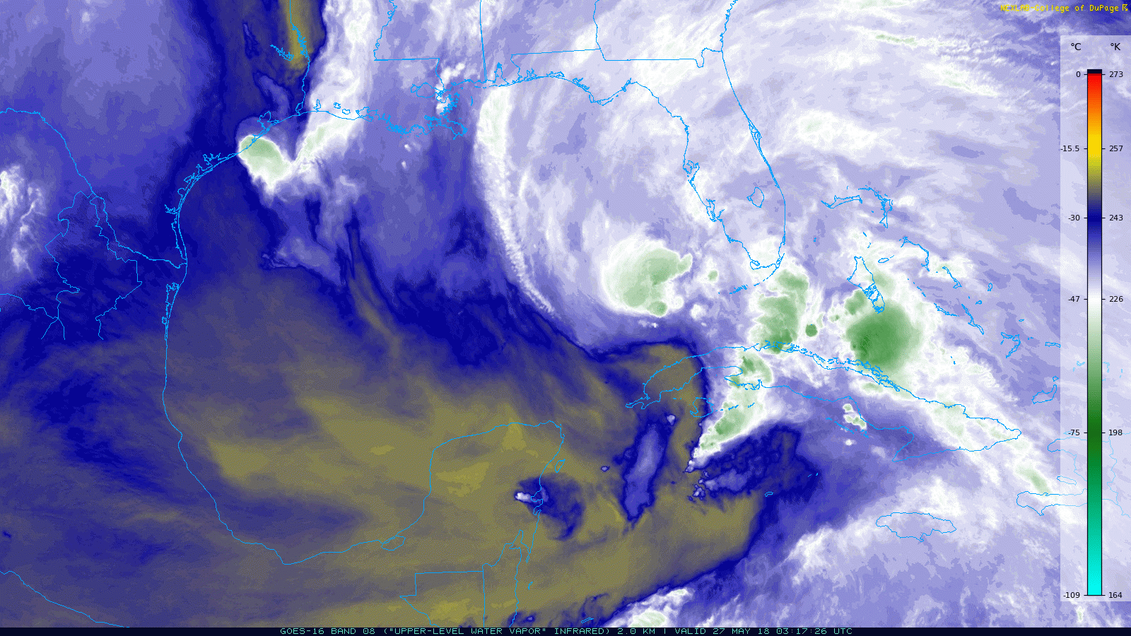
Satellite Loop
Computer Model Forecast Tracks
At this point it looks like Alberto will make more of a direct impact on our region by Thursday and Friday next week.
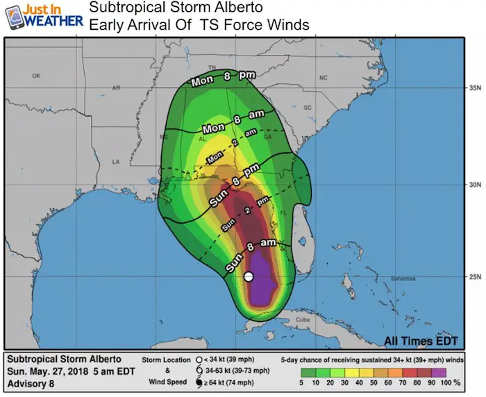
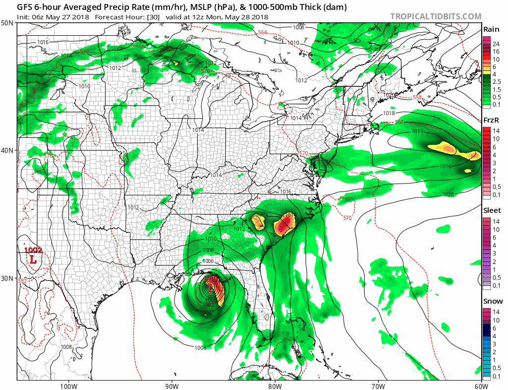
Rain From Alberto Reaches Us Next Week
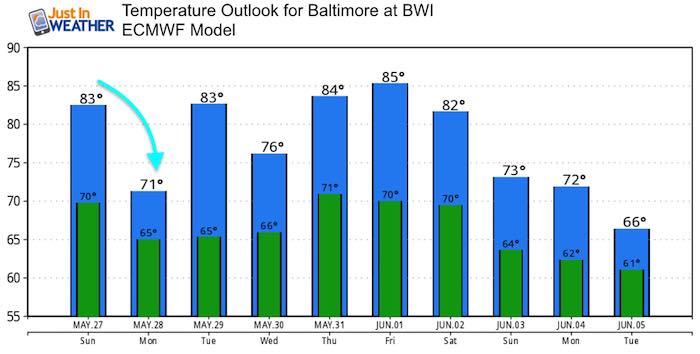
Temperature Outlook
Keep In Touch Every Day
Click here to sign up for email alerts…. Just in case you don’t get the post on your social media feed
![]()
Shine On
Proceeds from all sales go to Just In Power Kids. Click the image to shop and show your support.

Please share your thoughts, best weather pics/video, or just keep in touch via social media
-
Facebook: Justin Berk, Meteorologist
-
Twitter: @JustinWeather
-
Instagram: justinweather
 Get the award winning Kid Weather App I made with my oldest son and support our love for science, weather, and technology. Our 3 year anniversary of the release and our contribution to STEM education is this November. It has been downloaded in 60 countries, and works in both temperature scales. With your support we can expand on the fun introduction to science and real weather.