 May 27 2018
State of Emergency in Maryland
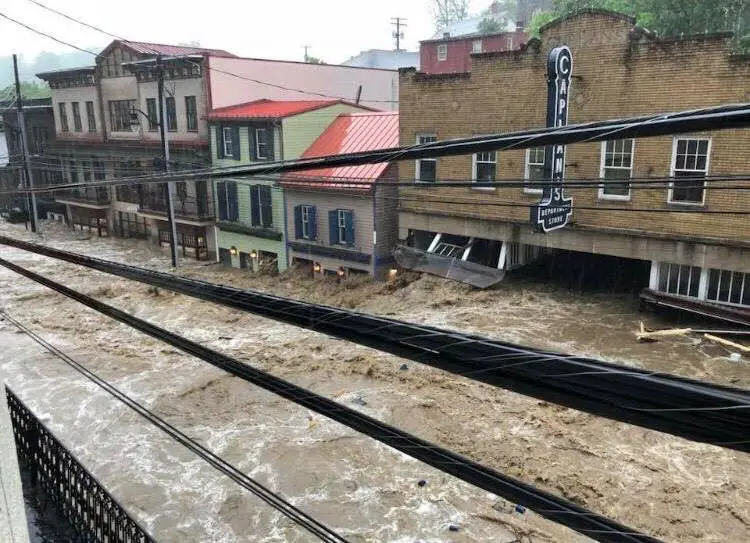
Strong thunderstorms and flooding was expected today, but not like this. This was worse than the once in a lifetime flood just 2 years ago in this same area. The photos tell it all (Main Street raging as seen from Shannon Baranoski). This breaks my heart, as with many of you. My Maryland Trek goes right down this road each August and we were rerouted in 2016 due to that flood. It is impossible to imagine what local business are dealing with, many of whom just recently opened back up again.
The rain that developed over central Maryland was along a stationary front that helped the storms develop and track over the same locations, called training. About 1000 miles away, Subtropical Storm Alberto was gaining strength in the Gulf of Mexico, but did help send some tropical moisture this far north. The net result was the focus of the heaviest rain over the worst area that resulted in nearly 6 inches in 2 hours and a total of 8 inches estimated by Doppler Radar. Weather Bug Station in Waverly ES recorded 7.45″ of rain for the day. Nearby BWI Airport average 3.99″ for the entire month of May! Some local stations report up to 10 inches for the event.

Ask locals and they know the history of heavy rain and floods on Main Street in Ellicott City. But many will say the overdevelopment and poor planning for the drainage
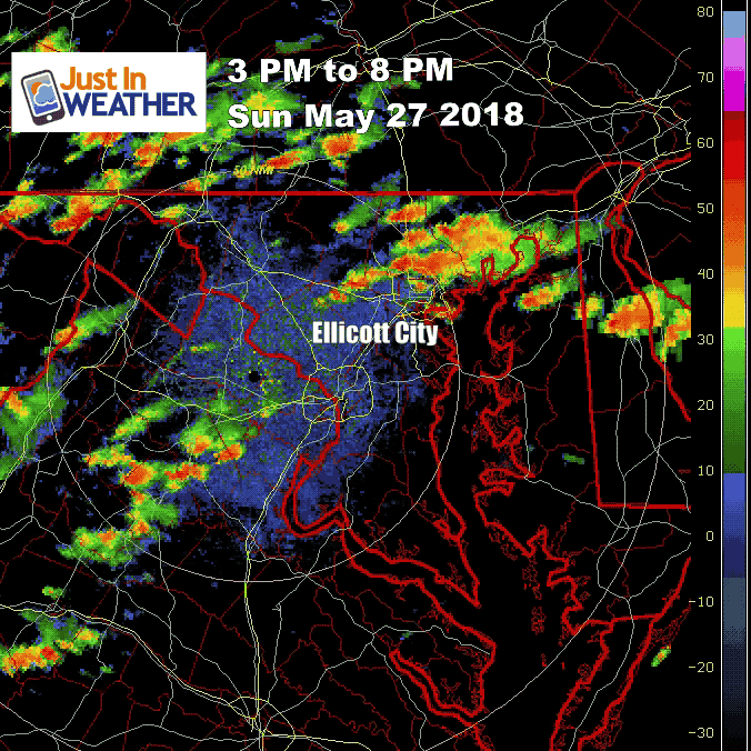
Radar Loop Animation
This is the National Weather Service Doppler Radar from Sterling VA between 3 PM and 8 PM. Watch as the storm evolved, then sit and dump over the same areas.
Power of Water
This is a snapshot from the video below, thanks to Christa Rose. The water level was higher than the 2016 event, but the water raging through the buildings out into the street was amazing.
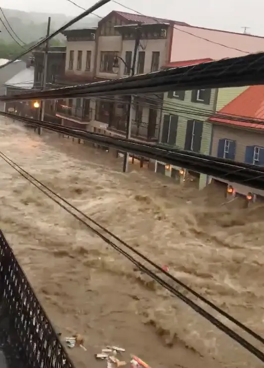
Flooding on Main Street in Ellicott City
Watch closely and see the force of water raging out of the buildings. This was much worse than the 2016 storm.
Photos: Governor Larry Hogan Toured The Area
–> slider
[metaslider id=62698]
Message from Gov Larry Hogan
State and local rescue workers and law enforcement will be working throughout the night to help those in need in Ellicott City. Please stay off the roads; those affected by the storm who are in need of non-emergency assistance can call Howard County Police Department at 410-313-2200. Shelters are available Howard County Recreation and Parks’ Roger Carter Community Center or St. Peter’s Episcopal Church.
Water Vapor Satellite (6 hour loop ending 11 PM)
See the moisture from Alberto feedings into Maryland.
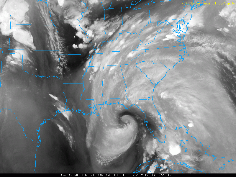
Note: We could still get more rain form Alberto later in the work week.
Keep In Touch Every Day
Click here to sign up for email alerts…. Just in case you don’t get the post on your social media feed
Please share your thoughts, best weather pics/video, or just keep in touch via social media
-
Facebook: Justin Berk, Meteorologist
-
Twitter: @JustinWeather
-
Instagram: justinweather
![]()
Shine On
Proceeds from all sales go to Just In Power Kids. Click the image to shop and show your support.

 Get the award winning Kid Weather App I made with my oldest son and support our love for science, weather, and technology. Our 3 year anniversary of the release and our contribution to STEM education is this November. It has been downloaded in 60 countries, and works in both temperature scales. With your support we can expand on the fun introduction to science and real weather.