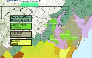
Flash Flood Watch And Updated Michael Rain Timeline
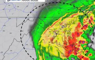
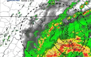
Thursday October 11 2018 If this was a winter storm, the northern edge of the precipitation would be the low confidence zone. I realize that starting off with that you
Thursday October 11 2018 If this was a winter storm, the northern edge of the precipitation would be the low confidence zone. I realize that starting off with that you
Thursday October 11 2018 Rain has already passed through this morning but the bulk of what we will see will be tonight. The impact of Tropical Storm Michael will be
10 AM Wednesday October 10 2018 Hurricane Michael will make landfall on Florida's Northern Gulf Coast this afternoon. It will be the strongest storm to hit that area on record,
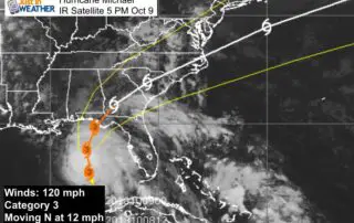
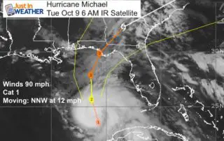
5:45 PM Tuesday October 9 2018 I think this now has everyone's attention. Major Hurricane Michael now has top winds of 120 mph and it looks like it may continue
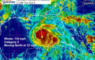
11 AM Tuesday October 9 Category 2 Hurricane Michael is fully utilizing the warm water in the Gulf of Mexico. As of the 11 AM update from the National Hurricane
Tuesday October 9 2018 It is all about Hurricane Michael. A State of Emergency has been declared for parts of Alabama and Florida with Hurricane and Storm Surge Warnings extending
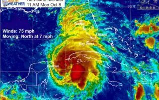
Monday October 8 2018 Michael is now the 7th storm in the Atlantic Basin this year to reach hurricane intensity. Winds are 75 mph and it is moving to the

Monday October 8 2018 No rest for the weary. We have fog problems and Tropical Storm Micheal is expected to become a hurricane today. Hurricane Watches have been issue for
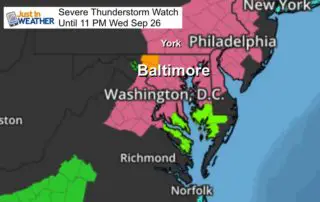
September 26 2018 A Severe Thunderstorm Watch has been issued for our area until 11 PM. This means the strong line of storms will have the potential to produce winds

Tuesday September 18 2018 Storms are possible today in Maryland that could turn severe. The remains Florence will act like a cold front with a line of storms developing mid