Tuesday October 9 2018
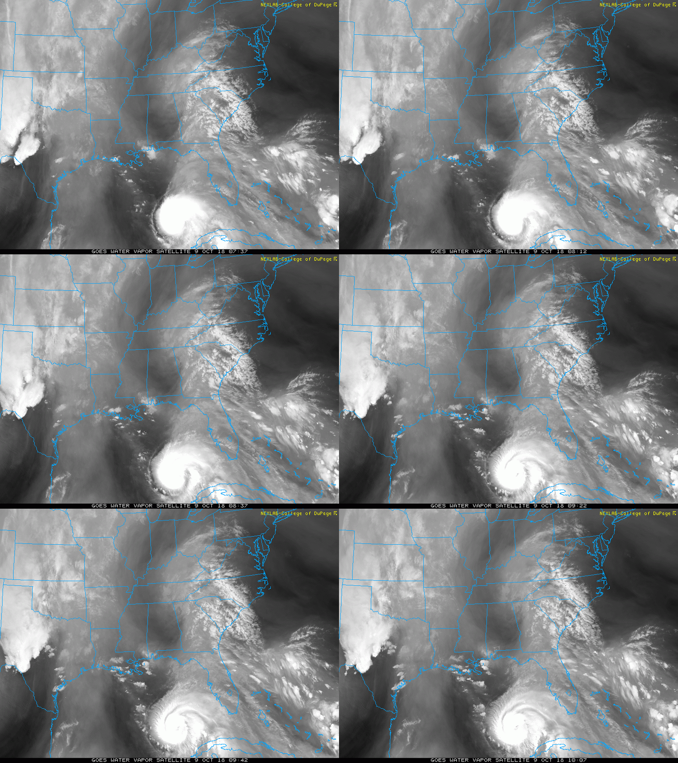
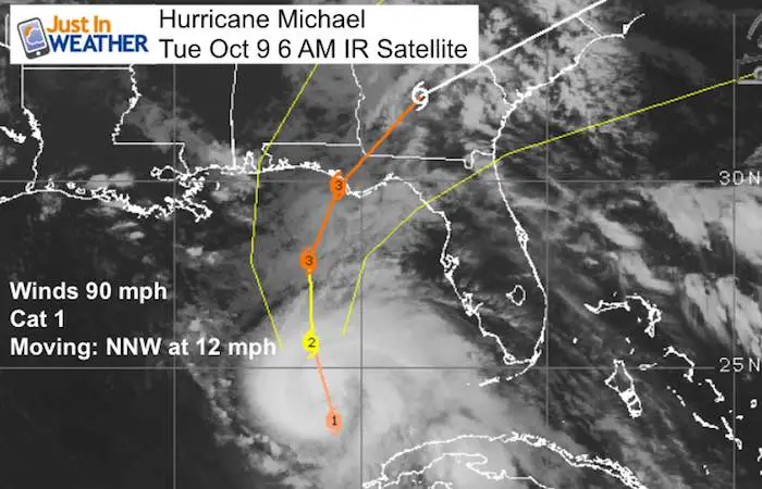
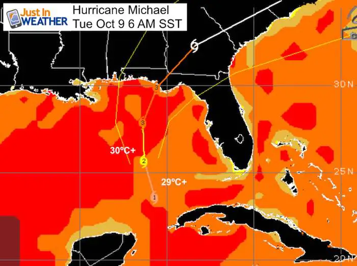
It is all about Hurricane Michael. A State of Emergency has been declared for parts of Alabama and Florida with Hurricane and Storm Surge Warnings extending across a large area. While the storm is in the Gulf of Mexico and expected to make landfall on Florida tomorrow, it will be a game changer for us. The direct impact will stay to our south. As of this morning, Michael has winds of 90 mph, still a Category 1. But the warm water will help it intensity quickly to a major storm Category 3. Landfall Wednesday will produce severe storm surge on Florida’s Big Bend area and then spread heavy rain into Georgia and The Carolinas where she areas are still flooded from Florence.
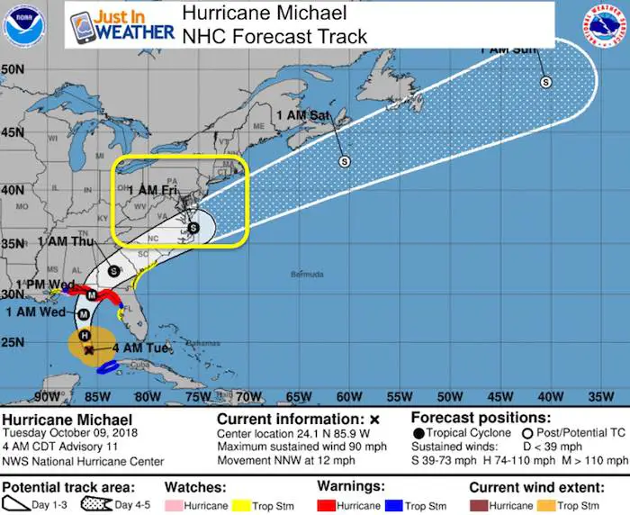
The track of Michael will stay south of Maryland and the heaviest of rain might reach Ocean City Thursday night. But as the storm races off of the coast, it will drag in very chilly air and change our pattern back to fall temperatures. It may also be a signal for storm patterns into winter. I am logging this for the snow potential in a few months. The morning stats and short range outlook is below:
Local Weather Stats For October 9 in Baltimore
Average High: 69ºF
Record High: 94ºF in 12007
Average Low: 48ºF
Record Low: 28ºF in 2001
Sunrise: 7:10 AM
Sunset 6:36 PM
*Daylight = 2:31 shorter than yesterday
*Bay Water Temperature = 73ºF at Thomas Pt. Light House
Also see:
Will A Wet Summer Bring A Snowy Winter?
Winter Outlook From Two Different Farmers Almanacs
Morning Weather
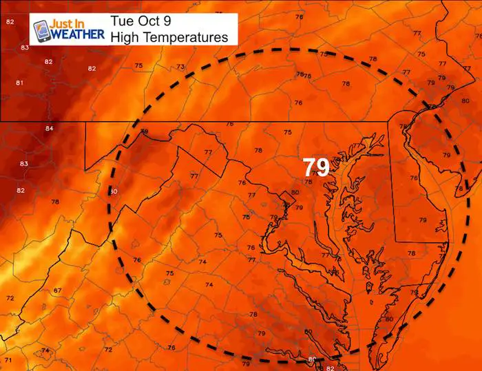
We are warm and muggy again with some areas of fog. The clouds form Hurricane Michael are moving up from the south and could help spawn an isolated shower this afternoon. But the storm is a day away from landfall and will not truly impact us until Wednesday night and Thursday.
Afternoon Highs
Hurricane Michael
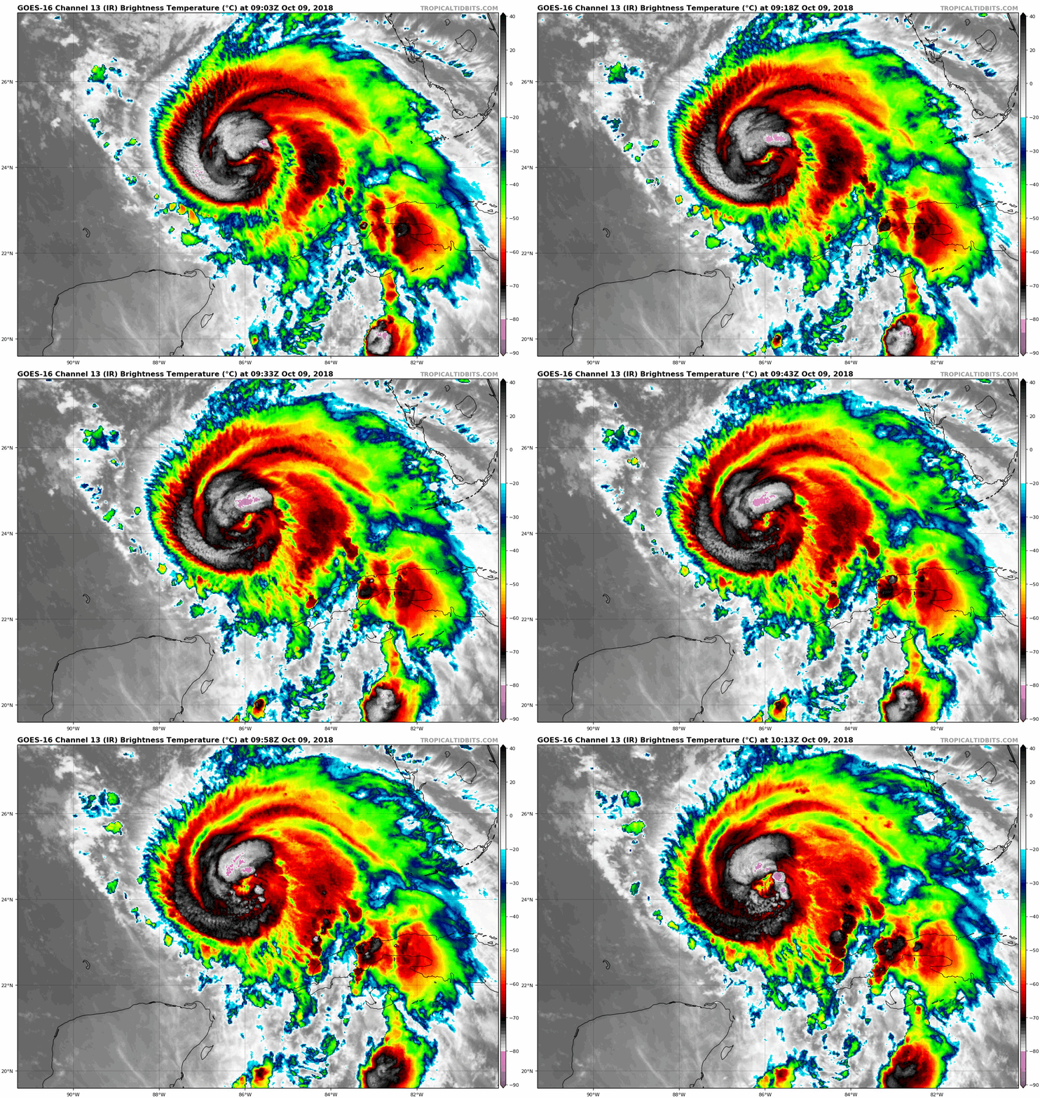
Satellite Loop
This looks very healthy as the highest cloud tops (grey and pink) are wrapping around the developing eye. This storm is about to explode with intensity and should jump to a Category 3 by the end of today. The visible satellite should show an eye by later today.
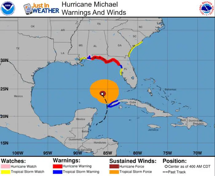
SUMMARY OF 400 AM CDT...0900 UTC...INFORMATION
----------------------------------------------
LOCATION...24.1N 85.9W
ABOUT 420 MI...680 KM S OF PANAMA CITY FLORIDA
ABOUT 390 MI...630 KM S OF APALACHICOLA FLORIDA
MAXIMUM SUSTAINED WINDS...90 MPH...150 KM/H
PRESENT MOVEMENT...NNW OR 345 DEGREES AT 12 MPH...19 KM/H
MINIMUM CENTRAL PRESSURE...973 MB...28.74 INCHES
Sea Surface Temperatures
This warm water will feed into the development today. 30ºC = 86ºF . The warmest waters are in the path en route to Apalachicola.
Warnings
Storm Surge Potential: (see map below)
Indian Pass FL to Cedar Key FL...8-12 ft
Cedar Key FL to Crystal River FL...6-8 ft
Okaloosa/Walton County Line FL to Indian Pass FL...6-9 ft
Crystal River FL to Anclote River FL...4-6 ft
Anclote River to Anna Maria Island FL including Tampa Bay...2-4 ft
Alabama/Florida border to Okaloosa/Walton County Line FL...2-4 ft
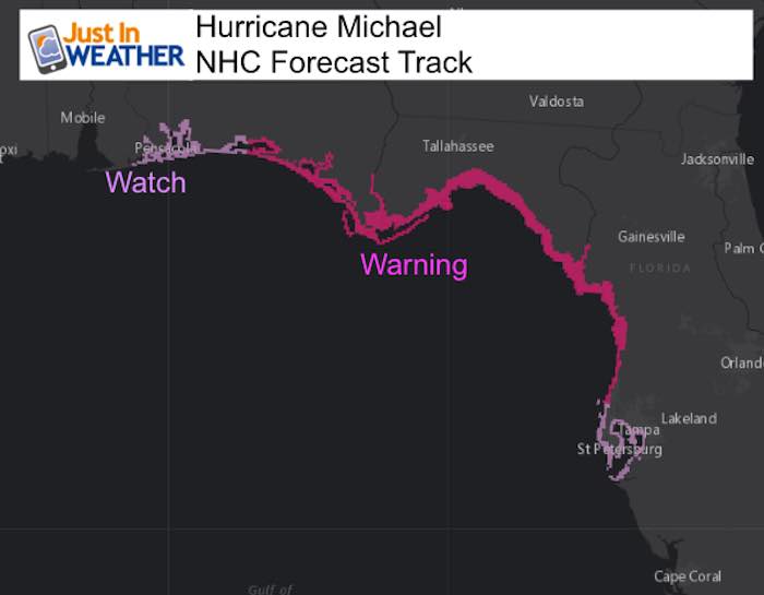
Hurricane and Tropical Storm Warnings/Watches
SUMMARY OF WATCHES AND WARNINGS IN EFFECT: (see map below)

A Storm Surge Warning is in effect for...
* Okaloosa/Walton County Line Florida to Anclote River Florida

A Storm Surge Watch is in effect for...
* Anclote River Florida to Anna Maria Island Florida, including
Tampa Bay
* Alabama/Florida border to Okaloosa/Walton County Line Florida

A Hurricane Warning is in effect for...
* Alabama/Florida border to Suwannee River Florida

A Hurricane Watch is in effect for...
* Alabama/Florida border to the Mississippi/Alabama border

A Tropical Storm Warning is in effect for...
* Alabama/Florida border to the Mississippi/Alabama border
* Suwanee River Florida to Chassahowitzka Florida
* The Cuban province of Pinar del Rio

A Tropical Storm Watch is in effect for...
* Chassahowitzka to Anna Maria Island Florida, including Tampa Bay
* Mississippi/Alabama border to the Mouth of the Pearl River
* Fernandina Beach, Florida to South Santee River, South Carolina
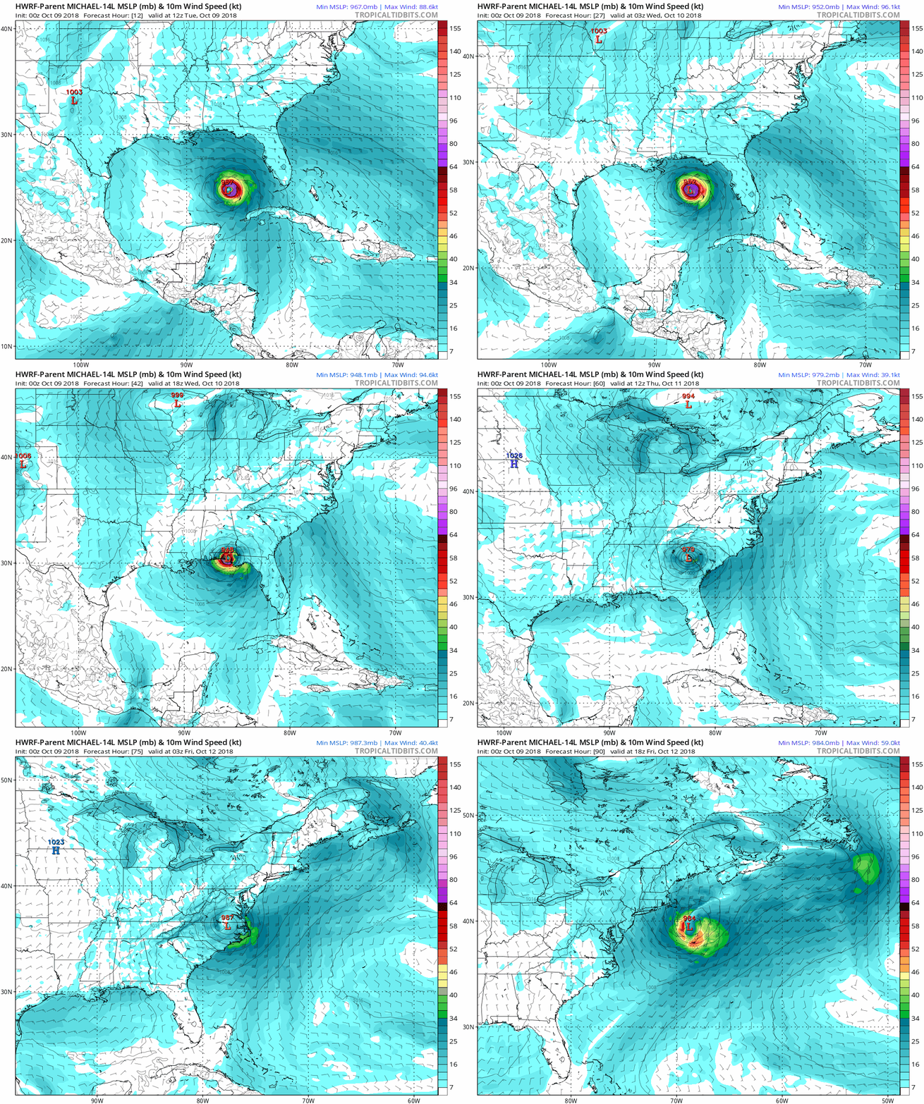
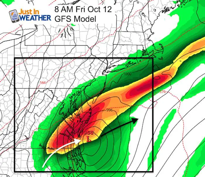
Forecast Animation
HWRF Model shows the core Low making landfall Wednesday afternoon near Apalachicola and then curving across the Carolinas and out to the Atlantic just south of Ocean City, MD near Virginia Beach.
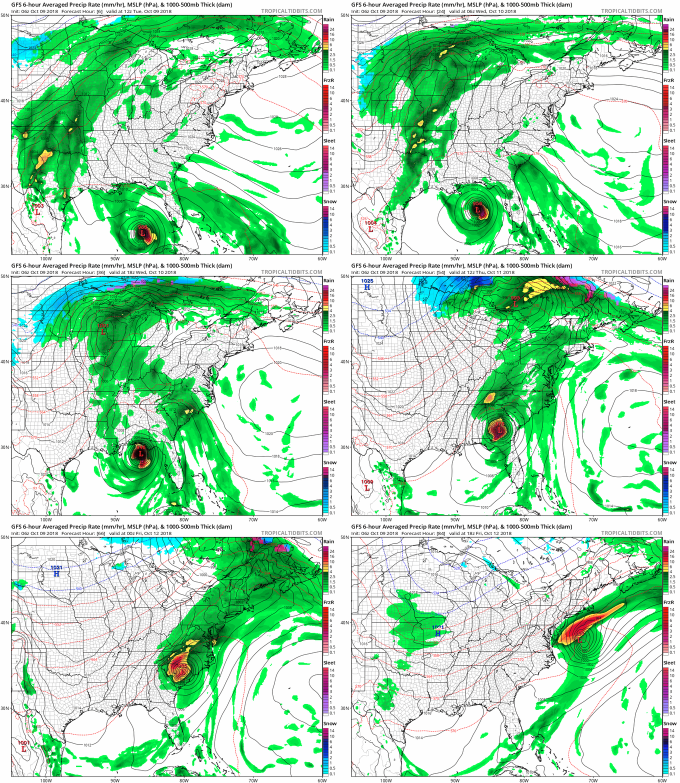
Rainfall Forecast Track
Snapshot Friday Morning
National Hurricane Center Forecast
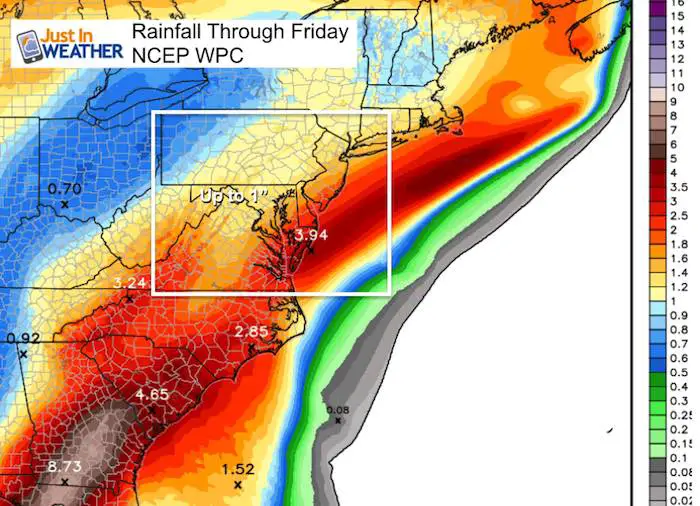
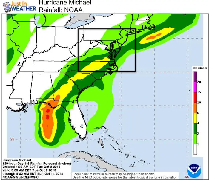
Rainfall Potential
The NOAA Outlook does include rainfall from the cold front for our region to get over 1″. However the impact from Michael should be focused from Ocean City and southward.
Our rain likelihood will increase Wednesday afternoon and evening, then last Ito Thursday. Most of the area will be clearing out Friday morning.
Temperature Outlook
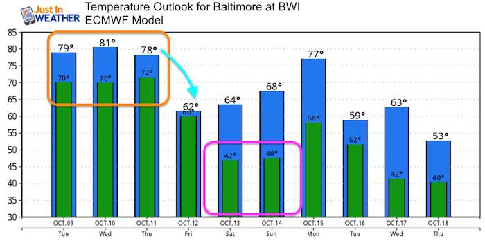
Notice the drop into the 60s Friday and lows over the weekend in the 40s.
Next Storm Update Around 11 AM
Keep In Touch Every Day
Click here to sign up for email alerts…. Just in case you don’t get the post on your social media feed
Please share your thoughts, best weather pics/video, or just keep in touch via social media
-
Facebook: Justin Berk, Meteorologist
-
Twitter: @JustinWeather
-
Instagram: justinweather
Love Maryland Shirt For Breast Cancer Research Foundation

 Get the award winning Kid Weather App I made with my oldest son and support our love for science, weather, and technology. Our 3 year anniversary of the release and our contribution to STEM education is this November. It has been downloaded in 60 countries, and works in both temperature scales. With your support we can expand on the fun introduction to science and real weather.

