Winter Storm Watch Monday Night Through Tuesday Night
February 8- A Winter Storm Watch has been posted for Monday night through Tuesday night Feb 8 to 9. This will begin late afternoon and evening with a light
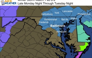
February 8- A Winter Storm Watch has been posted for Monday night through Tuesday night Feb 8 to 9. This will begin late afternoon and evening with a light

February 7 - This Super Bowl Sunday I have a super hard forecast. I know you don't want to read much and honestly I don't want to write much before
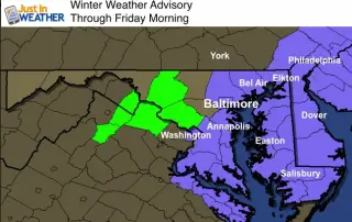
February 4- The front that was stalled is hanging back even longer. Below is an update radar simulation through 7 AM Friday. The only adjustment to my prior forecast is that
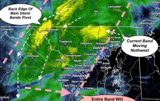
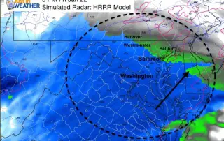
January 23 11:30 AM- We are in the time of the storm now where the surface Low will be nearly stalled. This could last 3 to 6 hours, as the

January 22- The Blizzard of 2016 is living up to all expectations. You know the expression 'a blanket of snow'? I thick this is more like a mattress and the

Janaury 23 2016- The Blizzard of 2016 is barely halfway over. In fact as of 7 AM, the 12.4" at BWI can easily double. So much more than a blanket
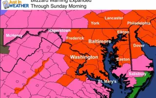
January 22 - The Blizzard Warning we have chatting about now covers a wider area. York and Lancaster along with southern Pennsylvania to Phildelphia are included. It's the National Weather

January 22- Now the the first flakes are moving in, I wanted to give another look at the storm formation before the full force of the blizzard warning kicks in.

January 22- At 1 PM, like many of you I have been watching the radar. A winter event will typically give false reading of the leading edge of snow since
January 22 2016- Today will begin a few days of The Blizzard of 2016. This will be our first storm of the kind since the twin blizzards of early February