Rain Timeline Friday Pushes Back Rocket Launch And Turns Much Cooler
May 6 2021 This active weather pattern is about to send us another push of chilly rain, which still may contain thunder. Temps have already stepped down, but even cooler
May 6 2021 This active weather pattern is about to send us another push of chilly rain, which still may contain thunder. Temps have already stepped down, but even cooler
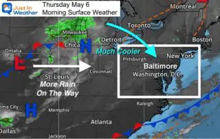
Thursday May 6 The weather pattern has flipped back to early spring conditions. Afternoon temperatures will be average 10 degrees below average and we may still see frost inland over
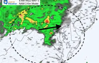
Wednesday May 5 2021 A new round of rain is already spreading in this morning. This is part of a cold front that will push this summer preview out of
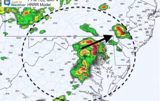
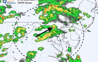
Tuesday May 4 2021 We are set up with the potential for another round of strong to severe storms this afternoon and evening. Below is a comparison of two computer
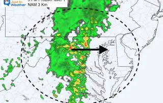
Monday May 3 2021 Update at 3 PM I am writing this update from the perspective of a parent with a kid that has a game this evening. After school
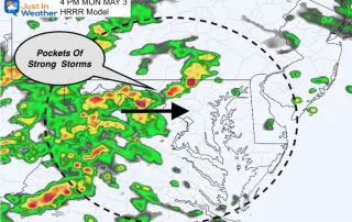
Monday May 3 2021 The timing of the weather worked out pretty well. After a nice weekend, the needed rain (it’s been pretty dry) is moving in this morning. It
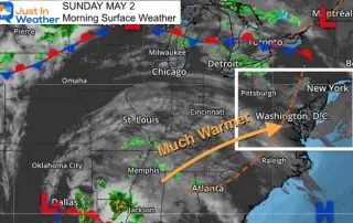
Sunday May 2 2021 Three years ago we started a three day record heat wave in our region. BWI recorded 90ºF + between May 2 and May 4 2018. We
Tuesday Evening April 27 2021 We have transitioned quickly through the seasons. Last week we had snow showers and today we were deep into the 80s. Baltimore officially reported 85ºF
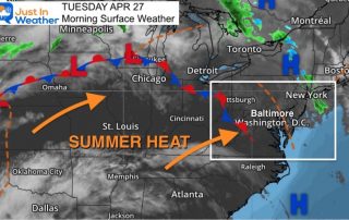
Tuesday April 27 2021 A complete phase change is taking place and you will surely notice it today. Last week we had snow showers. Now summer heat is building in
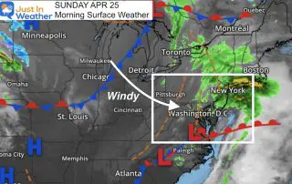
Sunday April 25 2021 This could have been one of the best outcomes for our weekend weather. The bulk of the rain fell overnight and ended this morning. Even if