Severe Thunderstorm Watch: Warnings North And New Rain Timeline
4 PM Tue June 28 - A Severe Thunderstorm Watch is in effect for much of southern Pennsylvania, central Maryland, and northern Delaware until 10 PM. This means storms have
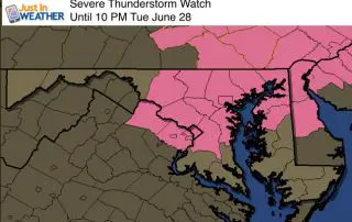
4 PM Tue June 28 - A Severe Thunderstorm Watch is in effect for much of southern Pennsylvania, central Maryland, and northern Delaware until 10 PM. This means storms have
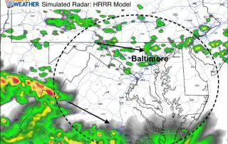
Tuesday June 28 - It is sticky! There is no avoiding the increased humidity today as dew points are in the 70s it is just muggy. The Rain overnight is
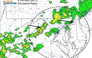
June 27 - After a nearly perfect weather weather by late June standards, we will get an increase of clouds today that will bring in showers and some thunderstorms. Not
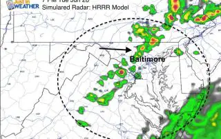
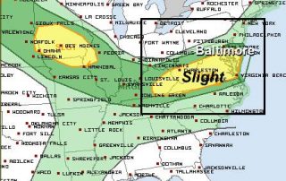
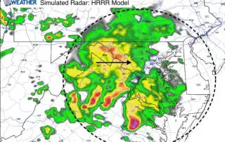
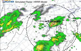
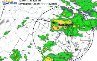
June 23 - I am writing this update to share the latest simulated radar as we are under a slight risk for severe storms, but this should not be too

Thursday June 23 - As expected, we wake up with a cluster of rain this morning. But this will be just a morning thing. While it will be some heavy
June 20 2016 - Summer starts today with the brightest day since 1948. The natural light we get today will be more rare than a professional sports championship in Cleveland.
Thursday June 16 1:30 PM - Watching a line of severe storms to our west move our way, it is easy to expect we will get in on it. Combine

Thursday June 16 - We start today with some fog and a very muggy environment thanks to rain overnight. There has been enough energy left over to produce lightning in
Wednesday June 15 9 PM - Did you notice the increase in humidity today? After the rain this morning that was more pronounced than expected for sum, a moist wind
Wednesday June 15 - If you had solid rain this morning, consider yourself in the primed zone. There has been a very narrow band of rain roughly 50 miles wide