June 24 Weather Less Humid Means Less Storms
June 24 2020 After a routine of daily storms, we are about to get a break in the action. West winds will bring a drop in humidity and dramatically cut
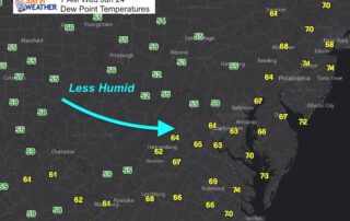
June 24 2020 After a routine of daily storms, we are about to get a break in the action. West winds will bring a drop in humidity and dramatically cut
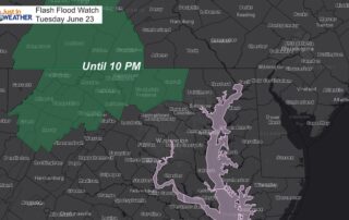
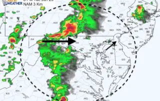
Tuesday June 23 2020 Here we go again. Anther afternoon and another round of developing showers and thunderstorms. This has been expected, but we have also had a pattern of
Tuesday June 23 2020 The eruption of storms yesterday brought some flooding and tree damage around Ellicott City and other parts of central Maryland. This continued the trend of storms
Monday June 22 2020 Over the past few days I have mentioned that the computer modeling was not doing a good job simulating the storms. This was because they were
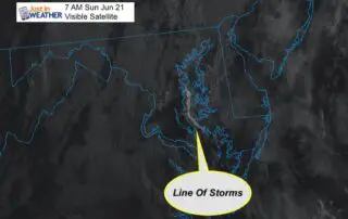
Sunday June 21 2020 Something really cool happened this morning! Today is the first full day of summer, and it already feels like it. Higher humidity after yesterday's storms has
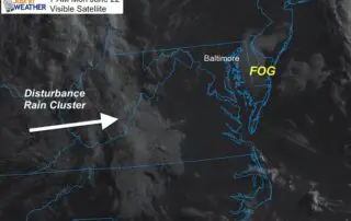
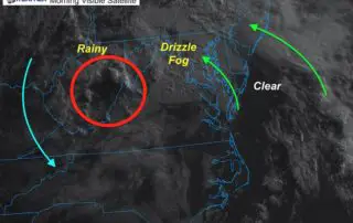
Saturday June 20 2020 If you had rain last night, then you might have had fog this morning. There is more moisture around and we are still under the influence
Friday June 19 2020 The winds have shifted. We still have the ghost of that upper level low affecting our area, but it is a shell of what it once
Thursday June 18 2020 That cut off Low has wondered north across the Virginia and West Virginia border. We are in the warmer and more humid flow from the Southeast
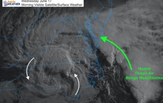
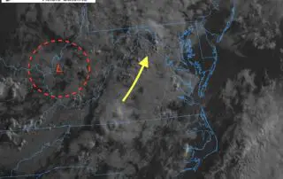
Wednesday June 17 2020 This morning's visible satellite shows the upper level cut off Low over North Carolina. This is responsible for bringing back the clouds and pumping in the

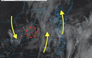
June 16 2020 The 'cut off' Low is the Carolinas is slowly creeping north. It has made for a spectacular satellite loop this morning, which highlights the circulation and easterly