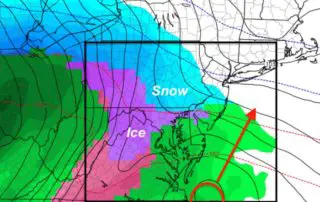
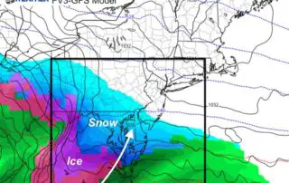
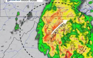
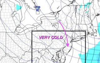
Friday Afternoon Update On Snow And Ice Early Next Week
Friday February 8 2019 As the sun came out today, that was the leading edge of a cold front. It may not seem like it with the sun that warmed

Friday February 8 2019 As the sun came out today, that was the leading edge of a cold front. It may not seem like it with the sun that warmed
Friday February 8 2019 There are showers and some fog to start this Friday, and this morning may be the warmest part of the day. A cold front will be
Thursday February 7 2019 We are still on the cool side of this frontal boundary, but it is trying to move back north. The result will bring some light scattered
Saturday November 24 2018 It is a soggy and chilly day, but most areas have thawed above freezing. There are some sheltered valleys that still have some ice, and the
Monday November 19 2018 Today will continue the mild trend and get us back to average. This may actually feel like a little spring break and compared to what is
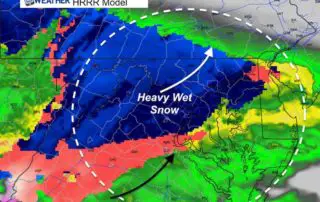
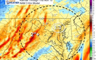
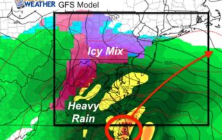
Thursday November 15 2018 The first storm of the season is knocking on our door just before sunrise. We have Winter Weather Advisories and Winter Storm Warnings in place. What
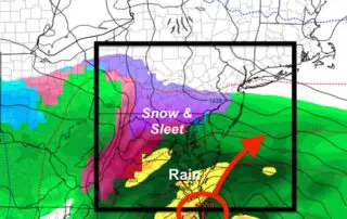
November 14 Evening Update We are going to get snow in the morning. At this point wintry weather is almost a certainty. The main questions relate to when and what will
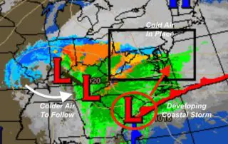
November 13 2018 There is a lot of attention on the next storm for the snow and sleet that we will get on Thursday. I wrote up my first call
Tuesday November 13 2018 The current storm is moving away, but there will be some rain showers left over this morning. Temperatures will reach their peak around noon, then cool
Monday November 12 2018 at 3PM Here we go again, and again. There really is no question that we are stuck in a pattern. If there was a question about