 Monday November 12 2018 at 3PM
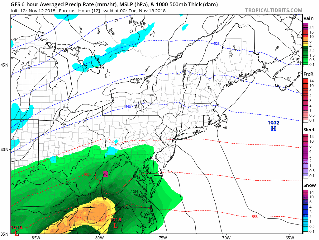
Here we go again, and again. There really is no question that we are stuck in a pattern. If there was a question about my Atmospheric Memory Theory, check out the Low Pressure location. This afternoon it is developing along the Gulf Coast and will track through the Panhandle of Florida tonight. Tomorrow morning it will be off of the southeast coast of Virginia and the next one on Thursday will be there too. Both following in a string of coastal systems in that same path since Hurricane Michael. Many of them qualify as a legit Nor’easter and there will be more.
That track keeps us on the cold side which will be important this winter. This Thursday, it may be cold enough to start as snow or a wintry mix.
| Tuesday Morning | Thursday Afternoon |
 |
 |
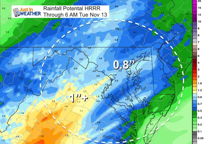
Before we get ahead of ourselves, it is early in the season and the time of day will play a role on any potential stickage. More on that below. First, check out the rain timeline and totals expected as we edge closer to the wettest year on record for Baltimore.
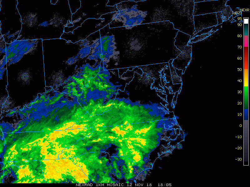
Doppler Radar Monday Afternoon
2 Hours up to 3 PM
Radar Simulation –> slider
[metaslider id=68193]
Rainfall Potential Through Tuesday Morning
Storm Animation
Notice the path of both systems following along the coast.
Thursday Snow Or Icy Mix
This is something that will be addressed in more detail after round one of rain. But keep in mind that while the first flakes are possible, the timing of the daylight hours will inhibit stickage on the roads. The pavement is still warm as well as many surrounding areas. If this races in earlier, that might change things.
The atmopshere should be cold enough to support many areas to see snow or sleet as this moves in during the morning. But also note that warmer air will follow so we should turn over to rain, even in the colder northern zones by nightfall.

Rainfall Potential This Week
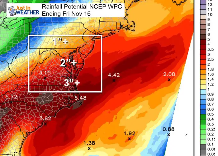
Rainfall 2018 Total: Rank 3rd Wettest Year
We have the potential to take the top spot this week. It will be close.

Winter Outlook
My Winter Outlook 2018-19: Multiple Nor’Easters and more snow

Related Winter Outlooks
Solar Cycle: When Sun Spots Are Low We Get More Snow
El Nino Modoki May Enhance Snow Chances
Sweet Spot: Hitting 70ºF on Halloween is followed by more winter snow
Will A Wet Summer Bring A Snowy Winter?
NOAA Winter 2018-2019 Outlook Explained: This Actually Supports Snow
Winter Outlook From Two Different Farmers Almanacs
FITF and SnowStix Stores are now OPEN

Snowstix- We Need You To Measure Snow Too
We are giving 10% of each sale to Just In Power Kids: Providing FREE holistic care for pediatric oncology patients.

Keep In Touch Every Day
Click here to sign up for email alerts…. Just in case you don’t get the post on your social media feed
Please share your thoughts, best weather pics/video, or just keep in touch via social media
-
Facebook: Justin Berk, Meteorologist
-
Twitter: @JustinWeather
-
Instagram: justinweather