August 7 Weather Flood Watch With More Storms And Heavy Rain Through Tonight
Friday August 7 2020 One more day in this pattern will keep us humid and bring in locally heavy rain. The storms will develop this afternoon mainly in the mountains
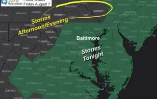
Friday August 7 2020 One more day in this pattern will keep us humid and bring in locally heavy rain. The storms will develop this afternoon mainly in the mountains
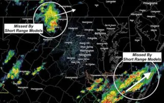
Thursday August 6 2020 The break from the rain is being filled back in by growing clouds and new area thunderstorms. Below is an updated radar simulation, but the models
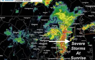
Thursday August 6 2020 Many people woke up early with lightning and thunder rolling through central Maryland. Many severe thunderstorm warnings were issued, which is rare in the morning. This

Wednesday August 5 2020 This quick evening weather update is for the changes on the way. We had a really nice break today after the tropical storm left the region,
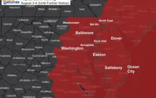
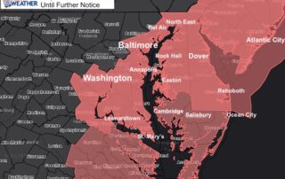
Monday August 3 2020 The Tropical Storm Warning has been expanded to include more of central Maryland. This now includes Carroll, Howard, and Montgomery Counties. The warning means tropical storm
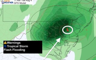
Monday August 3 2020 Tropical Storm Isaias has been holding at 70 mph overnight and will try one more time to reach hurricane intensity briefly today before making landfall. But
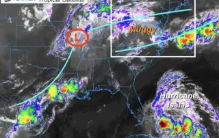
Sunday August 2 2020 Tropical Storm Isaias has tried to gain some strength today off of the coast of Florida. More importantly the track seems to have settled in to

Sunday August 2 2020 We've had a few storms early this morning represent a warm front. Without doubt it is very steamy today and heat index values will reach 100ºF.

Saturday August 1 2020 The storm known as Isais (ees-ah-EE-ahs) weakened to a tropical storm during the afternoon, but is expected to return to hurricane intensity tonight. It already looks healthier on the
Saturday August 1 2020 We just finished the hottest month on record in Baltimore with the coolest day of that month. No rest for the weary, as the humidity is