Severe Thunderstorm Watch Until 8 PM Sunday June 2
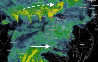
Sunday June 2 2019 A Severe Thunderstorm Watch has been issued for central Maryland west of the Bay, through the mountains, and much of northern Virginia. The is in place

Sunday June 2 2019 A Severe Thunderstorm Watch has been issued for central Maryland west of the Bay, through the mountains, and much of northern Virginia. The is in place
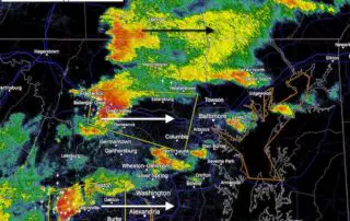
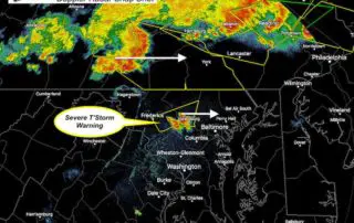
Thursday May 30 2019 Tornado Warning until 3:45 PM in Howard County between Columbia and Ellicott City. But its sals really bad north into Sykesville and Eldersburg. Look out
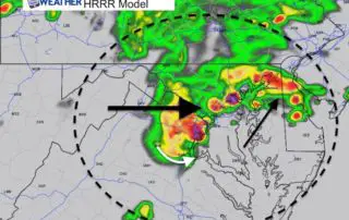
Thursday May 30 2019 As we spend another day with a risk of severe storms, we are waiting for the atmosphere to ignite with heat of the day to trigger
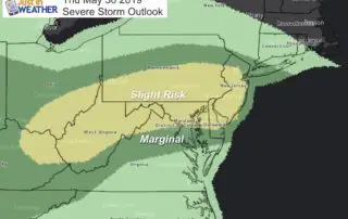
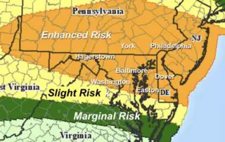
Thursday May 30 2019 Here we go again! The Storm Prediction Center has our region in the Slight Risk category for storms to turn severe today. This term may be
5 PM Wednesday May 29 A Tornado Watch was issued earlier for much of Pennsylvania, Cecil County MD, and northern Delaware. The important issue here is that a recent Severe
May 29 2019 Today will bring us high heat into the mid 90s and a trigger in the atmosphere to use that fuel for storms to form. The Storm Prediction
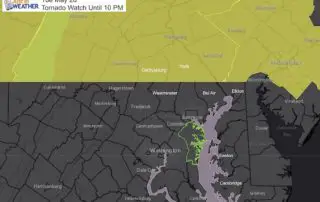
Tuesday Afternoon May 28 2019 A Tornado Watch has been issued for much of Pennsylvania until 10 PM. This includes Adams, York, and Lancaster Counties boarding Maryland. But south of
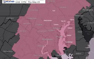
2 PM Thursday May 23 2019 A Severe Thunderstorm Watch has been issued for much of our region until 8 PM. This includes most of southern Pennsylvania, central Maryland between
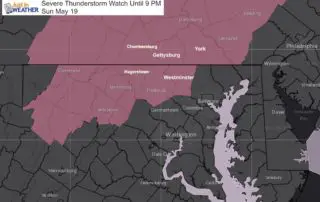
4 PM Sunday May 19 2019 We definitely got the heat this afternoon and we have a few boundaries to watch for where storms may develop and travel. Here is
Sunday May 5 2019 Bands of heavy rain already have set up this morning across northern Maryland and southern Pennsylvania. This is part of the larger storm system that will