September 1 New Month But More Flooding Possible Through Labor Day
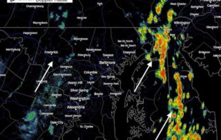
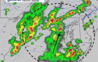
September 1 2018 I really hope you were able to see my morning report Friday and it helped. The expectation for slow moving storms proved itself and the High Resolution
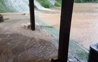
September 1 2018 I really hope you were able to see my morning report Friday and it helped. The expectation for slow moving storms proved itself and the High Resolution
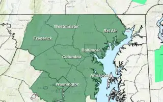
August 31 2018 A Flash Flood Watch is in effect through midnight for central and northern Maryland. The conditions that enhance storms in our area are present today. A stalled
August 31 2018 Labor Day Weekend is now here and temperatures are still warm and muggy this morning. The difference is that we have already had some rain and storms
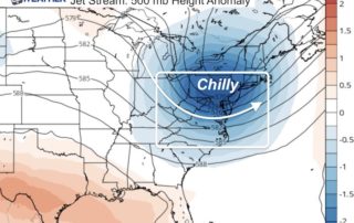
Thursday August 30 2018 Here we go again! The morning starts off with most areas showing temperatures in the mid 70s to lower 80s. Today marks the date of the
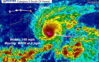
Wednesday August 22 2018 The headline weather story today is extreme super Hurricane Lane on the move towards Hawaii. This Category 5 storm has winds measured at 160 mph with
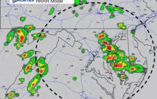
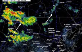
Tuesday August 21 2018 This is a quick look at the storms on the way today. The radar at 9 AM this morning appeared more impressive with development in northern
Monday August 20 2018 Clouds and cooler temperatures today. There is plenty of moisture around that may bring showers in central Maryland, drizzle again to the north, and sadly a
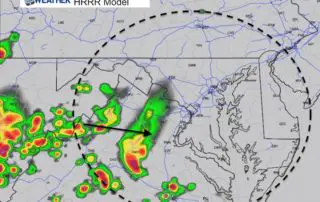
August 3 2018 While we are under a Flash Flood Watch and a have a marginal risk for storms to turn severe today, the best thing we can do is
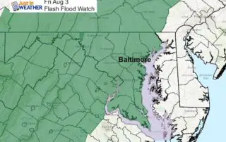
August 3 2018 Another Flash Flood Watch has been issued for today though tonight. Any additional rain can lead to flooding as we have soggy soil and swollen waterways. The
Thursday August 2 2018 Here we go again. The atmosphere is getting charged up to dump more rain, and some of that will be heavy. The Flash Flood Watch is