Monday August 20 2018
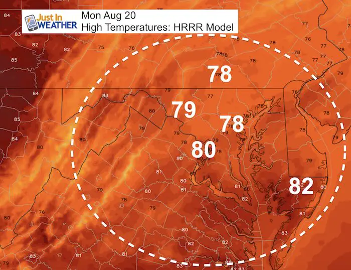
Clouds and cooler temperatures today. There is plenty of moisture around that may bring showers in central Maryland, drizzle again to the north, and sadly a few storms around the beaches. I picked a good day to return back to posting weather as a big adjustment is on the way after two weeks of sticky humidity. The change this week will bring in very cool air by Thursday morning and perhaps set the mood for summer winding down. September 1 is the start of meteorological autumn but we are not done yet. So hang on as the first few pushed of cooler air are likely to be short lived.
Stats For August 20 in Baltimore
Average High: 85ºF
Record High: 105ºF in 1983 *Hottest for the month
Average Low: 65ºF
Record Low: 49ºF in 1998
Sunrise: 6:23 AM
Sunset 7:54 PM
*Daylight = 2:20 shorter than yesterday
*Bay Water Temperature = 81ºF at Thomas Pt. Light House
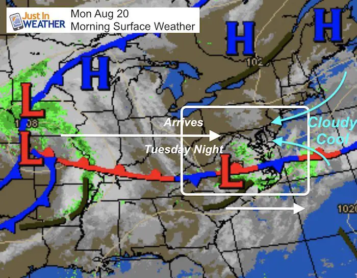
Morning Set Up
A band of showers was trying to move through central Virginia. It has been breaking up on the north end, but we can watch this for some showers this morning across central and southern Maryland. Otherwise, there may be some drizzle in the northern hills like Sunday.
RADAR: 2 Hour Loop 4:35 to 6:35 AM

Morning Weather Map
This shows cool northeast winds keeping the clouds around today and most of the area will have temperatures stay in the 70s. The next weather feature will be arriving Tuesday night with stronger storms and finally kick the humidity out of here.
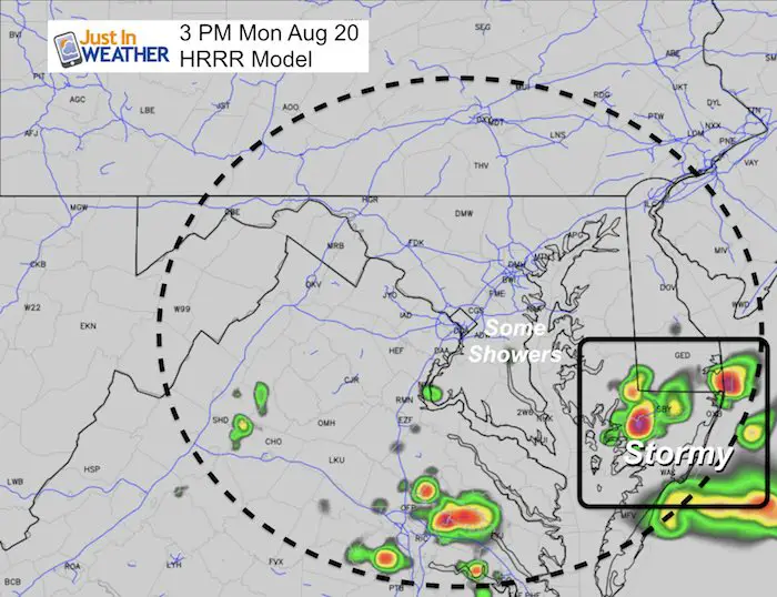
This Afternoon
The HRRR Model highlights a stormy afternoon across the beaches. This may repeat through Wednesday. Inland, some showers not shoeing up that well are likely across the mid portion of the Bay, while drizzle might linger in the northern hills.
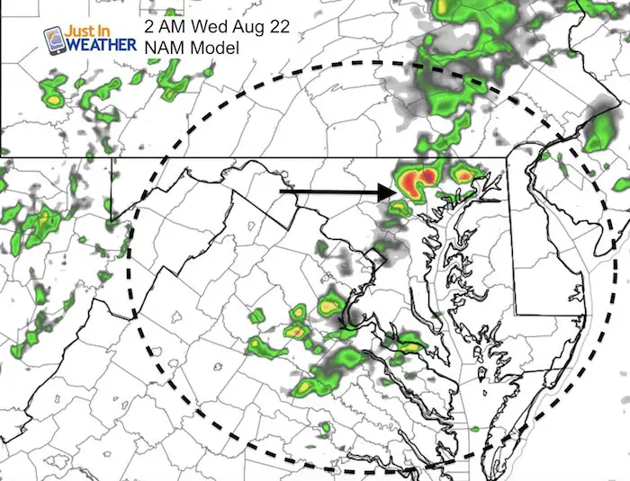
Tuesday: More Showers
Showers are possible any time during the day. The system to our west will bring in a line of storms during the evening in the Maryland mountains. This will cross metro areas after midnight.
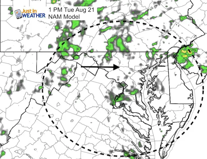
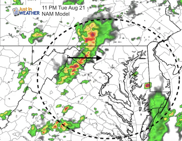
Best chance for storms in metro areas will be after midnight.
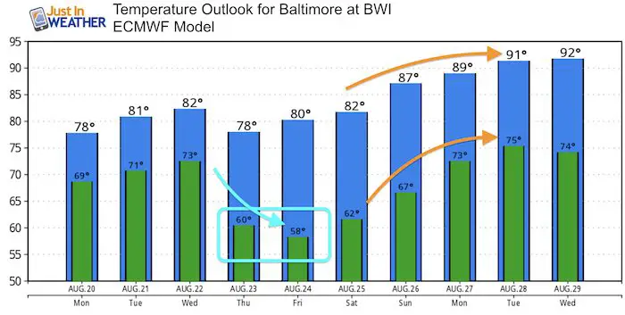
Weather Outlook
*Cooler air in blue and warmer air in orange.
Snapshot
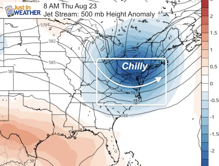
Animation: Thursday morning represents the coolest air aloft, but that will translate to the coolest air on the surface for us Friday morning. Warmer air wil build over the weekend and into early next week. That is when we should get back to the 90s.
Temperature Trend:
The push of chilly air will be Wednesday. You will notice the chilly mornings Thursday and Friday, when many inland areas will drop into the 50s. Western Maryland will be in the 40s.
Return of summer heat builds back by the end of the weekend and early next week when the 90s will return.
Power Partner Just In Power Kids and Maryland Trek 5:

Please share your thoughts, best weather pics/video, or just keep in touch via social media
-
Facebook: Justin Berk, Meteorologist
-
Twitter: @JustinWeather
-
Instagram: justinweather
Keep In Touch Every Day
Click here to sign up for email alerts…. Just in case you don’t get the post on your social media feed
 Get the award winning Kid Weather App I made with my oldest son and support our love for science, weather, and technology. Our 3 year anniversary of the release and our contribution to STEM education is this November. It has been downloaded in 60 countries, and works in both temperature scales. With your support we can expand on the fun introduction to science and real weather.
Still Time To Support Just In Power Kids
We are still taking donations for our best Maryland Trek yet. Every penny goes to Just In Power Kids programs to provide FREE holistic care for kids in cancer treatment and up to 5 years post treatment.
![]()