September 1 2018
I really hope you were able to see my morning report Friday and it helped. The expectation for slow moving storms proved itself and the High Resolution Rapid Refresh Model did a decent job depicting the hardest hit areas in northeastern Maryland and Southern PA. There is a frontal boundary still draped across our area and it should ignite more showers this morning in northeastern Maryland, then shift the focus to the mountains this afternoon and evening. We are stuck with this through Labor Day. But pinning down who is most prone will depend on where this quasi-stationary boundary sets up.
Today marks the start of a new month and new season. September 1 is the beginning of Meteorological Autumn. But, it looks like we are stuck with the same pattern.
Recap Of Flooding Friday August 31
The hardest hit areas were in Harford County Maryland and York/Lancaster Counties in PA. Doppler estimates over 4 inches of rain, with up to 6 inches in some spots.


If you did not see this on Facebook, please go to my page wall and adjust the settings to see updates. Apparently it defaults back every few weeks and my wife keeps going in to adjust it again.
-
Facebook: Justin Berk, Meteorologist
Local Weather Stats For September 1 in Baltimore
Average High: 83ºF
Record High: 99ºF in 1962
Average Low: 63ºF
Record Low: 53ºF in 1963
Sunrise: 6:34 AM
Sunset 7:37 PM
*Daylight = 2:28 shorter than yesterday
*Bay Water Temperature = 82ºF at Thomas Pt. Light House
Also see: Winter Outlook From Two Different Farmers Almanacs
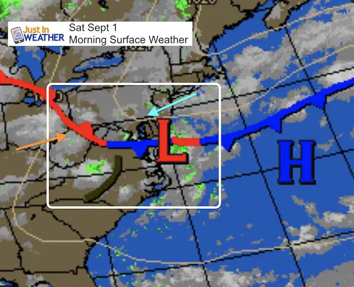
Morning Snapshot
On the north side of this boundary, winds will be cool and moist from the northeast. The other end of the energy field will be in the Virginia mountains where warm and humid air will build up storms later today.
Closer in…
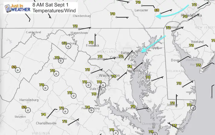
The northeast winds may not show the cool flow this morning, but it will limit our temperatures this afternoon. The surface wind direction is what will feed in moisture, but also slow down the storms that try to move in from the other direction… The west. This is due to upper level winds moving the clouds.
Radar Simulation —> slider
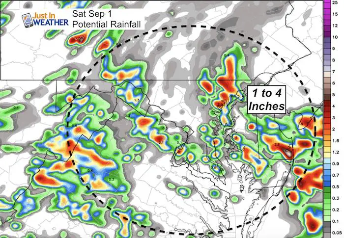
Showers will try to erupt this morning with leftover energy aloft… near and just northeast of Baltimore. The afternoon storm complex in the Virginia Mountains is likely to produce a few severe storm cells.
[metaslider id=65107]
Rainfall Potential
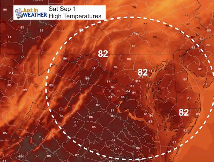
High Temperatures
Rain Animation
More Showers… Same old thing through Labor Day.

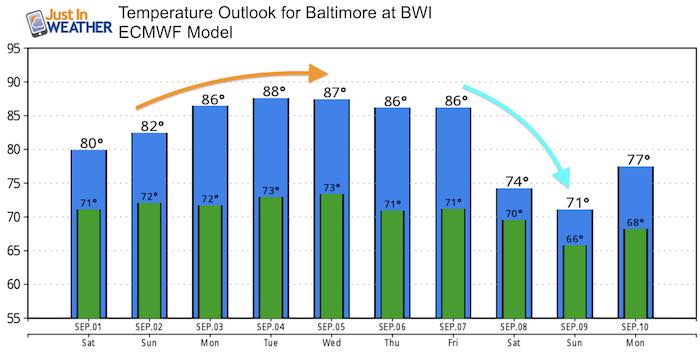
Temperature Outlook
Another warm up next week is looking ‘less hot’. But it will stile sticky. The relief will come next weekend with another storm but shifting the jet stream to allow some autumn like air to filter in to our region.
Power Partner Just In Power Kids and Maryland Trek 5:

Please share your thoughts, best weather pics/video, or just keep in touch via social media
-
Facebook: Justin Berk, Meteorologist
-
Twitter: @JustinWeather
-
Instagram: justinweather
Keep In Touch Every Day
Click here to sign up for email alerts…. Just in case you don’t get the post on your social media feed
Still Time To Support Just In Power Kids
We are still taking donations for our best Maryland Trek yet. Every penny goes to Just In Power Kids programs to provide FREE holistic care for kids in cancer treatment and up to 5 years post treatment.
![]()