December 10 Weather Warm Start With Rain Then Snow Tonight
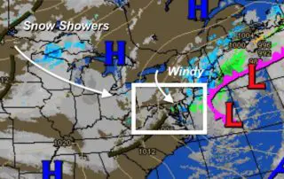
Tuesday December 10 2019 Temperatures will be reversed today. We start mild and warm to the upper 50s and near 60ºF by noon, then the colder air spills in with
Tuesday December 10 2019 Temperatures will be reversed today. We start mild and warm to the upper 50s and near 60ºF by noon, then the colder air spills in with
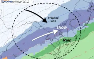
Monday December 9 2019 Today's rain is moving out this tonight, but the storm has a few more parts to it. Tuesday will bring mid 50s to nearly 60ºF to
Monday December 9 2019 One batch of rain has already moved through and is passing east, while some freezing rain has passed to our west. In between you might have
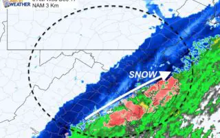
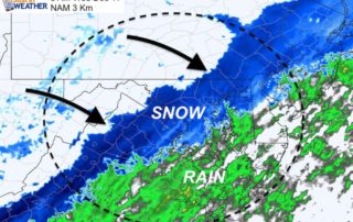
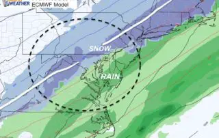
Sunday December 8 2019 It is going to snow this week. FIFT! There is high confidence now that following heavy rain Monday and Tuesday, colder air will move in and
Saturday December 7 2019 This morning temperatures were very cold, but we are turning the corner this weekend. The weather will be quiet and afternoon temperatures will get back to
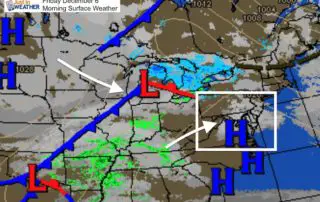
Friday December 6 2019 A chilly start to the day, but mild temps will be streaming ahead of the next cold front. Some rain showers will develop this afternoon and
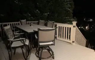
Wednesday December 4 2019 Well, the snow did just about what was expected this morning. That system came in after midnight a little robust, and there is a fresh coating
Tuesday December 3 2019 There is a disturbance in the force. This one is a short wave or 'vort max' in the jet stream heading our way after midnight. It
Tuesday December 3 2019 The storm is moving off of the coast, but we have a widespread colder flow of air for a few days. Within this will be a
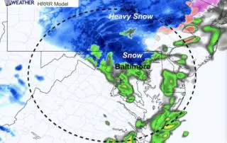
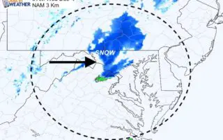
UPDATE MONDAY MORNING Good morning. The short range modeling lost support for the snow burst, but the radar is looking close to what the simulation showed last night (see below).