November 30 Weather Rain Timeline Today Snow Showers Tomorrow
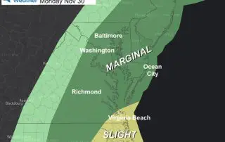
November 30 2020 As I write this report, the heavy rain is moving through our region. The rain will fade to showers later this morning, then a chance for thunderstorms
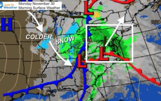
November 30 2020 As I write this report, the heavy rain is moving through our region. The rain will fade to showers later this morning, then a chance for thunderstorms
Sunday November 29 2020 Now we have some shape to the evolving pattern. Here is the Gulf Storm, the first of many (I expect this winter). This one will have
Saturday November 28 2020 I was all set to start applying the new winter pattern and snow to real events next week, plus the chance for flakes to reach central
Tuesday November 24 2020 Temperatures are near normal today, which means it will be cool. But we are still in for rapid changes in a developing busy weather patterns. The
Monday November 23 2020 Rain fell overnight, but most of it is already done. So if you get out early, the ground might be wet. But wait a little longer
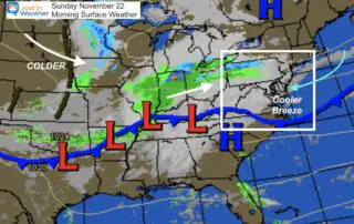
Sunday November 22 The clouds have dominated our weekend, but now we have the wind from the east. That is a cooler direction with more dampness. The rain will hold
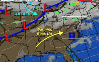
Friday November 20 2020 We are already moving the needle upwards. The coldest of the last air mass brought us the coldest day since last March. Now we warm up
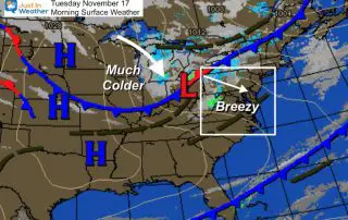
Tuesday November 17 2020 We are in the middle of the step down of air masses with one more cold front to move through today. This will increase the winds,
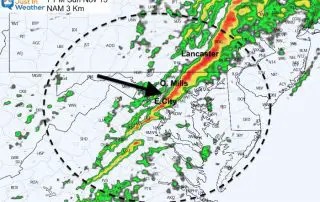
Sunday November 15 2020 The winds have been increasing today and will continue to grow stronger through the evening. There have been numerous warnings with the cold front as it
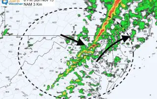
Sunday November 15 2020 A strong cold front is on the way later today and what follows will be a reality check. Winds later today could take down some trees