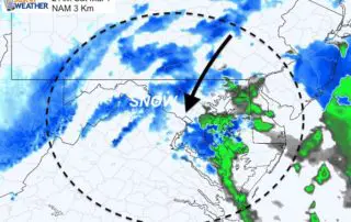
Tracking Potential Storm Rumbling With Heavy Rain Early Friday Morning
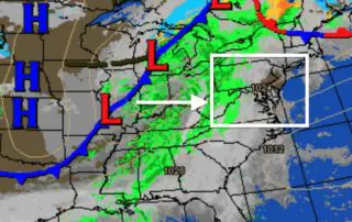
Thursday Evening March 12 2020 This is a quick update on the storm charing our way this evening. It appears on schedule with my prior report. This cluster is across
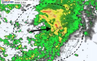
Thursday Evening March 12 2020 This is a quick update on the storm charing our way this evening. It appears on schedule with my prior report. This cluster is across
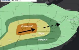
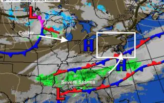
Thursday March 12 2020 The clouds are still around and we will have some showers develop this afternoon. But the main story may be watching the severe storm potential this
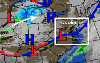
Wednesday March 11 2020 The rain overnight has passed and the sky has cleared. We are on the cooler side now, but a true testament to this pattern is that
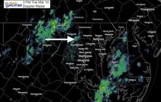
Tuesday March 10 2020 We are in a spring pattern now. That may be obvious, but important when reviewing computer model guidance when active weather is moving through our region.
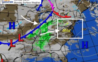
Tuesday March 10 2020 A high of 75ºF was reached yesterday in Baltimore at BW. This morning we are still mild in the 50s and the afternoon will reach the
Friday March 6 2020 A storm is developing and trying to phase. That is when two pieces join forces for a larger and stronger system. We will be on the
Thursday March 5 2020 The nation is still coming to grips with the tornado outbreak in middle Tennessee and Nashville. NWS released this statement about 'one' of the tornadoes that
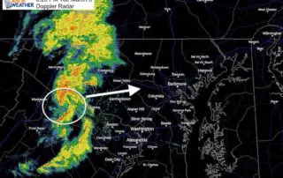
Tuesday March 3 2020 Updated at 6:30 PM A strong cold front is holding energy past sunset to produce some circulating storm cells as they enter our area. The forward
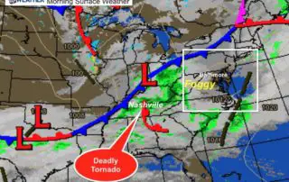
Tuesday March 3 2020 A tornado hit Nashville, TN overnight, killing at least 5 people. Local schools are closed as they wait for daylight to explore the full extent of
Monday March 2 2020 Mild air is moving in this morning, but a cold pocket is hanging over parts of the area. The rain this morning has been confined to