June 26 Weather Some Showers Today The Hot With Severe Storm Risk Saturday
Friday June 26 2020 Today we will feel a drop in the humidity, but the atmosphere just wants to keep trying. There is a small chance for a few afternoon
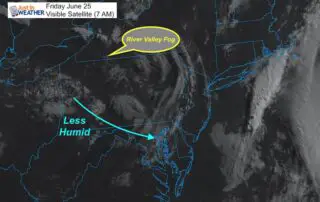
Friday June 26 2020 Today we will feel a drop in the humidity, but the atmosphere just wants to keep trying. There is a small chance for a few afternoon

Thursday June 25 2020 My wife went on her walk last evening and captured this photo of the colorful sky at sunset. She said it was more vivid in person!
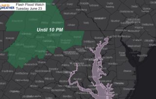
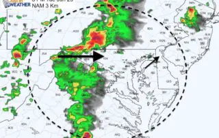
Tuesday June 23 2020 Here we go again. Anther afternoon and another round of developing showers and thunderstorms. This has been expected, but we have also had a pattern of
Tuesday June 23 2020 The eruption of storms yesterday brought some flooding and tree damage around Ellicott City and other parts of central Maryland. This continued the trend of storms
Monday June 22 2020 Over the past few days I have mentioned that the computer modeling was not doing a good job simulating the storms. This was because they were
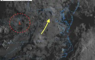
Friday June 19 2020 The winds have shifted. We still have the ghost of that upper level low affecting our area, but it is a shell of what it once
Thursday June 18 2020 That cut off Low has wondered north across the Virginia and West Virginia border. We are in the warmer and more humid flow from the Southeast
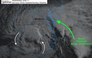
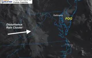
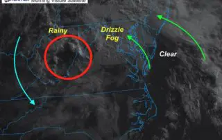
Wednesday June 17 2020 This morning's visible satellite shows the upper level cut off Low over North Carolina. This is responsible for bringing back the clouds and pumping in the

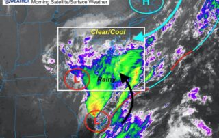
June 16 2020 The 'cut off' Low is the Carolinas is slowly creeping north. It has made for a spectacular satellite loop this morning, which highlights the circulation and easterly
June 15 2020 We are threading the needle this morning with a very delicate balance of clear cool air to the north and persistent rain to the south. This is