Rain Moving South Today And Staying Cool: Warm Up Shows No Heat In Sight
Monday June 11 2018 A cold front is already moving into southern Maryland. The rain is lagging behind, but will also push south today. It is mid June and temps
Monday June 11 2018 A cold front is already moving into southern Maryland. The rain is lagging behind, but will also push south today. It is mid June and temps

Sunday June 10 2018 The morning sky is filled with clouds and the air is heavy with humidity. But the source of energy for the next round of rain is
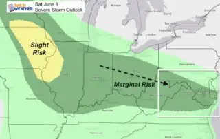
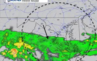
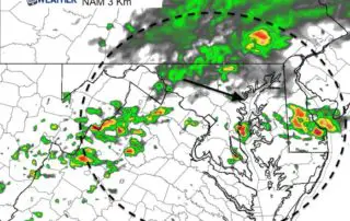
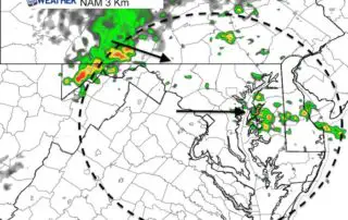
Saturday June 9 2018 The energy for today's weather is located in the southern Great Lakes and the upper level flow is pointing in our direction. Storms will be developing
Friday June 8 2018 We finally get back into summer like weather with temperatures building back into the 80s today and a little more humidity. That brings in the risk
Thursday June 7 2018 There will be some clouds today, but the wind will shift and temperatures will be warmer. Basically another pleasant weather day, but the pattern will not
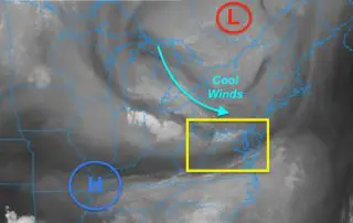
June 6 2018 The weather map really looks like late winter. A strong upper level Low in eastern Canada was responsible for yesterday's cold front and now sending cool weather

Tuesday June 5 2018 The satellite view looks like a winter patter today. Cold air aloft is circulating around the eastern Great Lakes and heading our way. A rogue thundershower

June 5 2018 Temperatures this morning started off quite chilly, but it is June so the high sun angle will help to boost those in a hurry. However, there is

June 4 2018 The heavy rain over the weekend still has some roads closed and high water that will slowly drain out. This photo of River Road in Sykesville from
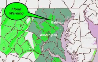
4 PM Sunday June 3 2018 The heavy rain with our coastal Low Pressure has produced up to 1.5 inches of rain in the past hour in central Maryland's Baltimore,