 June 4 2018
The heavy rain over the weekend still has some roads closed and high water that will slowly drain out. This photo of River Road in Sykesville from Kevin Casey shows the destructive power of our repeating wet weather and running water. This is one of multiple flooded roads, but this area did see over 4 inches of rain this weekend. Here is the Doppler Radar estimate of rainfall showing the hardest hit areas. 
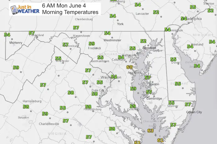
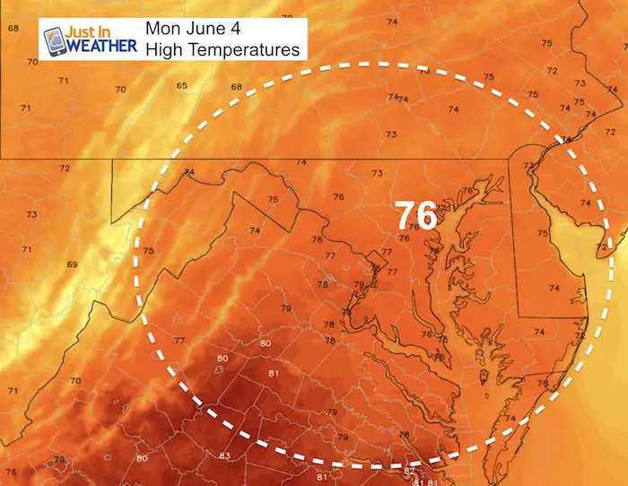
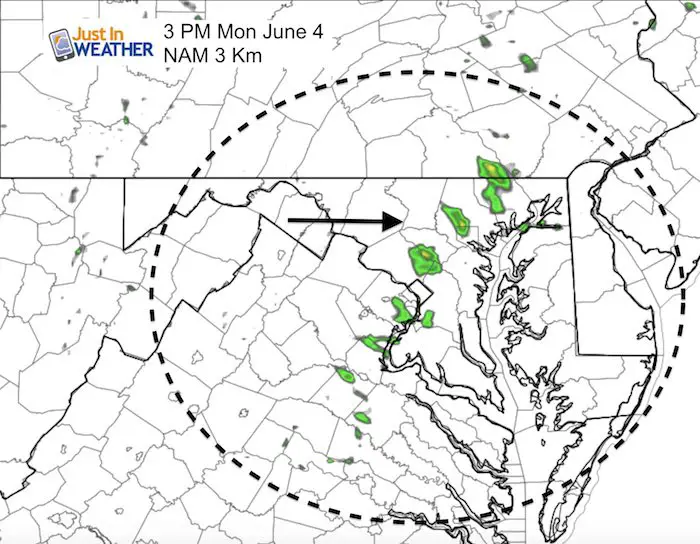
This morning may seem chilly in the 50s. Today will be a nice day with a mix of clouds and sun. Only a small chance of a shower after 2 or 3 PM. Tuesday brings in another cold front and more showers/storms. Then cooler temps may result in highs only in the 60s on Wednesday. I wish that was it for highlights, but our pattern may repeat next week. Sadly there is potential for yet another storm on the coast resulting in another wet weekend.
Stats For June 4 in Baltimore
Average High: 80ºF
Record High: 96ºF in 1930
Average Low: 58ºF
Record Low: 46ºF in 1964
Sunrise: 5:40 AM
Sunset 8:29 PM
*Daylight = 0:58 longer than yesterday
*Bay Water Temperature = 70ºF at Thomas Pt. Light House
Keep In Touch Every Day
Click here to sign up for email alerts…. Just in case you don’t get the post on your social media feed
Ellicott City Flood Reports:
Raw video, radar, and rain totals
Video of damage from the air, history, and area development concerns
This Morning
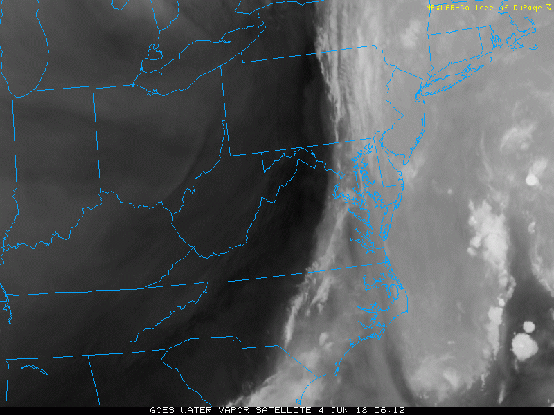
Water Vapor Satellite Loop
The best news I can show is the clearing out of this storm… Watch the primary cloud line roll east.
This Afternoon
Slight Chance Of A Shower
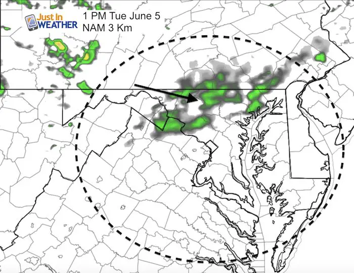
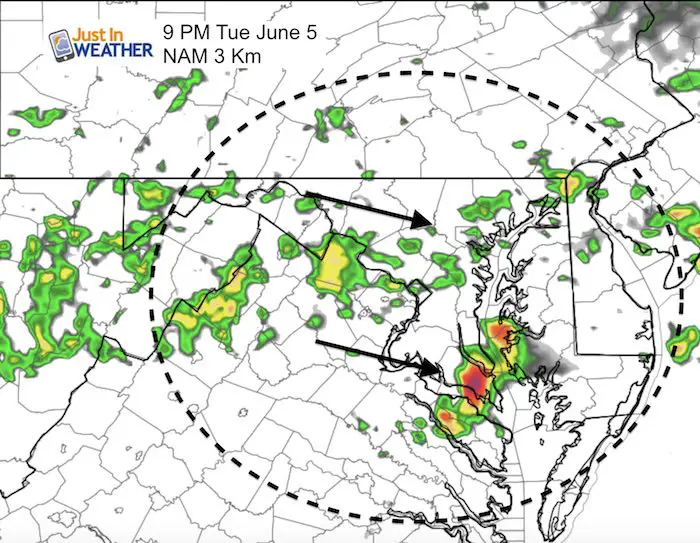
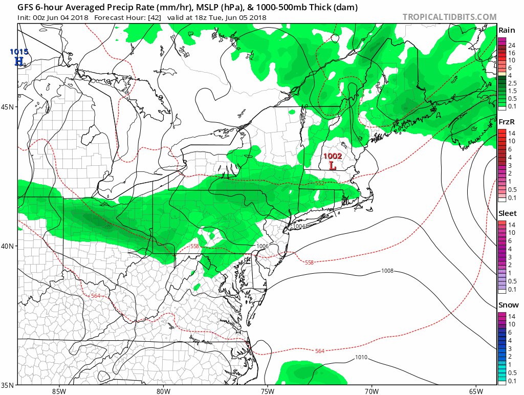
Tuesday Showers Possible
 Get the award winning Kid Weather App I made with my oldest son and support our love for science, weather, and technology. Our 3 year anniversary of the release and our contribution to STEM education is this November. It has been downloaded in 60 countries, and works in both temperature scales. With your support we can expand on the fun introduction to science and real weather.
Looking Ahead…
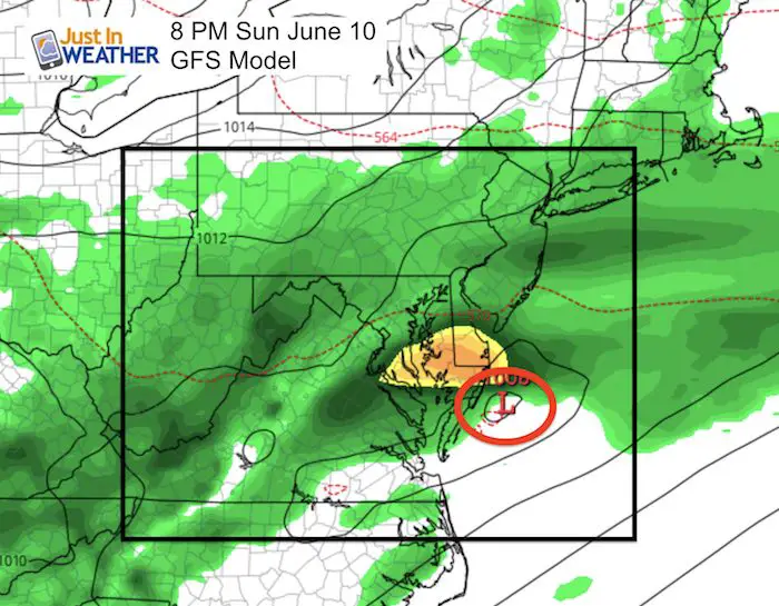
Repeat Weekend?
If you are familiar with my atmospheric memory theory, this GFS outlook map for next Sunday looks a lot like what we just saw. Low Pressure located in the Mid Atlantic is one thing, but another wet weekend is definitely NOT what anyone wants to see around here.
Storm Animation- Wednesday Through Sunday
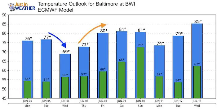
Temperature Outlook
![]()
Shine On
Proceeds from all sales go to Just In Power Kids. Click the image to shop and show your support.

Please share your thoughts, best weather pics/video, or just keep in touch via social media
-
Facebook: Justin Berk, Meteorologist
-
Twitter: @JustinWeather
-
Instagram: justinweather
Keep In Touch Every Day
Click here to sign up for email alerts…. Just in case you don’t get the post on your social media feed