Friday June 8 2018
We finally get back into summer like weather with temperatures building back into the 80s today and a little more humidity. That brings in the risk of afternoon showers and thunderstorms. They will not be widespread today, but will increase over the weekend. It is important to not that this is NOT a going to be a total washout, but rain in is the forecast and more likely at some times vs. others. I have the radar simulations below to try and help you plan for your events.
Stats For June 8 in Baltimore
Note: June 5th was the earliest date on record that Baltimore has broken 100 degrees, back in 1925
Average High: 81ºF
Record High: 99ºF in 2011
Average Low: 60ºF
Record Low: 43ºF in 1977
Sunrise: 5:39 AM
Sunset 8:31 PM
*Daylight = 0:45 longer than yesterday
*Bay Water Temperature = 69ºF at Thomas Pt. Light House
Keep In Touch Every Day
Click here to sign up for email alerts…. Just in case you don’t get the post on your social media feed
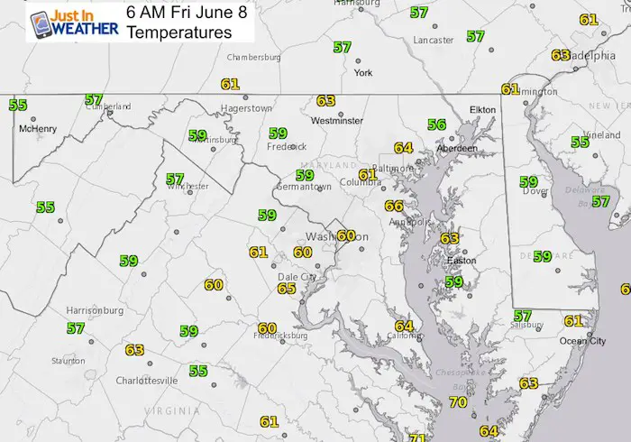
Morning Temperatures
Radar Simulation—> Afternoon Showers Slider
[metaslider id=63030]
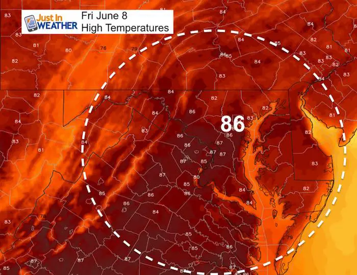
Afternoon High Temperatures
Weekend Outlook
The best way to look at this: More rain will fall on Sunday. But there will be scattered showers and storms all weekend. The norther half of the area will be under the influence near Rt 50 and northward. Here’s a guide to how that might turn out.
Radar Simulation—> Saturday Slider
[metaslider id=63043]
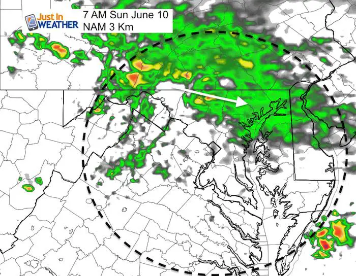
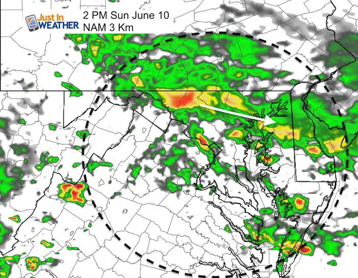
Sunday Rain
This continues to look like a raining morning between Baltimore and York Pa… essentially the north half of our area. This line will enhance some storms into the afternoon and spread south.
Looking Ahead:
Next week our pattern should quiet down, but the long range modeling continues to show a potential tropical system forming in the Gulf of Mexico and making landfall on the Gulf coast. This animation shows how familiar that looks as it send moisture into another systems that pumps rain back into our area next weekend…
Of course this is a week away, but there has been consistency with this projection, so I thought I would share. It is worth watching.
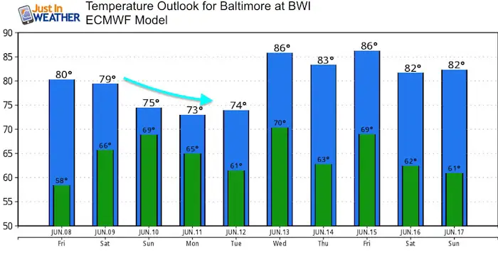
Temperature Outlook
This model is a little cooler for today than likely, but it shows the cool down this weekend into early next week. Then we warm back up ahead of the next wave of potential rain next weekend.
![]()
Shine On
Proceeds from all sales go to Just In Power Kids. Click the image to shop and show your support.

Please share your thoughts, best weather pics/video, or just keep in touch via social media
-
Facebook: Justin Berk, Meteorologist
-
Twitter: @JustinWeather
-
Instagram: justinweather
Keep In Touch Every Day
Click here to sign up for email alerts…. Just in case you don’t get the post on your social media feed
 Get the award winning Kid Weather App I made with my oldest son and support our love for science, weather, and technology. Our 3 year anniversary of the release and our contribution to STEM education is this November. It has been downloaded in 60 countries, and works in both temperature scales. With your support we can expand on the fun introduction to science and real weather.