Major Hurricane Laura Has Winds Of 115 mph Forecast To Hit As Cat 4
Tuesday August 26 2020 Hurricane Laura has taken full advantage of the conditions in the Gulf of Mexico to flare up overnight. Winds are now 115 mph, making this a
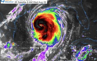
Tuesday August 26 2020 Hurricane Laura has taken full advantage of the conditions in the Gulf of Mexico to flare up overnight. Winds are now 115 mph, making this a
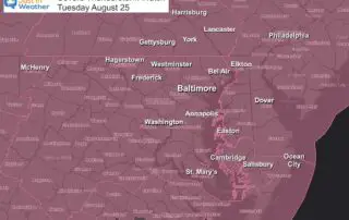
Tuesday August 25 2020 A cold front will ignite a line of storms this evening. It has been developing in central PA this afternoon and will drop south into Maryland
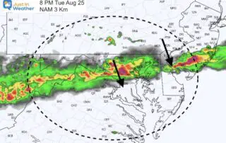
Tuesday August 25 2020 A cold front will bump into the hot and humid air we have in place today and this evening. A line of strong and severe thunderstorms

Tuesday August 25 2020 There is progress in the tropics a little faster than expected. Air Force Reconnaissance has found 75 mph winds, upgrading Laura to a hurricane. This is
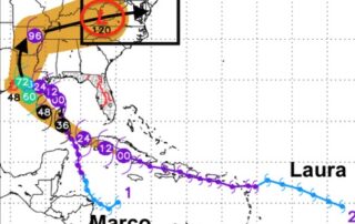
Monday August 24 2020 The short version of this tropical look is that Marco is getting weaker and Larua is getting stronger. The second hit will pack the bigger punch.

Sunday August 23 2020 Hurricane Marco has 75 mph winds and is expected to make landfall on Monday. Laura is a Tropical Storm with winds of 60 mph, but is

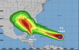
Saturday August 22 2020 It almost seems as if nothing in 2020 would be a surprise. Now we have two tropical storms that may possibly become hurricanes an forecast to
Saturday August 22 2020 There is a lot to cover in this morning report and I wanted to simplify it for you. We have had local rain and the short
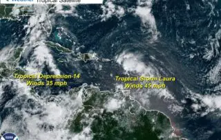
Friday August 21 2020 The 11 AM Advisory from the National Hurricane Center has official named Tropical Storm Laura (formerly Tropical Depression 13). The winds were 45 mph and it
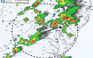
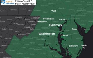
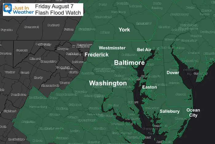
Friday August 7 2020 The Flash Flood Watch has been expanded into southern Pennsylvania. I mentioned in my morning report that this should happen as the front and development of