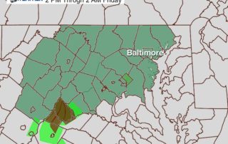
Flash Flood Watch This Afternoon: Rain Timeline May 31
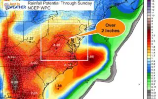
May 31 2018 We start the morning with more widespread fog which is just a sign of the moisture in the air. The remains of Subtropical Depression Alberto have pushed
May 31 2018 We start the morning with more widespread fog which is just a sign of the moisture in the air. The remains of Subtropical Depression Alberto have pushed
Tuesday May 29 2018 More rain is on the way this week. This morning the visibility is the main issue. Fog and some mist will be a dominant part of
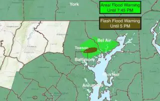
May 27 2018 Heavy rain has already erupted early this afternoon and prompted Flash Flooding in Baltimore and Hartford Counties. Doppler Radar is showing heavy rain moving over the same

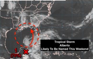
Sunday May 27 2018 We start today with a tropical feel to the air. This is the part of Memorial Day Weekend we talked about all week as having the
Friday May 25 2018 H is good, L is bad. That is the simple approach to weather a friend of mine had years ago. Well, the big H is on
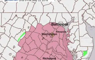
May 22 2018 A Severe Thunderstorm Watch is in effect until 9 PM for our region south of Baltimore and west of the Chesapeake Bay This includes Howard, Anne Arundel,
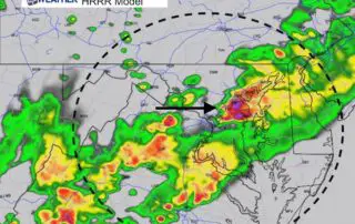
May 22 2018 One round of rain this morning was quite heavy in spots. Not good for those trying to view the Blue Angels practice flights and not good for
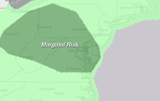
May 22 2018 We have a marginal risk of severe storms. This means there will be widespread showers and some thunderstorms with a select few that could reach severe limits.
Saturday May 19 2018 Not much more to day other than bands of rain continue. It looks like there may be a break in the afternoon to help some try

Friday May 18 2018 Let's cut to the chase and just say it is going to rain again today. It already is and will be heavy in spots. If you