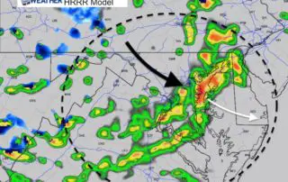
Rain Timeline Update For Tuesday April 2 Afternoon And Evening
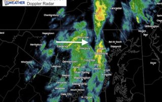
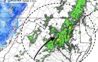
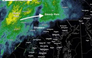
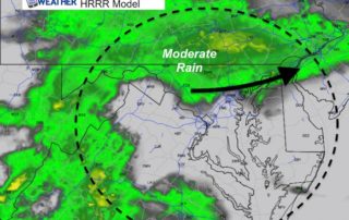
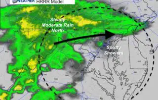
Tuesday April 2 2019 A strong storm is developing to our south and will really crank off of the coast. Showers are moving through already, but the steady rain could
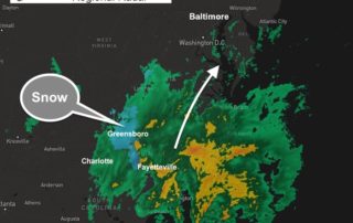
Tuesday April 2 2019 A strong storm is developing to our south and will really crank off of the coast. Showers are moving through already, but the steady rain could
Sunday March 31 2019 The warm 70s from Saturday will be a distant memory this afternoon as another push of cold air is arriving. The cold front this morning is
Saturday March 30 2019 As soon as you step outside this morning you will notice the difference. Temperatures are warmer and it feels like spring. The big question today will
Friday March 29 2019 Today is a day that helps describe how the hills and mountains west and north of Baltimore often redirect weather systems. If you are reading this
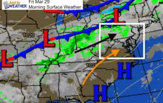
March 29 2019 This date on the calendar marks the most extreme weather on the Baltimore record book. This single date stands for the largest snowstorm and highest temperature. It's
Monday March 25 2019 The rain has moved in, for northern and western parts of our area. This is the type of day where the message of a wet day
Monday March 25 2019 We made it through the weekend with two dry days, so we are due for more rain. The system today will not impact all of our
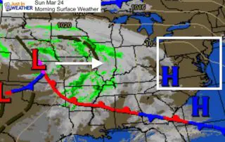
Sunday March 24 2019 Most of what I have to share is good news today. We are about to complete a dry weekend with temperatures warming up nicely this afternoon
Friday March 22 2019 This mid day update is pertaining the the last part of this Nor'easter. The Low Pressure is to our north and the storm is pulling away.
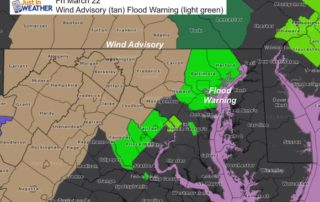
Friday March 22 2019 The Noreaster is moving away this morning but it definitely overachieved. Most of our area received between 2 and 3 inches of rain, with some spots