August 19 Weather Rain Timeline Climate Data And Observations
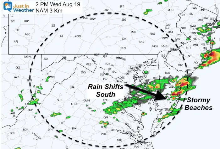
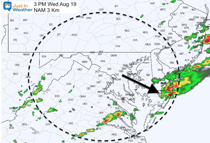
Wednesday August 19 2020 This morning is starting with rain in central Maryland and Virginia. This will shift east by mid day, but strong storms will develop at the beach
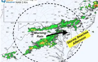

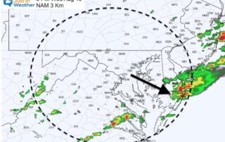
Wednesday August 19 2020 This morning is starting with rain in central Maryland and Virginia. This will shift east by mid day, but strong storms will develop at the beach
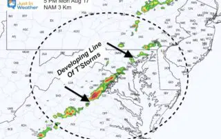
Monday August 17 2020 With the storm well off of the coast and the wind shift, the humidity is much lower and more comfortable this morning. But a cold front
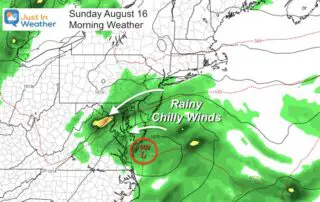
Sunday August 16 2020 It seems like we just did this a few days ago. A pretty strong area of Low Pressure has spread rain across the region with strong
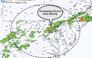
Wednesday August 12 2020 A Flash Flood Watch has been issued for our area today. Slow moving storms will develop after 2 PM and could drop between 1 to 3
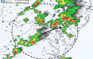
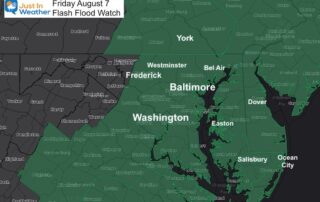
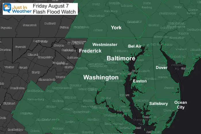
Friday August 7 2020 The Flash Flood Watch has been expanded into southern Pennsylvania. I mentioned in my morning report that this should happen as the front and development of
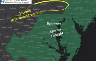
Friday August 7 2020 One more day in this pattern will keep us humid and bring in locally heavy rain. The storms will develop this afternoon mainly in the mountains
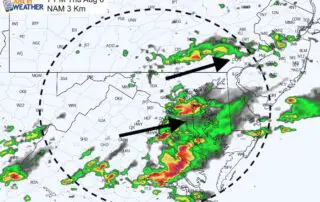
Thursday August 6 2020 The break from the rain is being filled back in by growing clouds and new area thunderstorms. Below is an updated radar simulation, but the models
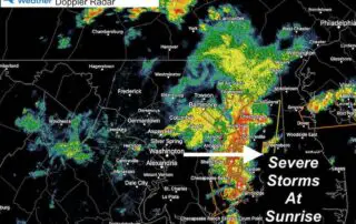
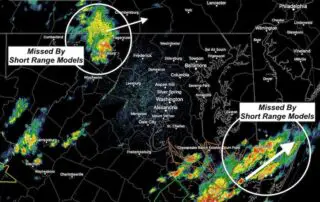
Thursday August 6 2020 Many people woke up early with lightning and thunder rolling through central Maryland. Many severe thunderstorm warnings were issued, which is rare in the morning. This
Wednesday August 5 2020 This quick evening weather update is for the changes on the way. We had a really nice break today after the tropical storm left the region,
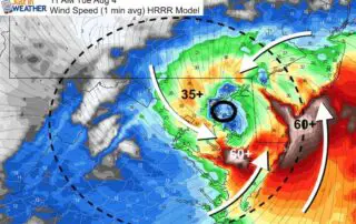
Tuesday August 4 at 8AM This morning our region is under a Tropical Storm Warning, Tornado Watch and Flash Flood Watch. Some of these events have begun to impact some