Rain Timeline Tuesday May 10
Tuesday May 10 - At this point the rain has become so routine, the only thing we can do is just plot it on the timeline. I must be like
Tuesday May 10 - At this point the rain has become so routine, the only thing we can do is just plot it on the timeline. I must be like

May 9 2016 - We started the day with sunshine, but that didn't last long. The same front that moved through to clear us out for Mother's Day is on
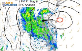
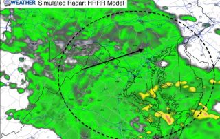
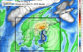
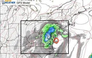
Friday May 6 - The coastal storm we are dealing with today continues to move to the west off of the ocean and is expected to stall over the northern
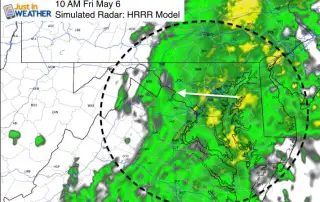
Friday May 6: Heavy rain is moving inland from off of the ocean today. A storm in the Atlantic is getting pushed westward and the center will settle over the
Thursday May 5 - We are in an unusual weather pattern for May that has made it feel like late winter. A large upper level Low has dropped from the
Thursday May 5 - Cinco de Mayo still feels like March as temperatures remain in the 50s. We remain stuck in this cool and damp pattern, which will bring one

Tuesday May 3 - After the impressive hail producing storms Monday and some local flooding, there is lingering rain and some fog. We are still in the thick of it,

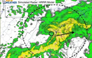
3:20 PM Monday May 2 - The sun finally broke free of the low clouds and marine layer today. But this will add fuel to an unstable environment and trigger
Sunday May 1 - Our Sunday soaker is here, and it looks like the heaviest rain will cross Washington, Baltimore, and the southern half of Maryland. Check out the radar

Saturday April 30 - Cool and damp is something we have gotten use to, but when will the real rain hit and could it impact your plans? At one point