On The Edge Of Extreme Heat And Severe Storms
Friday July 22 - It's mid summer and we have a heat wave building. That should be expected and not a headline. But the famed Heat Dome across the nation
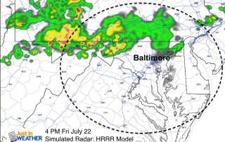
Friday July 22 - It's mid summer and we have a heat wave building. That should be expected and not a headline. But the famed Heat Dome across the nation

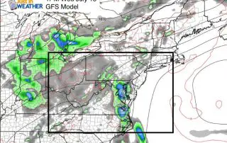
Monday July 18 - We have another cold front on the way today. Ahead of it, the heat and some humidity will surge back in. Temperatures will be in the
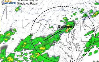
Saturday July 16 - I woke up this morning with the sun and wondered if there was some chance the front moved through. It didn't! We still have the heat,
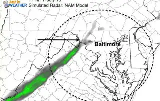
Friday July 15 - There is a cold front on the way and it will bring a refreshing change in the air... west of the Bay today. On Thursday BWI
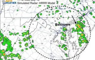
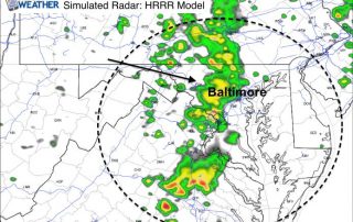
July 13 - We had the expected rain fall overnight and early this morning. Now the atmosphere is primed for more showers and storms, but it looks like the bulk
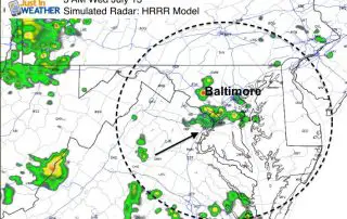
July 12 - There may be a band of showers after midnight into Wednesday morning. This is the leading edge of a new air mass that will bring back the
Tuesday July 12 - The air is still comfortable this morning, but you may have notices more clouds overhead. That is a signal of the chancing air mass, and eventually
July 11 - Happy Seven - Eleven! Today's date may get you a fee slushy or low admission to Six Flags, but it's not the typical summer heat you from
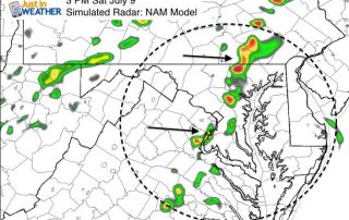
Saturday July 9 - We still have high humidity around this morning. A weak front will trigger some storms this afternoon that will help bringing a slight improvement for tomorrow.
July 8 at 12 PM - The slight risk of severe storms today has some heightened attention. The line of storms has already begun to form this morning and will