June 7 Weather Contrast: Nice For Us At Tropical Storm Cristobal Hits Gulf Coast
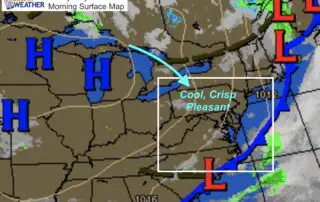
Sunday June 7 We finally pushed the heat and humidity out of our region. The air will have a crisp feel as we can see the clearing on the satellite

Sunday June 7 We finally pushed the heat and humidity out of our region. The air will have a crisp feel as we can see the clearing on the satellite
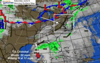
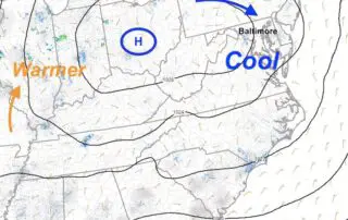
Saturday June 6 2020 The worst of our weather with this pattern has passed. There will be some showers this afternoon and evening, but this is the transition to a
Friday June 5 2020 Another round of thunderstorms are expected today. Temperatures will be a little lower and the storms may be less intense. There is still a chance of
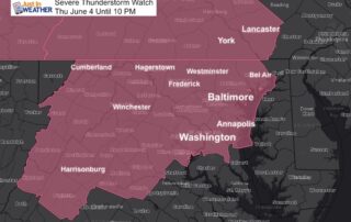
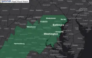
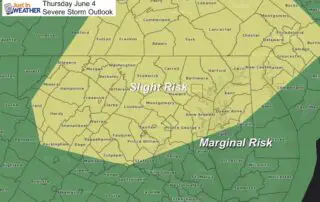
Thursday June 4 2020 Here we go again. The atmosphere is primed to produce severe thunderstorms today, with the focus shifting to the more densely populated central Maryland and Washington
Thursday June 4 2020 After the derecho hit Pennsylvania and New Jersey yesterday, there is heightened anxiety for storms today. The energy will be shifting south and now puts central
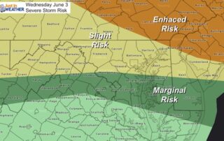
Wednesday June 3 2020 It's going to be hot and humid today, perhaps the first 90s for many areas. The severe storm risk is coming into focus and today the
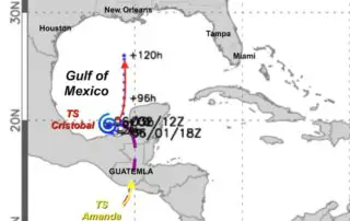
June 2 2020 In the southern Gulf of Mexico, a newly named Tropical Storm Cristobal is in rare company. This is the earliest on record for a third named storm
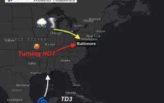
Tuesday June 2 2020 As if we didn't have enough going on, the weather is going to make some headlines. A few rain showers have reached the region this morning,
Monday June 1 A new season has just begun, for meteorological records. We block off full months for seasons, and June 1 is the beginning of summer. Astronomical summer begins
Sunday May 31 2020 We are about to close out another month, that last week was the second coolest on record. That modified quite a bit with very warm weather.