June 15 Weather Still Cool On The Edge Of Southern Rain
June 15 2020 We are threading the needle this morning with a very delicate balance of clear cool air to the north and persistent rain to the south. This is

June 15 2020 We are threading the needle this morning with a very delicate balance of clear cool air to the north and persistent rain to the south. This is

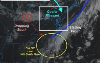
Sunday June 14 2020 Today is Flag Day and you will be able to see them flapping in the breeze. We are still caught in-between a stalled front on the
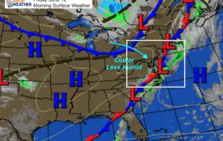
Saturday June 13 2020 The entire region starts today with cooler air and lower humidity. This is the result of a Canadian air mass, with will also help to develop
Friday June 12 2020 A new air mass is moving in and most of the region has a clear sky this morning. The morning satellite shows the clouds still hugging
Thursday June 11 2020 Something really interesting is unfolding today. The air is thick this morning across much of our region. The cold front that will bring in a cooler
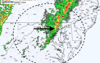
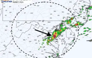
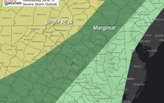
Wednesday June 10 2020 The local focus on storms may be two-fold: One round this evening, then another close to sunrise on Thursday. Then we will watch that front cross
Wednesday June 10 2020 Today will be the peak of the heat with this weather chapter. The increasing humidity will bring the heat index close to 100ºF for some areas.

June 10, 2020 Document and journal Maryland Weather conditions observed in Baltimore yesterday, climate report today, sunrise/sunset, moon phase, and daily weather map. Record rainfall observed at BWI. Climate Data
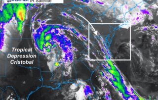
Tuesday June 9 2020 Temperatures will be cranking up for a few days. We can look west at the remains of Cristobal for shifting the upper level winds to allow
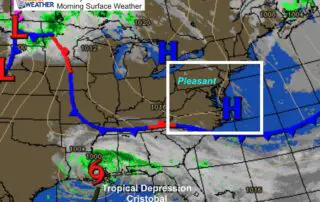
Monday June 8 2020 The weather this morning starts off cool and crisp by June standards. While this may seem uneventful, we look to Tropical Depression Cristobal well to our