August 12 Flash Flood Watch Rain Timeline Climate Data and Maryland Trek 7 Day 4
Wednesday August 12 2020 A Flash Flood Watch has been issued for our area today. Slow moving storms will develop after 2 PM and could drop between 1 to 3
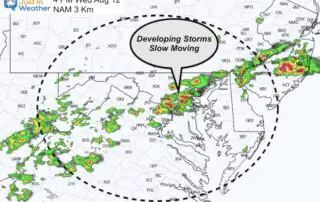
Wednesday August 12 2020 A Flash Flood Watch has been issued for our area today. Slow moving storms will develop after 2 PM and could drop between 1 to 3
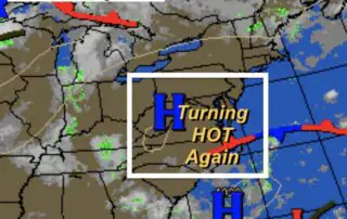
Monday August 10 2020 Document and journal Maryland Weather conditions observed in Baltimore yesterday, climate report today, sunrise/sunset, moon phase, and daily weather map Climate Data Update Observations Yesterday: Sunday

Saturday August 8 2020 This morning report will be a little different and I hope you take a moment to see why. The storms have moved out, even from the
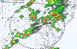
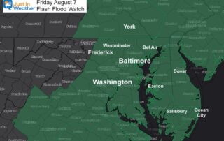
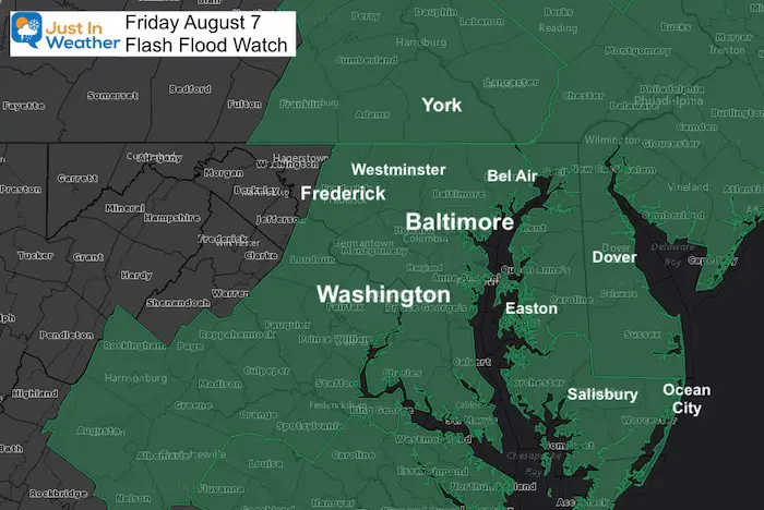
Friday August 7 2020 The Flash Flood Watch has been expanded into southern Pennsylvania. I mentioned in my morning report that this should happen as the front and development of
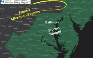
Friday August 7 2020 One more day in this pattern will keep us humid and bring in locally heavy rain. The storms will develop this afternoon mainly in the mountains
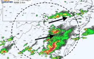
Thursday August 6 2020 The break from the rain is being filled back in by growing clouds and new area thunderstorms. Below is an updated radar simulation, but the models
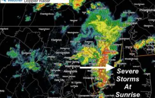
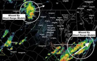
Thursday August 6 2020 Many people woke up early with lightning and thunder rolling through central Maryland. Many severe thunderstorm warnings were issued, which is rare in the morning. This
Wednesday August 5 2020 This quick evening weather update is for the changes on the way. We had a really nice break today after the tropical storm left the region,
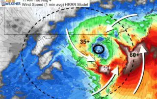
Tuesday August 4 at 8AM This morning our region is under a Tropical Storm Warning, Tornado Watch and Flash Flood Watch. Some of these events have begun to impact some
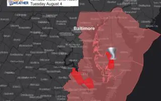
Tuesday August 4 2020 Tropical Storm Isaias still had top winds of 70 mph at 5 AM. The storm is moving faster to the North-Northeast at 28 mph. That means