Dry Weekend Then Very Cold Thanksgiving The Sharp Warm Up
November 17 2018 We are in a cold pattern that may feel like winter as much as it looks. The long range trend does support more long duration cold events
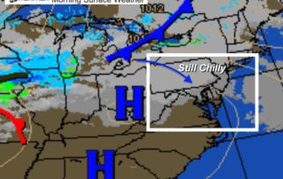
November 17 2018 We are in a cold pattern that may feel like winter as much as it looks. The long range trend does support more long duration cold events
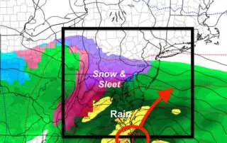
Friday November 16 2018 Now that the storm is gone and the final burst of snow has moved out, the initial assessment this morning was what may have turned back
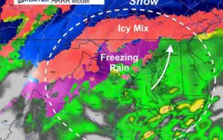
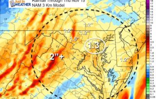
November 15 2018 We need to look at the calendar and the date again. It is mid November and here we are in a legitimate winter storm. This definitely overachieved
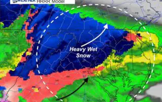
Thursday November 15 2018 The first storm of the season is knocking on our door just before sunrise. We have Winter Weather Advisories and Winter Storm Warnings in place. What
November 14 Evening Update We are going to get snow in the morning. At this point wintry weather is almost a certainty. The main questions relate to when and what will
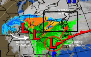
Wednesday November 14 We are set up for our first winter event of the season. It will be a coastal storm, but the impact will be moderate at best. There
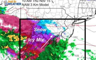
November 13 2018 There is a lot of attention on the next storm for the snow and sleet that we will get on Thursday. I wrote up my first call
Tuesday November 13 2018 The current storm is moving away, but there will be some rain showers left over this morning. Temperatures will reach their peak around noon, then cool
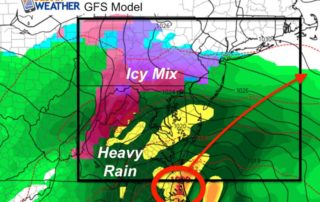
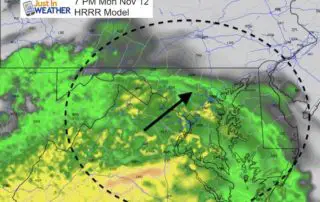
Monday November 12 2018 at 3PM Here we go again, and again. There really is no question that we are stuck in a pattern. If there was a question about
Monday November 12 2018 The weather this morning was frozen. Temperatures have produced widespread frost, but a disturbance also brought flurries to the suburbs north of Baltimore. This includes parts