Friday November 16 2018
Now that the storm is gone and the final burst of snow has moved out, the initial assessment this morning was what may have turned back to ice overnight. The last gasp of snow passed through early this morning and the radar loop showed it was the quick hit it was supposed to be. Temperatures in most areas are above freezing and will warm into the afternoon. So we get to thaw out.
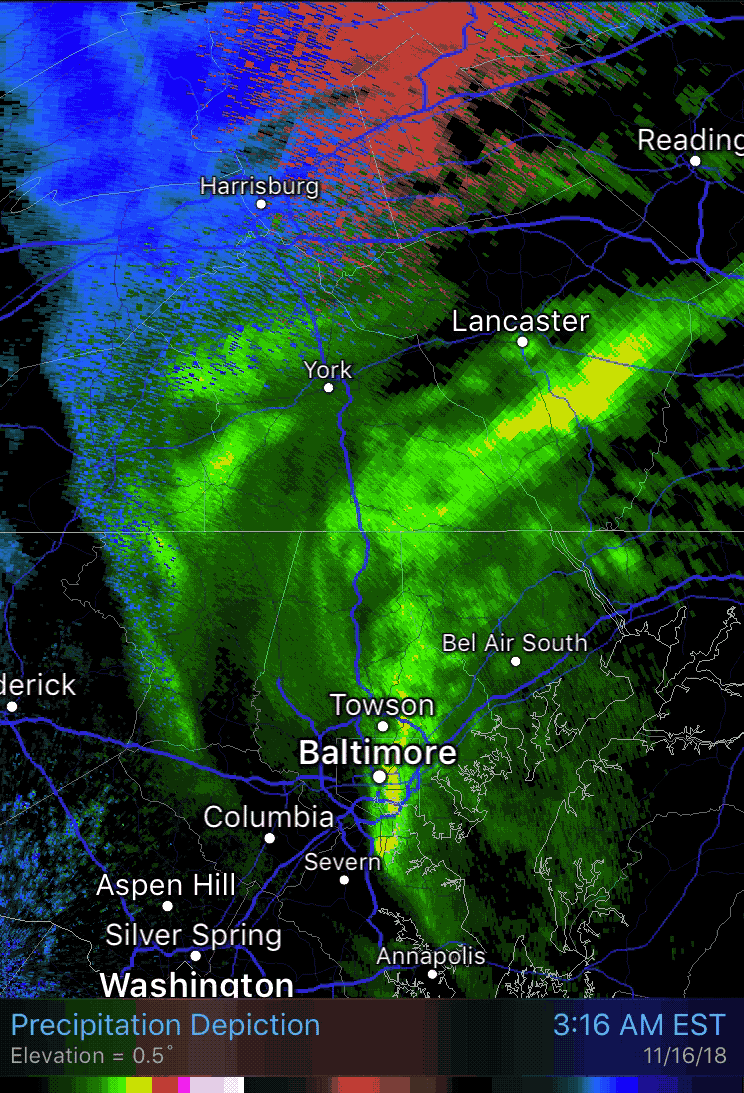
Morning Radar:
Rain (green) and snow (blue) between 3:16 AM to 4:39 AM
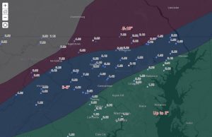
How Much Snow Fell?
See the storm reports in our new interactive map here. Thanks Jared Scott.
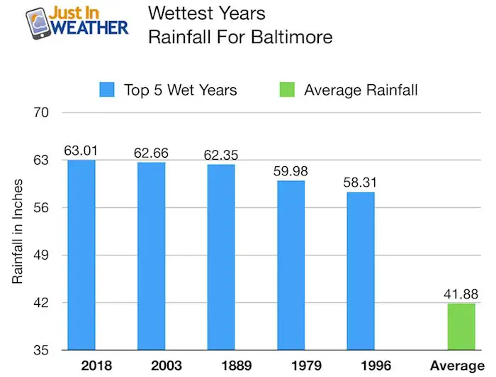
The storm that broke a 110 year of snow record also put us over the top for the wettest year on record! It is official and we have 6 weeks to add to the total:
Rainfall 2018 Total: Rank Wettest Year On Record In Baltimore
For the first time on record, Baltimore had over 63 inches of rain in a single year!
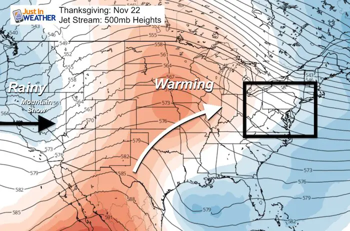
We have quiet pattern ahead is good news up through Thanksgiving as temps warm and the next weekend storm looks warm. Even better news I wanted to share is the rain on the way for California. It will be a while, but a rainy pattern is a Thanksgiving they can be thankful for. More on that below:
Just In: #FITF Hats

Local Weather Stats For November 16 in Baltimore
Average High: 56ºF
Record High: 76ºF in 2005
Average Low: 37ºF
Record Low: 19ºF in 1996
*Record Snow: Trace in 2000
Sunrise: 6:51 AM
Sunset 4:50 PM
*Daylight = 1:52 shorter than yesterday
*Bay Water Temperature = 50ºF at Thomas Pt. Light House
Keep In Touch Every Day
Click here to sign up for email alerts…. Just in case you don’t get the post on your social media feed
The FITF Store Is Open With Gear And SnowStix
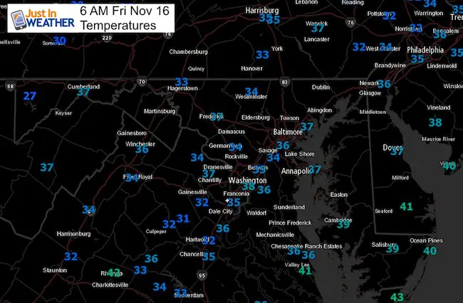
Morning Snapshot:
Temperatures
Mid Morning (School Delay Start Time)

Afternoon Highs

Looking Ahead
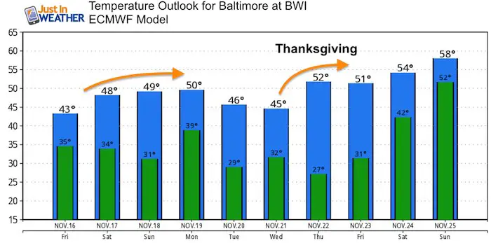
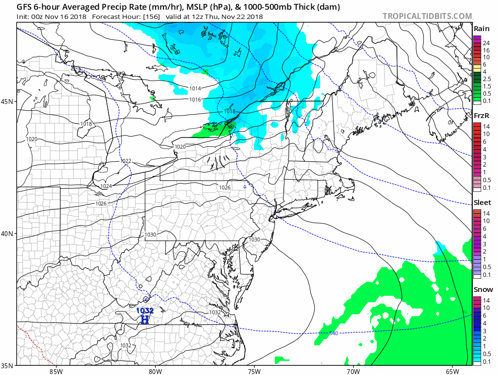
Temperatures wil be gradually warming through Thanksgiving. The weekend looks quiet with snow or rain showers to our north not reaching central Maryland. Next event will be rain on the weekend AFTER Thanksgiving.
Temperature Outlook
Thanksgiving Weekend Weather:
This is more than a week away, but at this time it looks like we should be dry until rain chances increase Saturday night into Sunday.
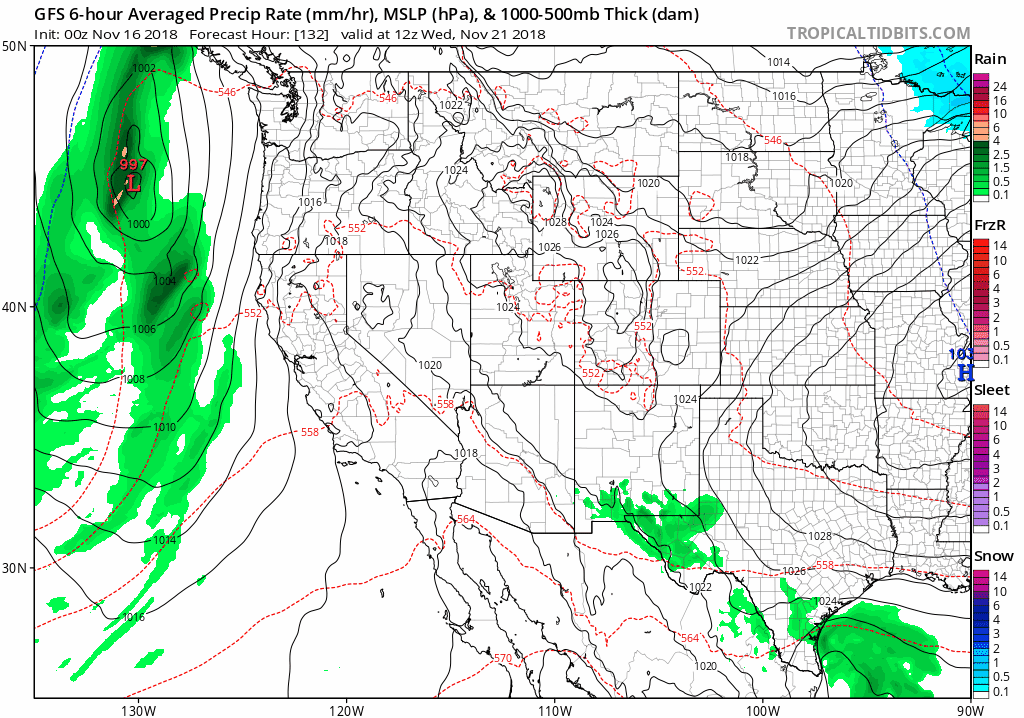
California: Need Rain For Fire Relief
Rain appears to show up in a few events for California from Wednesday evening through Thanksgiving and a second storm next weekend.
FITF and SnowStix Stores are now OPEN

Please share your thoughts, best weather pics/video, or just keep in touch via social media
-
Facebook: Justin Berk, Meteorologist
-
Twitter: @JustinWeather
-
Instagram: justinweather
Keep In Touch Every Day
Click here to sign up for email alerts…. Just in case you don’t get the post on your social media feed
Winter Outlook
My Winter Outlook 2018-19: Multiple Nor’Easters and more snow

Related Winter Outlooks
Solar Cycle: When Sun Spots Are Low We Get More Snow
El Nino Modoki May Enhance Snow Chances
Sweet Spot: Hitting 70ºF on Halloween is followed by more winter snow
Will A Wet Summer Bring A Snowy Winter?
NOAA Winter 2018-2019 Outlook Explained: This Actually Supports Snow
Winter Outlook From Two Different Farmers Almanacs
Maryland Winters: Snowfall Maps and Baltimore Snow History

Snowstix- We Need You To Measure Snow Too
We are giving 10% of each sale to Just In Power Kids: Providing FREE holistic care for pediatric oncology patients.
