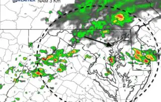
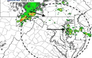
Tracking Storms Today: Radar Simulation For Saturday June 9
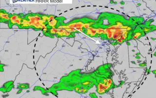
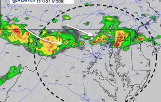
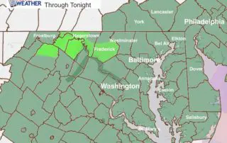
Saturday June 9 2018 The energy for today's weather is located in the southern Great Lakes and the upper level flow is pointing in our direction. Storms will be developing
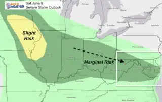
Saturday June 9 2018 The energy for today's weather is located in the southern Great Lakes and the upper level flow is pointing in our direction. Storms will be developing
Friday June 8 2018 We finally get back into summer like weather with temperatures building back into the 80s today and a little more humidity. That brings in the risk
Thursday June 7 2018 There will be some clouds today, but the wind will shift and temperatures will be warmer. Basically another pleasant weather day, but the pattern will not
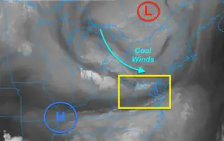
June 6 2018 The weather map really looks like late winter. A strong upper level Low in eastern Canada was responsible for yesterday's cold front and now sending cool weather
Tuesday June 5 2018 The satellite view looks like a winter patter today. Cold air aloft is circulating around the eastern Great Lakes and heading our way. A rogue thundershower
June 5 2018 Temperatures this morning started off quite chilly, but it is June so the high sun angle will help to boost those in a hurry. However, there is

June 4 2018 The heavy rain over the weekend still has some roads closed and high water that will slowly drain out. This photo of River Road in Sykesville from
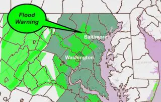
4 PM Sunday June 3 2018 The heavy rain with our coastal Low Pressure has produced up to 1.5 inches of rain in the past hour in central Maryland's Baltimore,
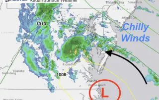
Sunday June 3 2018 The weather today is far from what we would expect for the first weekend of June. A new Low Pressure has formed as expected and will
Saturday June 2 2018 A new Flash Flood Watch is in place for most of our area through tonight as another round of heavy rain and thunderstorms will develop. It's