Friday August 23 Weather Rainy And Much Cooler
Friday August 23 2019 Today may be a shock to your system for a few reasons. With daylight there will be a lot of storm assessment from flooding, power outages,
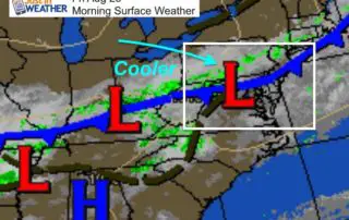
Friday August 23 2019 Today may be a shock to your system for a few reasons. With daylight there will be a lot of storm assessment from flooding, power outages,
Thursday August 22 2019 Today is the last day of the heat wave, but the end may be anticlimactic. It will be hot and humid, and we do expect storms.
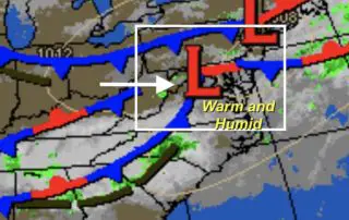
Wednesday August 21 2019 The heat and humidity are still with us, but it's starting to taper off a little as storm chances are increasing. We should get more widespread
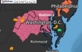
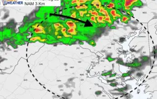
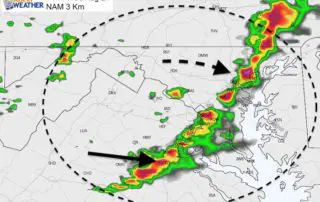
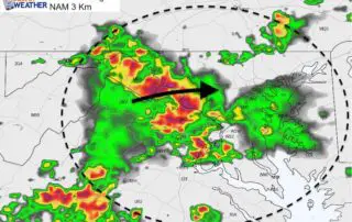
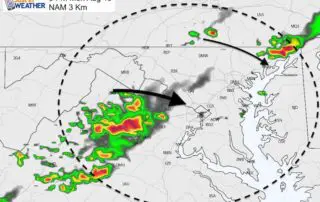
Tuesday August 20 2019 A Severe Thunderstorm Watch has been issued for much of our area until 9 PM. The National Weather Service has issued this for counties WEST of
Tuesday August 20 2019 The last two days rewrote the record books in Baltimore. A high temperature of 96ºF was tied on Sunday, then 99ºF set a new record Monday.
Monday August 19 2019 Here we go again. Sunday tied the record high at BWI with 96ºF with 2002. The heat today may be a little higher, and the heat
Sunday August 18 2019 We are now in another heat wave. Temperatures will be reaching into the 90s and heat index values will be pushing 100ºF or higher today into
Friday August 16 2019 Summer does not want to ease up on us. It is quite warm and muggy this morning. The humidity will help produce storms this afternoon and
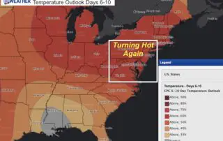
Thursday August 15 The risk of showers today remains for some of our area. However, the typical ho-hum August weather has one glaring thing jumping out. The extended outlook shows
Wednesday August 14 2019 We got lucky yesterday missing out on the worst of the severe storms. The potential for scattered storms remain with us as the air is still